-
Created by
 Karen O'Regan, last updated by Christel Prudhomme on Apr 16, 2026
2 minute read
Karen O'Regan, last updated by Christel Prudhomme on Apr 16, 2026
2 minute read

Flood Risk Products
For a detailed description of these products, see this page.
| Product Name | Description (established over forecast horizon) | Output | Source | |
|---|---|---|---|---|
Rapid Flood Mapping | Estimated flood extent at 3 arc second (~90 m) spatial resolution based on the matching of return periods from the GloFAS streamflow forecast and a catalogue of modelled inundation extents. Data are only generated for basins greater than 500 km2 and where the maximum return period is greater than 10 years in the 15-day forecast horizon. The role of flood defences is not considered.
| Map | Flood hazard data: https://data.jrc.ec.europa.eu/collection/id-0054 | |
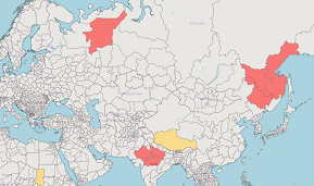
Rapid Impact Assessment | Potential impact of floods on population, land use (agriculture, urban), schools, health and education facilities based on their intersection with the 3 arc second (~90 m) spatial resolution rapid flood mapping layer. Results are aggregated over administration regions. Colours represent the location within an impact matrix based on the time to peak GloFAS streamflow and how many people live within the footprint of the flood inundation. Data are only generated for basins greater than 500 km2 and where the maximum return period is greater than 10 years. The role of flood defences is considered from FLOPROS estimates. | Map Impact Matrix | Population data - Global Human Settlement Layer (GHSL): https://ghsl.jrc.ec.europa.eu/ Landcover data - ESA Climate Change Initiative (CCI) landcover: https://www.esa-landcover-cci.org/ Health, education and airport facility information: openstreetmap.org Flood defences: FLOPROS (Scussolini et al., 2016): https://doi.org/10.5194/nhess-16-1049-2016 Administration regions - 1) NUTS: https://ec.europa.eu/eurostat/web/nuts/background, 2) GADM: https://gadm.org/ |