...
- [MAGP-999] - NetCDF: polygon shading crashes when plotting netCDF exported from XArray
- [MAGP-1128] - Plotting of curves from netCDF in Metview
- [MAGP-1130] - NetCDF: ncbyte encoded data is not correctly decoded
- [MAGP-1139] - XSection: wind plotting error
- [MAGP-1145] - Thermo: isotherms are not plotted in skew-t above 100 hPa
- [MAGP-1146] - Metview related code deactivated by using undefined METVIEW macro
- [MAGP-1147] - Python interface - search also MAGPLUS_HOME for librarMagics Version 2.29.3 - 18 July 2016 [branch:master tag:2.29.3]
- [MAGP-831] - PDF and PNG output looks blurry if cell shading is used
- [MAGP-835] - CellShading send polylines and image
- [MAGP-833] - Polylines are missing in Magics plot after upgrade
- [MAGP-834] - Borders of Libanon and Israel are not displayed correctly
- [MAGP-837] - Magics fails to plot coastlines in Mercator projection
- the south pole plotting a reduced gaussian field
- [MAGP-693] - Netcdf: allow wind thinning in NetCDF XY matrix
- [MAGP-716] - Geopoints: do not plot missing values
- [MAGP-717] - NetCDF: change default missing value attribute to _FillValue
- [MAGP-747] - Contour and grib : implements grib_interpolation_method = nearest_valid
- [MAGP-737] - Allow use of ww_symbols for marker shading
- [MAGP-739] - input_mars_metadata : new parameter to allow automatic contouring setting
- [MAGP-639] - Decoder: Add a GeoJSon decoder for the need of CDB
Magics Version 2.24.7 - 14 May 2015 [branch:release/r2.24 tag:r2.24.7]
- [MAGP-643] - Legend : Seg fault when plotting legend for matker Shading
- [MAGP-645] - netcdf_field_scaling_factor and netcdf_field_add_offset don't work correctly for netcdf_type = "complex_matrix"
...
New test versions become 2.24.3 on the 10/4 on on all platforms and is available for download.
- [MAGP-636] - Metview-4.5.3/Magics-2.24.3 do not plot wind flags correctly
- [MAGP-637] - Axis : Wrong labelling when using position_list
- [MAGP-638] - C include files are not installed
- [MAGP-640] - Page frame not plotted in non-interactive output drivers in Metview
...
New test versions become 2.24.3 on the 10/4 on on all platforms and is available for download.
- [MAGP-631] - Contouring: cell shading plus isolines cause a crash
- [MAGP-632] - Grib_interpolation_method is ignored in metview
- [MAGP-635] - Contouring problem using octrahedral grib data
...
New test versions become 2.24.3 on on all platforms and is available for download.
- [MAGP-626] - Legend : add support for an automatic legend attached to the right side of the plot
- [MAGP-627] - Graph : enable use of netcdf time series
- [MAGP-628] - Frame attributes for Page and Subpage
...
Magics Version 3.0.4 - [branch:master tag:3.0.4]
- [MAGP-1042] - Wave metgram are giving strange result when sea ice voevr is above 30%
- [MAGP-1057] - Netcdf: SCM NetCDF data fails to plot
- [MAGP-1058] - Tephigram: empty wind plotting
...
  Improve legend for gradients colours [MAGP-1040]
  COASTLINES - remove stray polygon from the Atlantic [MAGP-1038]
  Implement contour_shade_colour_method=palette [MAGP-1004]
Magics Version 3.0.0 - [branch:master tag:3.0.0]
...
Visualisation of the Netcdf-CF has been simplified
- Improvment of the new colour setting gradients
- Python3 Ready
- [MAGP-787] - Bug fixes on the colour gradients : can now be used in metview
- [MAGP-902] - Offer Python3 interface
- [MAGP-989] - Implement functionaility to plot cyclone database geoJSON output
- [MAGP-848] - Enable the possibility to create 1, 4 or 9 threads to produce the contouring
- [MAGP-856] - Use Python distutils to install Python modules
- [MAGP-901] - Move Python interface from swig to ctypes
- [MAGP-915] - Netcdf : handle the time dimension setting in a better way : ie interpret the CF conventions
- [MAGP-987] - Guess netcdf types
- [MAGP-1012] - Add Contributions of Meteo-France
Bug
- [MAGP-610] - Spurious coastline along dateline from South Pole to coast
- [MAGP-614] - magics does not compile if numpy is missing, but python is present
- [MAGP-909] - Plotting over the date line doesn't work with Web Mercator projection (EPSG:3857)
- [MAGP-1002] - Mercator projection: no Administrative Boundaries and the default geographical area is an extended globe
- [MAGP-1013] - Check Shading and isoline : double call
Magics Version 2.34.3 - [branch:master tag:2.34.3]
HotFix Version:
- [MAGP-981] Regression : anti-Clockwise is not respected when one of the colours is white
- [MAGP-610] Spurious coastline along dateline from South Pole to coast
Magics Version 2.34.0 - 29 June 2017 [branch:master tag:2.34.0]
Improvement
- [MAGP-955] - Allow user to load a specific shape file as coastlines layers.
- [MAGP-962] - Improve labelling of grid in mollweide and robinson projection, add the possibility to add a frame around these 2 projections.
Bug
- [MAGP-870] - Mercator projection does not allow to set a subdomain or large domain
- [MAGP-959] - Problem with classic Metgram plot with Magics
- [MAGP-961] - Fix the setting of colours for magjson when graph_type=area
- [MAGP-965] - Fix issue with shading and level_list
Magics Version 2.33.0 - 31 May 2017 [branch:master tag:2.33.0]
Improvement
- [MAGP-904] - Continuous legend
- [MAGP-943] - Python interpreter crashes when invalid file name is given
- [MAGP-948] - Improve use of json files as input of graph
Bug
- [MAGP-931] - Plotting of winds on rotated_ll grids does not work
- [MAGP-932] - the parameter map_label_latitude_frequency does not seem to be taken into account fro polar stereographic projection.
- [MAGP-944] - Marker shading: does not clear between subsequent plots
- [MAGP-945] - Wind thinning at the edge of the grid is not correct
Magics Version 2.32.0 - 23 March 2017 [branch:master tag:2.32.0]
Improvement
- [MAGP-913] - Add a new method to define colour for shading ...
A new method is being implemented to simplify the setting of colourmap. This will be really nice in Metview. [MAGP-929] - Geopoints coordinates expressed in Proj4 projection
GeoPoints can now be expressed using a proj4 string representation. The representation should be expressed in the header using the keyword #PROJECTION.
Ex :
Code Block #GEO #FORMAT XYV #PROJECTION +proj=laea +lat_0=48.0 +lon_0=9.0 +x_0=0.0 +y_0=0.0 +units=m +a=6378388 +b=6378388 x/long y/lat value #DATA 739500.0 -237500.0 1 740500.0 -236500.0 1
- [MAGP-913] - Add a new method to define colour for shading ...
Bug
- [MAGP-502] - Coloured wind arrows with a third field gives wrong or empty plot
- [MAGP-877] - Projection: polar stereographic view with rotation
- [MAGP-888] - Latitudes not written along central longitude on the map
- [MAGP-914] - Check the grid in polar south !
- [MAGP-927] - Magics library bug -> function round() clashes with the round() function of libm.so
...
Magics Version 2.31.0 - 27 January 2017 [branch:master tag:2.31.0]
New Features:
- [MAGP-889] - Magics can now produce horizontal bar
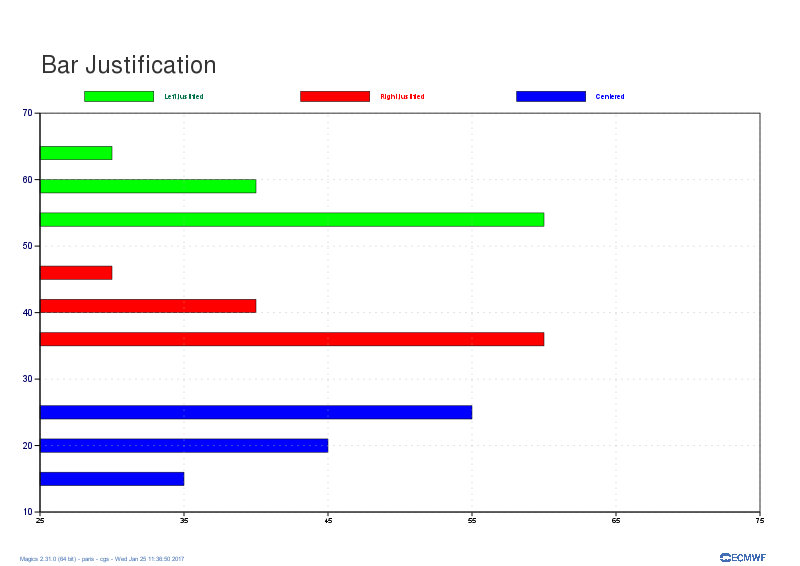
- [MAGP-889] - Magics can now produce horizontal bar
Improvements
Bug Fixes

...
part of the November 2016 Software release: Magics is now using ecCodes
- [MAGP-419] - Symbol Plotting: indexing was wrong when mode=text and not all points are visible
- [MAGP-789] - Python package were not installed in the right location when
- [MAGP-794] - Input Visualiser with geoline axis: does not plot when the line is along a meridian
- [MAGP-816] - Legend for symbol plotting was not always correct
- [MAGP-868] - Symbol plotting: shifted text when symbol_type = text
- [MAGP-873] - Legend: parameter LEGEND_ENTRY_PLOT_ORIENTATION had no effect on a legend
- [MAGP-875] - Multi pages in PDF
- [MAGP-845] - GRIB: add new high-resolution surface precipitation to list of known parameters
- [MAGP-880] - Make ecCodes the default for GRIB decoding
- [MAGP-798] - Add Projection EPSG 3857
- [MAGP-808] - Generate hatched fill with "Grid shading"
- [MAGP-815] - Improve legend for rainbow contour
- [MAGP-817] - implements legend_text_units : will add the text to the last entry of the legend.
- [MAGP-841] - Combine cell shading to improve output file sizes
- [MAGP-866] - Add some parameters to enable and style an axis_minor_grid
...
part of the October 2016 Software release.
- Fix bug in implementation of contour_hi
- Improve handling of missing values in .
Magics Version 2.29.5 - 2 September 2016 [branch:master tag:2.29.6]
- [MAGP-855] - Boundaries around Morocco are wrongly displayed
...
Magics Version 2.29.3 - 18 July 2016 [branch:master tag:2.29.3]
- [MAGP-831] - PDF and PNG output looks blurry if cell shading is used
- [MAGP-835] - CellShading send polylines and image
- [MAGP-833] - Polylines are missing in Magics plot after upgrade
- [MAGP-834] - Borders of Libanon and Israel are not displayed correctly
- [MAGP-837] - Magics fails to plot coastlines in Mercator projection
Magics Version 2.29.2 - 28 June 2016 [branch:master tag:2.29.2]
- [MAGP-830] - FIX: Cannot plot satellite GRIB fields
Magics Version 2.29.1 - 27 June 2016 [branch:master tag:2.29.1]
- [MAGP-761] - Add support to compile with eccodes instead of grib_api
- [MAGP-533] - FIX: Axis_tick_position_list is not working when using logarithmic
- [MAGP-594] - FIX: Drivers: problem when the output file's path does not exist
- [MAGP-818] - FIX: Parameter MAP_ADMINISTRATIVE_BOUNDARIES combined with POLAR_STEREOGRAPHIC projection not working
- [MAGP-821] - FIX: Drivers: bug in filename generation with numbered pages
- [MAGP-828] - FIX: Strange stripe on the zero line with Input Matrix
- [MAGP-547] - Update Apache License text in source code
- [MAGP-822] - Observation Plotting : implement feedback from Evaluation
- [MAGP-823] - Remove unused Terralib code
Magics Version 2.29.0 - 10 May 2016 [branch:master tag:r2.29.0]
- [MAGP-780] - Wind: wind field produces empty plot or crash
- [MAGP-805] - Mgb rendering crashes
- [MAGP-806] - Wind: duplicated wind arrows
- [MAGP-810] - Wind: missing wind arrows along zero degree meridian
- [MAGP-811] - Marker Shading is not working
- [MAGP-801] - Polyline: add transparency option for trajectory
- [MAGP-763] - Config: set minimum version of GRIB_API to 1.14.6
- [MAGP-796] - GeoJson input support: add more types [FeatureCollection, Feature, Point]
- [MAGP-797] - CellShading becomes grid shading depending of resolution
- [MAGP-799] - Axis: Add parameter to contyrol colour of Sundays
- [MAGP-803] - Implement WMO symbols for tropical cyclones
- [MAGP-807] - Allow tiling with coastlines in WMS context
Magics Version 2.28.0 - 17 March 2016 [branch:master tag:r2.28.0]
- [MAGP-435] [MAGP-205] [MAGP-596] - New Coastlines from Natural Earth
- Spurious lines are gone, polders in The Netherlands are displayed, regional administrative borders are improved, better Performance
- [MAGP-767] - Improvements for weather parameters and classic metgram
- [MAGP-776] - Titles: change default text colour from blue to navy
- [MAGP-769] - Epsgrams and Octahedral
- [MAGP-557] - Improve plotting of observation symbols
- [MAGP-749] - Add parameter to write creator (software) into output files
- [MAGP-764] - Epsgrams : Improve python facilities
- [MAGP-765] - InputMatrix : improve handling of increments
- [MAGP-781] - Contouring: subarea of reduced Gaussian grid
- [MAGP-755] - CDF plot should use climate min/max on label
- [MAGP-762] - Contouring: octahedral grid on subarea does not plot correctly
- [MAGP-772] - Build: option ENABLE_METVIEW_NO_QT failed on installation
- [MAGP-781] - Contouring: Fix subarea of reduced Gaussian grid
- The installation scripts are now based on ecBuild 2.0
Magics Version 2.26.2 - 14 December 2015 [branch:master tag:r2.26.2]
...
Magics Version 2.26.0 - 19 November 2015 [branch:master tag:r2.26.0]
- [MAGP-253] - Add Streamlines
- [MAGP-710] - Create a parameter subpage_clipping to turn of/off the clipping for subpages
- [MAGP-670] - Implement missing wmo cloud symbols for obs plotting
- [MAGP-701] - Wind plotting from netcdf (complex matrix)
- [MAGP-704] - Fixed incorrect wind plotting with antirotated grib
- [MAGP-706] - Wind: thinning on Lambert grids
- [MAGP-729] - Problem at the south pole plotting a reduced gaussian field
- [MAGP-693] - Netcdf: allow wind thinning in NetCDF XY matrix
- [MAGP-716] - Geopoints: do not plot missing values
- [MAGP-717] - NetCDF: change default missing value attribute to _FillValue
- [MAGP-747] - Contour and grib : implements grib_interpolation_method = nearest_valid
- [MAGP-737] - Allow use of ww_symbols for marker shading
- [MAGP-739] - input_mars_metadata : new parameter to allow automatic contouring setting
- [MAGP-639] - Decoder: Add a GeoJSon decoder for the need of CDB
Magics Version 2.24.7 - 14 May 2015 [branch:release/r2.24 tag:r2.24.7]
- [MAGP-643] - Legend : Seg fault when plotting legend for matker Shading
- [MAGP-645] - netcdf_field_scaling_factor and netcdf_field_add_offset don't work correctly for netcdf_type = "complex_matrix"
...
New test versions become 2.24.3 on the 10/4 on on all platforms and is available for download.
- [MAGP-636] - Metview-4.5.3/Magics-2.24.3 do not plot wind flags correctly
- [MAGP-637] - Axis : Wrong labelling when using position_list
- [MAGP-638] - C include files are not installed
- [MAGP-640] - Page frame not plotted in non-interactive output drivers in Metview
...
New test versions become 2.24.3 on the 10/4 on on all platforms and is available for download.
- [MAGP-631] - Contouring: cell shading plus isolines cause a crash
- [MAGP-632] - Grib_interpolation_method is ignored in metview
- [MAGP-635] - Contouring problem using octrahedral grib data
...
New test versions become 2.24.3 on on all platforms and is available for download.
- [MAGP-626] - Legend : add support for an automatic legend attached to the right side of the plot
- [MAGP-627] - Graph : enable use of netcdf time series
- [MAGP-628] - Frame attributes for Page and Subpage
...
part of the November 2016 Software release: Magics is now using ecCodes
- [MAGP-419] - Symbol Plotting: indexing was wrong when mode=text and not all points are visible
- [MAGP-789] - Python package were not installed in the right location when
- [MAGP-794] - Input Visualiser with geoline axis: does not plot when the line is along a meridian
- [MAGP-816] - Legend for symbol plotting was not always correct
- [MAGP-868] - Symbol plotting: shifted text when symbol_type = text
- [MAGP-873] - Legend: parameter LEGEND_ENTRY_PLOT_ORIENTATION had no effect on a legend
- [MAGP-875] - Multi pages in PDF
- [MAGP-845] - GRIB: add new high-resolution surface precipitation to list of known parameters
- [MAGP-880] - Make ecCodes the default for GRIB decoding
- [MAGP-798] - Add Projection EPSG 3857
- [MAGP-808] - Generate hatched fill with "Grid shading"
- [MAGP-815] - Improve legend for rainbow contour
- [MAGP-817] - implements legend_text_units : will add the text to the last entry of the legend.
- [MAGP-841] - Combine cell shading to improve output file sizes
- [MAGP-866] - Add some parameters to enable and style an axis_minor_grid
...
part of the October 2016 Software release.
Magics Version 2.29.5 - 2 September 2016 [branch:master tag:2.29.6]
- [MAGP-855] - Boundaries around Morocco are wrongly displayed
...
Magics Version 2.29.3 - 18 July 2016 [branch:master tag:2.29.3]
- [MAGP-831] - PDF and PNG output looks blurry if cell shading is used
- [MAGP-835] - CellShading send polylines and image
- [MAGP-833] - Polylines are missing in Magics plot after upgrade
- [MAGP-834] - Borders of Libanon and Israel are not displayed correctly
- [MAGP-837] - Magics fails to plot coastlines in Mercator projection
Magics Version 2.29.2 - 28 June 2016 [branch:master tag:2.29.2]
- [MAGP-830] - FIX: Cannot plot satellite GRIB fields
Magics Version 2.29.1 - 27 June 2016 [branch:master tag:2.29.1]
- [MAGP-761] - Add support to compile with eccodes instead of grib_api
- [MAGP-533] - FIX: Axis_tick_position_list is not working when using logarithmic
- [MAGP-594] - FIX: Drivers: problem when the output file's path does not exist
- [MAGP-818] - FIX: Parameter MAP_ADMINISTRATIVE_BOUNDARIES combined with POLAR_STEREOGRAPHIC projection not working
- [MAGP-821] - FIX: Drivers: bug in filename generation with numbered pages
- [MAGP-828] - FIX: Strange stripe on the zero line with Input Matrix
- [MAGP-547] - Update Apache License text in source code
- [MAGP-822] - Observation Plotting : implement feedback from Evaluation
- [MAGP-823] - Remove unused Terralib code
Magics Version 2.29.0 - 10 May 2016 [branch:master tag:r2.29.0]
- [MAGP-780] - Wind: wind field produces empty plot or crash
- [MAGP-805] - Mgb rendering crashes
- [MAGP-806] - Wind: duplicated wind arrows
- [MAGP-810] - Wind: missing wind arrows along zero degree meridian
- [MAGP-811] - Marker Shading is not working
- [MAGP-801] - Polyline: add transparency option for trajectory
- [MAGP-763] - Config: set minimum version of GRIB_API to 1.14.6
- [MAGP-796] - GeoJson input support: add more types [FeatureCollection, Feature, Point]
- [MAGP-797] - CellShading becomes grid shading depending of resolution
- [MAGP-799] - Axis: Add parameter to contyrol colour of Sundays
- [MAGP-803] - Implement WMO symbols for tropical cyclones
- [MAGP-807] - Allow tiling with coastlines in WMS context
Magics Version 2.28.0 - 17 March 2016 [branch:master tag:r2.28.0]
- [MAGP-435] [MAGP-205] [MAGP-596] - New Coastlines from Natural Earth
- Spurious lines are gone, polders in The Netherlands are displayed, regional administrative borders are improved, better Performance
- [MAGP-767] - Improvements for weather parameters and classic metgram
- [MAGP-776] - Titles: change default text colour from blue to navy
- [MAGP-769] - Epsgrams and Octahedral
- [MAGP-557] - Improve plotting of observation symbols
- [MAGP-749] - Add parameter to write creator (software) into output files
- [MAGP-764] - Epsgrams : Improve python facilities
- [MAGP-765] - InputMatrix : improve handling of increments
- [MAGP-781] - Contouring: subarea of reduced Gaussian grid
- [MAGP-755] - CDF plot should use climate min/max on label
- [MAGP-762] - Contouring: octahedral grid on subarea does not plot correctly
- [MAGP-772] - Build: option ENABLE_METVIEW_NO_QT failed on installation
- [MAGP-781] - Contouring: Fix subarea of reduced Gaussian grid
- The installation scripts are now based on ecBuild 2.0
Magics Version 2.26.2 - 14 December 2015 [branch:master tag:r2.26.2]
...
Magics Version 2.26.0 - 19 November 2015 [branch:master tag:r2.26.0]
- [MAGP-253] - Add Streamlines
- [MAGP-710] - Create a parameter subpage_clipping to turn of/off the clipping for subpages
- [MAGP-670] - Implement missing wmo cloud symbols for obs plotting
- [MAGP-701] - Wind plotting from netcdf (complex matrix)
- [MAGP-704] - Fixed incorrect wind plotting with antirotated grib
- [MAGP-706] - Wind: thinning on Lambert grids
- [MAGP-729] - Problem at the south pole plotting a reduced gaussian field
- [MAGP-693] - Netcdf: allow wind thinning in NetCDF XY matrix
- [MAGP-716] - Geopoints: do not plot missing values
- [MAGP-717] - NetCDF: change default missing value attribute to _FillValue
- [MAGP-747] - Contour and grib : implements grib_interpolation_method = nearest_valid
- [MAGP-737] - Allow use of ww_symbols for marker shading
- [MAGP-739] - input_mars_metadata : new parameter to allow automatic contouring setting
- [MAGP-639] - Decoder: Add a GeoJSon decoder for the need of CDB
Magics Version 2.24.7 - 14 May 2015 [branch:release/r2.24 tag:r2.24.7]
- [MAGP-643] - Legend : Seg fault when plotting legend for matker Shading
- [MAGP-645] - netcdf_field_scaling_factor and netcdf_field_add_offset don't work correctly for netcdf_type = "complex_matrix"
...
New test versions become 2.24.3 on the 10/4 on on all platforms and is available for download.
- [MAGP-636] - Metview-4.5.3/Magics-2.24.3 do not plot wind flags correctly
- [MAGP-637] - Axis : Wrong labelling when using position_list
- [MAGP-638] - C include files are not installed
- [MAGP-640] - Page frame not plotted in non-interactive output drivers in Metview
...
New test versions become 2.24.3 on the 10/4 on on all platforms and is available for download.
- [MAGP-631] - Contouring: cell shading plus isolines cause a crash
- [MAGP-632] - Grib_interpolation_method is ignored in metview
- [MAGP-635] - Contouring problem using octrahedral grib data
...
New test versions become 2.24.3 on on all platforms and is available for download.
- [MAGP-626] - Legend : add support for an automatic legend attached to the right side of the plot
- [MAGP-627] - Graph : enable use of netcdf time series
- [MAGP-628] - Frame attributes for Page and Subpage
...
Magics Version 3.0.4 - [branch:master tag:3.0.4]
- [MAGP-1042] - Wave metgram are giving strange result when sea ice voevr is above 30%
- [MAGP-1057] - Netcdf: SCM NetCDF data fails to plot
- [MAGP-1058] - Tephigram: empty wind plotting
...
  Improve legend for gradients colours [MAGP-1040]
  COASTLINES - remove stray polygon from the Atlantic [MAGP-1038]
  Implement contour_shade_colour_method=palette [MAGP-1004]
Magics Version 3.0.0 - [branch:master tag:3.0.0]
...
Visualisation of the Netcdf-CF has been simplified
- Improvment of the new colour setting gradients
- Python3 Ready
- [MAGP-787] - Bug fixes on the colour gradients : can now be used in metview
- [MAGP-902] - Offer Python3 interface
- [MAGP-989] - Implement functionaility to plot cyclone database geoJSON output
- [MAGP-848] - Enable the possibility to create 1, 4 or 9 threads to produce the contouring
- [MAGP-856] - Use Python distutils to install Python modules
- [MAGP-901] - Move Python interface from swig to ctypes
- [MAGP-915] - Netcdf : handle the time dimension setting in a better way : ie interpret the CF conventions
- [MAGP-987] - Guess netcdf types
- [MAGP-1012] - Add Contributions of Meteo-France
Bug
- [MAGP-610] - Spurious coastline along dateline from South Pole to coast
- [MAGP-614] - magics does not compile if numpy is missing, but python is present
- [MAGP-909] - Plotting over the date line doesn't work with Web Mercator projection (EPSG:3857)
- [MAGP-1002] - Mercator projection: no Administrative Boundaries and the default geographical area is an extended globe
- [MAGP-1013] - Check Shading and isoline : double call
Magics Version 2.34.3 - [branch:master tag:2.34.3]
HotFix Version:
- [MAGP-981] Regression : anti-Clockwise is not respected when one of the colours is white
- [MAGP-610] Spurious coastline along dateline from South Pole to coast
Magics Version 2.34.0 - 29 June 2017 [branch:master tag:2.34.0]
Improvement
- [MAGP-955] - Allow user to load a specific shape file as coastlines layers.
- [MAGP-962] - Improve labelling of grid in mollweide and robinson projection, add the possibility to add a frame around these 2 projections.
Bug
- [MAGP-870] - Mercator projection does not allow to set a subdomain or large domain
- [MAGP-959] - Problem with classic Metgram plot with Magics
- [MAGP-961] - Fix the setting of colours for magjson when graph_type=area
- [MAGP-965] - Fix issue with shading and level_list
Magics Version 2.33.0 - 31 May 2017 [branch:master tag:2.33.0]
Improvement
- [MAGP-904] - Continuous legend
- [MAGP-943] - Python interpreter crashes when invalid file name is given
- [MAGP-948] - Improve use of json files as input of graph
Bug
- [MAGP-931] - Plotting of winds on rotated_ll grids does not work
- [MAGP-932] - the parameter map_label_latitude_frequency does not seem to be taken into account fro polar stereographic projection.
- [MAGP-944] - Marker shading: does not clear between subsequent plots
- [MAGP-945] - Wind thinning at the edge of the grid is not correct
Magics Version 2.32.0 - 23 March 2017 [branch:master tag:2.32.0]
Improvement
- [MAGP-913] - Add a new method to define colour for shading ...
A new method is being implemented to simplify the setting of colourmap. This will be really nice in Metview. [MAGP-929] - Geopoints coordinates expressed in Proj4 projection
GeoPoints can now be expressed using a proj4 string representation. The representation should be expressed in the header using the keyword #PROJECTION.
Ex :
Code Block #GEO #FORMAT XYV #PROJECTION +proj=laea +lat_0=48.0 +lon_0=9.0 +x_0=0.0 +y_0=0.0 +units=m +a=6378388 +b=6378388 x/long y/lat value #DATA 739500.0 -237500.0 1 740500.0 -236500.0 1
- [MAGP-913] - Add a new method to define colour for shading ...
Bug
- [MAGP-502] - Coloured wind arrows with a third field gives wrong or empty plot
- [MAGP-877] - Projection: polar stereographic view with rotation
- [MAGP-888] - Latitudes not written along central longitude on the map
- [MAGP-914] - Check the grid in polar south !
- [MAGP-927] - Magics library bug -> function round() clashes with the round() function of libm.so
...
Magics Version 2.31.0 - 27 January 2017 [branch:master tag:2.31.0]
New Features:
- [MAGP-889] - Magics can now produce horizontal bar
- [MAGP-889] - Magics can now produce horizontal bar
Improvements
Bug Fixes
...
part of the November 2016 Software release: Magics is now using ecCodes
- [MAGP-419] - Symbol Plotting: indexing was wrong when mode=text and not all points are visible
- [MAGP-789] - Python package were not installed in the right location when
- [MAGP-794] - Input Visualiser with geoline axis: does not plot when the line is along a meridian
- [MAGP-816] - Legend for symbol plotting was not always correct
- [MAGP-868] - Symbol plotting: shifted text when symbol_type = text
- [MAGP-873] - Legend: parameter LEGEND_ENTRY_PLOT_ORIENTATION had no effect on a legend
- [MAGP-875] - Multi pages in PDF
- [MAGP-845] - GRIB: add new high-resolution surface precipitation to list of known parameters
- [MAGP-880] - Make ecCodes the default for GRIB decoding
- [MAGP-798] - Add Projection EPSG 3857
- [MAGP-808] - Generate hatched fill with "Grid shading"
- [MAGP-815] - Improve legend for rainbow contour
- [MAGP-817] - implements legend_text_units : will add the text to the last entry of the legend.
- [MAGP-841] - Combine cell shading to improve output file sizes
- [MAGP-866] - Add some parameters to enable and style an axis_minor_grid
...
part of the October 2016 Software release.
- Fix bug in implementation of contour_hi
- Improve handling of missing values in .
Magics Version 2.29.5 - 2 September 2016 [branch:master tag:2.29.6]
- [MAGP-855] - Boundaries around Morocco are wrongly displayed
...
Magics Version 2.29.3 - 18 July 2016 [branch:master tag:2.29.3]
- [MAGP-831] - PDF and PNG output looks blurry if cell shading is used
- [MAGP-835] - CellShading send polylines and image
- [MAGP-833] - Polylines are missing in Magics plot after upgrade
- [MAGP-834] - Borders of Libanon and Israel are not displayed correctly
- [MAGP-837] - Magics fails to plot coastlines in Mercator projection
Magics Version 2.29.2 - 28 June 2016 [branch:master tag:2.29.2]
- [MAGP-830] - FIX: Cannot plot satellite GRIB fields
Magics Version 2.29.1 - 27 June 2016 [branch:master tag:2.29.1]
- [MAGP-761] - Add support to compile with eccodes instead of grib_api
- [MAGP-533] - FIX: Axis_tick_position_list is not working when using logarithmic
- [MAGP-594] - FIX: Drivers: problem when the output file's path does not exist
- [MAGP-818] - FIX: Parameter MAP_ADMINISTRATIVE_BOUNDARIES combined with POLAR_STEREOGRAPHIC projection not working
- [MAGP-821] - FIX: Drivers: bug in filename generation with numbered pages
- [MAGP-828] - FIX: Strange stripe on the zero line with Input Matrix
- [MAGP-547] - Update Apache License text in source code
- [MAGP-822] - Observation Plotting : implement feedback from Evaluation
- [MAGP-823] - Remove unused Terralib code
Magics Version 2.29.0 - 10 May 2016 [branch:master tag:r2.29.0]
- [MAGP-780] - Wind: wind field produces empty plot or crash
- [MAGP-805] - Mgb rendering crashes
- [MAGP-806] - Wind: duplicated wind arrows
- [MAGP-810] - Wind: missing wind arrows along zero degree meridian
- [MAGP-811] - Marker Shading is not working
- [MAGP-801] - Polyline: add transparency option for trajectory
- [MAGP-763] - Config: set minimum version of GRIB_API to 1.14.6
- [MAGP-796] - GeoJson input support: add more types [FeatureCollection, Feature, Point]
- [MAGP-797] - CellShading becomes grid shading depending of resolution
- [MAGP-799] - Axis: Add parameter to contyrol colour of Sundays
- [MAGP-803] - Implement WMO symbols for tropical cyclones
- [MAGP-807] - Allow tiling with coastlines in WMS context
Magics Version 2.28.0 - 17 March 2016 [branch:master tag:r2.28.0]
- [MAGP-435] [MAGP-205] [MAGP-596] - New Coastlines from Natural Earth
- Spurious lines are gone, polders in The Netherlands are displayed, regional administrative borders are improved, better Performance
- [MAGP-767] - Improvements for weather parameters and classic metgram
- [MAGP-776] - Titles: change default text colour from blue to navy
- [MAGP-769] - Epsgrams and Octahedral
- [MAGP-557] - Improve plotting of observation symbols
- [MAGP-749] - Add parameter to write creator (software) into output files
- [MAGP-764] - Epsgrams : Improve python facilities
- [MAGP-765] - InputMatrix : improve handling of increments
- [MAGP-781] - Contouring: subarea of reduced Gaussian grid
- [MAGP-755] - CDF plot should use climate min/max on label
- [MAGP-762] - Contouring: octahedral grid on subarea does not plot correctly
- [MAGP-772] - Build: option ENABLE_METVIEW_NO_QT failed on installation
- [MAGP-781] - Contouring: Fix subarea of reduced Gaussian grid
- The installation scripts are now based on ecBuild 2.0
Magics Version 2.26.2 - 14 December 2015 [branch:master tag:r2.26.2]
...
Magics Version 2.26.0 - 19 November 2015 [branch:master tag:r2.26.0]
- [MAGP-253] - Add Streamlines
- [MAGP-710] - Create a parameter subpage_clipping to turn of/off the clipping for subpages
- [MAGP-670] - Implement missing wmo cloud symbols for obs plotting
- [MAGP-701] - Wind plotting from netcdf (complex matrix)
- [MAGP-704] - Fixed incorrect wind plotting with antirotated grib
- [MAGP-706] - Wind: thinning on Lambert grids
- [MAGP-729] - Problem at the south pole plotting a reduced gaussian field
- [MAGP-693] - Netcdf: allow wind thinning in NetCDF XY matrix
- [MAGP-716] - Geopoints: do not plot missing values
- [MAGP-717] - NetCDF: change default missing value attribute to _FillValue
- [MAGP-747] - Contour and grib : implements grib_interpolation_method = nearest_valid
- [MAGP-737] - Allow use of ww_symbols for marker shading
- [MAGP-739] - input_mars_metadata : new parameter to allow automatic contouring setting
- [MAGP-639] - Decoder: Add a GeoJSon decoder for the need of CDB
Magics Version 2.24.7 - 14 May 2015 [branch:release/r2.24 tag:r2.24.7]
- [MAGP-643] - Legend : Seg fault when plotting legend for matker Shading
- [MAGP-645] - netcdf_field_scaling_factor and netcdf_field_add_offset don't work correctly for netcdf_type = "complex_matrix"
...
New test versions become 2.24.3 on the 10/4 on on all platforms and is available for download.
- [MAGP-636] - Metview-4.5.3/Magics-2.24.3 do not plot wind flags correctly
- [MAGP-637] - Axis : Wrong labelling when using position_list
- [MAGP-638] - C include files are not installed
- [MAGP-640] - Page frame not plotted in non-interactive output drivers in Metview
...
New test versions become 2.24.3 on the 10/4 on on all platforms and is available for download.
- [MAGP-631] - Contouring: cell shading plus isolines cause a crash
- [MAGP-632] - Grib_interpolation_method is ignored in metview
- [MAGP-635] - Contouring problem using octrahedral grib data
...
New test versions become 2.24.3 on on all platforms and is available for download.
- [MAGP-626] - Legend : add support for an automatic legend attached to the right side of the plot
- [MAGP-627] - Graph : enable use of netcdf time series
- [MAGP-628] - Frame attributes for Page and Subpage
...
part of the November 2016 Software release: Magics is now using ecCodes
- [MAGP-419] - Symbol Plotting: indexing was wrong when mode=text and not all points are visible
- [MAGP-789] - Python package were not installed in the right location when
- [MAGP-794] - Input Visualiser with geoline axis: does not plot when the line is along a meridian
- [MAGP-816] - Legend for symbol plotting was not always correct
- [MAGP-868] - Symbol plotting: shifted text when symbol_type = text
- [MAGP-873] - Legend: parameter LEGEND_ENTRY_PLOT_ORIENTATION had no effect on a legend
- [MAGP-875] - Multi pages in PDF
- [MAGP-845] - GRIB: add new high-resolution surface precipitation to list of known parameters
- [MAGP-880] - Make ecCodes the default for GRIB decoding
- [MAGP-798] - Add Projection EPSG 3857
- [MAGP-808] - Generate hatched fill with "Grid shading"
- [MAGP-815] - Improve legend for rainbow contour
- [MAGP-817] - implements legend_text_units : will add the text to the last entry of the legend.
- [MAGP-841] - Combine cell shading to improve output file sizes
- [MAGP-866] - Add some parameters to enable and style an axis_minor_grid
...
part of the October 2016 Software release.
Magics Version 2.29.5 - 2 September 2016 [branch:master tag:2.29.6]
- [MAGP-855] - Boundaries around Morocco are wrongly displayed
...
Magics Version 2.29.3 - 18 July 2016 [branch:master tag:2.29.3]
- [MAGP-831] - PDF and PNG output looks blurry if cell shading is used
- [MAGP-835] - CellShading send polylines and image
- [MAGP-833] - Polylines are missing in Magics plot after upgrade
- [MAGP-834] - Borders of Libanon and Israel are not displayed correctly
- [MAGP-837] - Magics fails to plot coastlines in Mercator projection
Magics Version 2.29.2 - 28 June 2016 [branch:master tag:2.29.2]
- [MAGP-830] - FIX: Cannot plot satellite GRIB fields
Magics Version 2.29.1 - 27 June 2016 [branch:master tag:2.29.1]
- [MAGP-761] - Add support to compile with eccodes instead of grib_api
- [MAGP-533] - FIX: Axis_tick_position_list is not working when using logarithmic
- [MAGP-594] - FIX: Drivers: problem when the output file's path does not exist
- [MAGP-818] - FIX: Parameter MAP_ADMINISTRATIVE_BOUNDARIES combined with POLAR_STEREOGRAPHIC projection not working
- [MAGP-821] - FIX: Drivers: bug in filename generation with numbered pages
- [MAGP-828] - FIX: Strange stripe on the zero line with Input Matrix
- [MAGP-547] - Update Apache License text in source code
- [MAGP-822] - Observation Plotting : implement feedback from Evaluation
- [MAGP-823] - Remove unused Terralib code
Magics Version 2.29.0 - 10 May 2016 [branch:master tag:r2.29.0]
- [MAGP-780] - Wind: wind field produces empty plot or crash
- [MAGP-805] - Mgb rendering crashes
- [MAGP-806] - Wind: duplicated wind arrows
- [MAGP-810] - Wind: missing wind arrows along zero degree meridian
- [MAGP-811] - Marker Shading is not working
- [MAGP-801] - Polyline: add transparency option for trajectory
- [MAGP-763] - Config: set minimum version of GRIB_API to 1.14.6
- [MAGP-796] - GeoJson input support: add more types [FeatureCollection, Feature, Point]
- [MAGP-797] - CellShading becomes grid shading depending of resolution
- [MAGP-799] - Axis: Add parameter to contyrol colour of Sundays
- [MAGP-803] - Implement WMO symbols for tropical cyclones
- [MAGP-807] - Allow tiling with coastlines in WMS context
Magics Version 2.28.0 - 17 March 2016 [branch:master tag:r2.28.0]
- [MAGP-435] [MAGP-205] [MAGP-596] - New Coastlines from Natural Earth
- Spurious lines are gone, polders in The Netherlands are displayed, regional administrative borders are improved, better Performance
- [MAGP-767] - Improvements for weather parameters and classic metgram
- [MAGP-776] - Titles: change default text colour from blue to navy
- [MAGP-769] - Epsgrams and Octahedral
- [MAGP-557] - Improve plotting of observation symbols
- [MAGP-749] - Add parameter to write creator (software) into output files
- [MAGP-764] - Epsgrams : Improve python facilities
- [MAGP-765] - InputMatrix : improve handling of increments
- [MAGP-781] - Contouring: subarea of reduced Gaussian grid
- [MAGP-755] - CDF plot should use climate min/max on label
- [MAGP-762] - Contouring: octahedral grid on subarea does not plot correctly
- [MAGP-772] - Build: option ENABLE_METVIEW_NO_QT failed on installation
- [MAGP-781] - Contouring: Fix subarea of reduced Gaussian grid
- The installation scripts are now based on ecBuild 2.0
Magics Version 2.26.2 - 14 December 2015 [branch:master tag:r2.26.2]
...
Magics Version 2.26.0 - 19 November 2015 [branch:master tag:r2.26.0]
- [MAGP-253] - Add Streamlines
- [MAGP-710] - Create a parameter subpage_clipping to turn of/off the clipping for subpages
- [MAGP-670] - Implement missing wmo cloud symbols for obs plotting
- [MAGP-701] - Wind plotting from netcdf (complex matrix)
- [MAGP-704] - Fixed incorrect wind plotting with antirotated grib
- [MAGP-706] - Wind: thinning on Lambert grids
- [MAGP-729] - Problem at the south pole plotting a reduced gaussian field
- [MAGP-693] - Netcdf: allow wind thinning in NetCDF XY matrix
- [MAGP-716] - Geopoints: do not plot missing values
- [MAGP-717] - NetCDF: change default missing value attribute to _FillValue
- [MAGP-747] - Contour and grib : implements grib_interpolation_method = nearest_valid
- [MAGP-737] - Allow use of ww_symbols for marker shading
- [MAGP-739] - input_mars_metadata : new parameter to allow automatic contouring setting
- [MAGP-639] - Decoder: Add a GeoJSon decoder for the need of CDB
Magics Version 2.24.7 - 14 May 2015 [branch:release/r2.24 tag:r2.24.7]
- [MAGP-643] - Legend : Seg fault when plotting legend for matker Shading
- [MAGP-645] - netcdf_field_scaling_factor and netcdf_field_add_offset don't work correctly for netcdf_type = "complex_matrix"
...
New test versions become 2.24.3 on the 10/4 on on all platforms and is available for download.
- [MAGP-636] - Metview-4.5.3/Magics-2.24.3 do not plot wind flags correctly
- [MAGP-637] - Axis : Wrong labelling when using position_list
- [MAGP-638] - C include files are not installed
- [MAGP-640] - Page frame not plotted in non-interactive output drivers in Metview
...
New test versions become 2.24.3 on the 10/4 on on all platforms and is available for download.
- [MAGP-631] - Contouring: cell shading plus isolines cause a crash
- [MAGP-632] - Grib_interpolation_method is ignored in metview
- [MAGP-635] - Contouring problem using octrahedral grib data
...
New test versions become 2.24.3 on on all platforms and is available for download.
- [MAGP-626] - Legend : add support for an automatic legend attached to the right side of the plot
- [MAGP-627] - Graph : enable use of netcdf time series
- [MAGP-628] - Frame attributes for Page and Subpage
...