
-
Created by
 Christel Prudhomme, last updated on May 02, 2024
1 minute read
Christel Prudhomme, last updated on May 02, 2024
1 minute read

LISFLOOD routing and groundwater modules are used to simulate the groundwater and routing processes GloFAS until version 2.
LISFLOOD is a GIS-based spatially distributed hydrological model, which includes a one-dimensional channel routing model. Surface runoff is routed via overland flow to the outlet of each cell; subsurface storage and transport are modelled using two linear reservoirs.
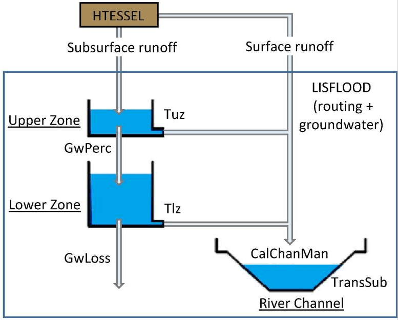
Schematic of the Lisflood hydrological model configuration used in GloFAS up to version 2