changes.mady.by.user Milana Vuckovic
Saved on Jan 28, 2019
...
Setting the geographical view
Customise coastlines tutorial Image Modified
Intro to contouring Image Modified
Intro to shading Image Modified
Intro to automatic shading Image Modified
Intro to Symbols plotting
Advanced Symbols plotting
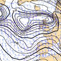
Introduction to wind plotting Image Modified
Legend customization Image Modified
Introduction to Text plotting Image Modified
A complex layout
Polar stereographic
Cylindrical projection
Lambert projection Image Modified
Mollweide projection
Boundaries and rivers Image Modified
High resolution coastline Image Modified
Sea, lakes and rivers Image Modified
Boundaries, cities and rivers Image Modified
Grid points Image Modified
Rainbow lines 1 Image Modified
Rainbow lines 2 Image Modified
Simple shading Image Modified
Colour list Image Modified
Level and colour list Image Modified
Gradients method 1 Image Modified
Gradients method 2 Image Modified
Cell shading Image Modified
Grid shading Image Modified
ECMWF style Image Modified
Predefined style Image Modified
Predefined palette Image Modified
Simple symbol Image Modified
Symbol with text Image Modified
Pictogram symbol Image Modified
Weather symbols Image Modified
Total clouds amount Image Modified
Cloud type symbol Image Modified
Advanced symbol Image Modified
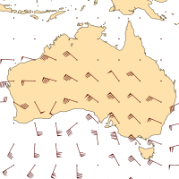
Wind arrows Image Modified
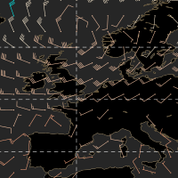
Coloured wind arrows Image Modified
Wind flags Image Modified
Coloured wind flags Image Modified
Temperature and arrows Image Modified
Temperature and flags Image Modified
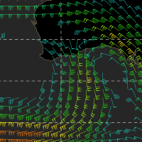
Wind flags and vorticity Image Modified
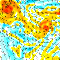
Wind and GH Image Modified