...
- The error occurs whenever the grid spacing Dj=360/Nj at a specific latitude line, j, with Nj longitude points has a remainder smaller than 10 microdegrees (1/100000 of a degree).
- The error accumulates linearly from 0° to 360° along the line of latitude.
- The error is minimal at grid points to the east and maximal at those to the west of the 0° meridian.
- The error is larger the greater the number of longitude points (Nj) along the line of latitude.
When the input grid is an original reduced Gaussian ("N-grids"):
- the error occurs in at bands of consecutive lines of latitude that have the same Nj.
- generally, the error is largest away from the equator (at about 20° N and 20° S for the N640 grid).
When the input grid is an octahedral reduced Gaussian ("O-grids"):
- the error can occur at almost all lines of latitude because the Nj changes continuously
- the error is largest close to the equator where the resolution is highest.
In situations where the error occurs, the incorrect computation of the longitude values leads to two issues:
...
The error is most evident for parameters where the gradient of the field is large and where a change in the nearest grid points or the interpolation weights used thus has a larger effect.
The error also affects the identification of points used for the
Which interpolations are affected ?
...
- interpolations from original reduced or octahedral reduced Gaussian grids to sub-areas of regular Gaussian grids (gridType=regular_gg);
- interpolations from original reduced or octahedral reduced Gaussian grids to sub-areas of unrotated regular latitude-longitude grids (gridType=regular_ll);interpolations from original reduced or octahedral reduced Gaussian grids to sub-areas of rotated latitude-longitude grids (gridType=rotated_ll).
Examples
...
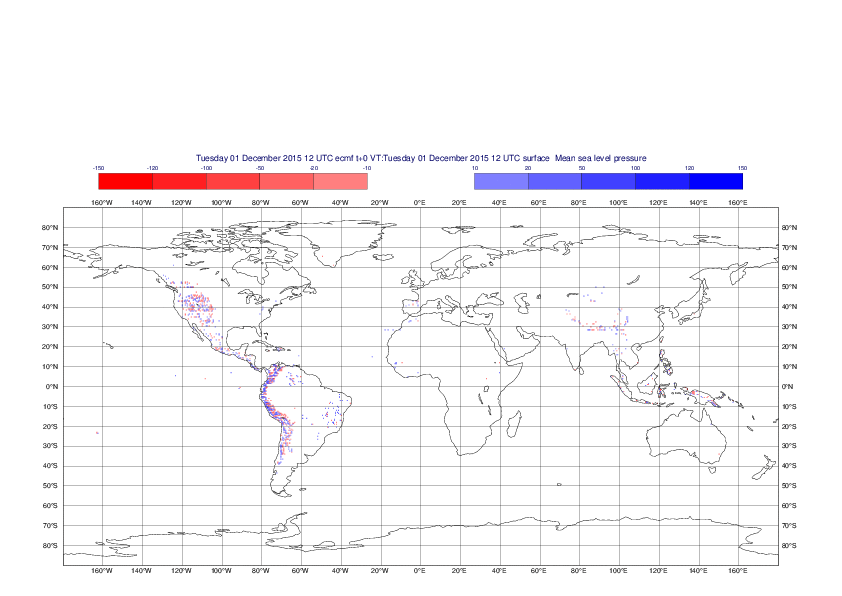
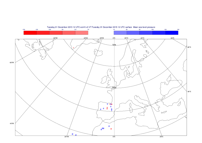
Mean sea-level pressure
The plots show the differences between the new interpolation method implemented in EMOSLIB cycle 000430 and the old method for the interpolation of the mean sea-level pressure from the reduced Gaussian grids to a 0.5°x0.5° regular latitude-longitude grid for the period 1-14 December 2015.
For this field the differences are:
- between -49.26 Pa and 37.76 Pa for interpolation from an the N640 original reduced Gaussian grid to a 0.5°x0.5° regular latitude-longitude grid
- between -169.26 Pa and 146.26 Pa for interpolation from an the O12800 octahedral reduced Gaussian grid to a 0.5°x0.5° regular latitude-longitude grid
| Section | ||||||||||||
|---|---|---|---|---|---|---|---|---|---|---|---|---|
| ||||||||||||
| Section |


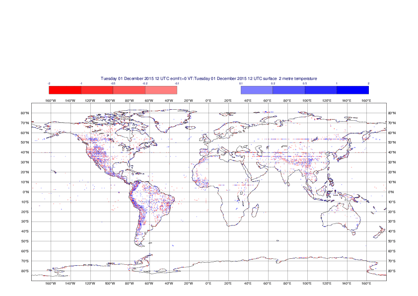
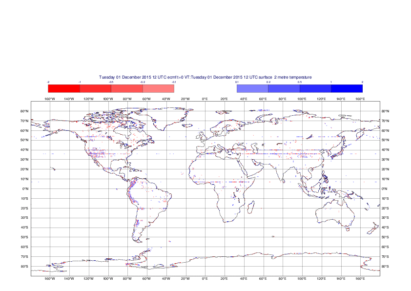
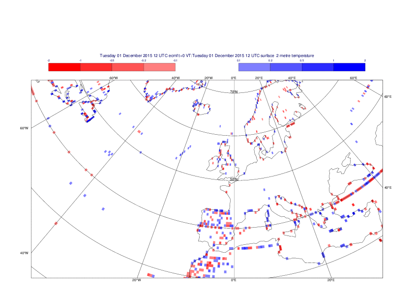
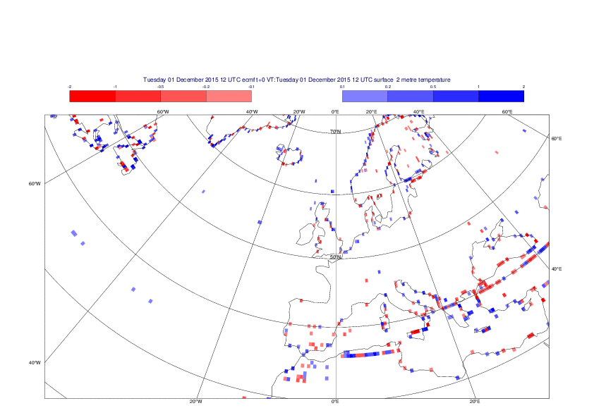
2 metre temperature
The plots show the differences between the new interpolation method implemented in EMOSLIB cycle 000430 and the old method for the interpolation of the 2m temperature from the reduced Gaussian grids to a 0.5°x0.5° regular latitude-longitude grid for the period 1-14 December 2015.
For this field the differences are:
- between -8.21 K and 4.79 K for interpolation from an the N640 original reduced Gaussian grid to a 0.5°x0.5° regular latitude-longitude grid
- between -3.62 K and 4.44 K for interpolation from an the O1280 octahedral reduced Gaussian grid to a 0.5°x0.5° regular latitude-longitude grid
| Section | ||||||||||||
|---|---|---|---|---|---|---|---|---|---|---|---|---|
|
...