HTESSEL (Hydrology Tiled ECMWF Scheme for Surface Exchanges over Land) is the land surface scheme used by ECMWF in its IFS (Balsamo et al., 2009). HTESSEL computes the land surface response to atmospheric forcing, and estimates the surface water and energy fluxes and the temporal evolution of soil temperature, moisture content and snowpack conditions. Operational daily ensemble forecasts of surface and sub-surface runoff (soil to groundwater percolation) are extracted daily from the outputs of the ECMWF ENS and monthly from the outputs of SEAS5, then resampled to 0.1° resolution to be used as input to the river routing model of Lisflood.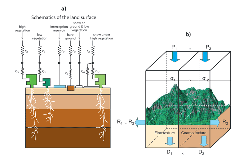
Schematic representation of the structure of (a) TESSEL land-surface scheme and (b) spatial structure added in HTESSEL
Page History
Overview
Community Forums
Content Tools