
LISFLOOD is a GIS-based spatially distributed hydrological model, which includes a one-dimensional channel routing model.
For GloFAS versions until 2.2, the transformation from precipitation to surface and sub-surface runoff is done by HTESSEL, with LISFLOOD routing and groundwater modules used to simulate the groundwater and routing processes. Surface runoff is routed via overland flow to the outlet of each cell; subsurface storage and transport are modelled using two linear reservoirs. 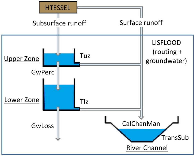
Schematic of the Lisflood hydrological model configuration used in GloFAS