MARS
To select a specific method for the interpolation of gridded fields.
interpolation=<value> |
|---|
The default interpolation method used is linear. The following specific groups or parameters will use the nearest neighbour method:
- index parameters: integer values associated to a predefined table
- ocean wave spectra and associated parameters: intensity as a function of discrete wavelengths
- vegetation cover ratio parameters
Valid values to specify the interpolation method are listed in the table below:
| Value | Description |
|---|---|
linear | Linear interpolation, based on a triangular mesh. This is the default behaviour. |
bilinear | Bilinear interpolation. |
nearest neighbour | Choosing the nearest grid point. |
nearest lsm | Choosing the nearest grid point in the target grid which has the same lsm properties as the input location |
When interpolating the land-sea mask field, fractional values greater than or equal to 0 and less than or equal to 1 are returned. Users should regard land-sea mask values greater than or equal to 0.5 as representing land points and those less than 0.5 as representing sea points.
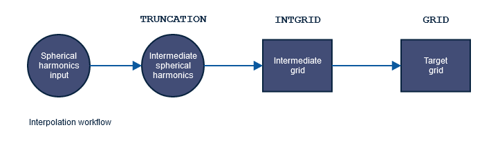
For other keywords controlling the interpolation see the diagram below.
Dissemination
To select a specific method for the interpolation of gridded fields.
interpolation=<value> |
|---|
The default interpolation method used is linear. The following specific groups or parameters will use the nearest neighbour method:
- index parameters: integer values associated to a predefined table
- ocean wave spectra and associated parameters: intensity as a function of discrete wavelengths
- vegetation cover ratio parameters
Valid values to specify the interpolation method are listed in the table below:
| Value | Description |
|---|---|
linear | Linear interpolation, based on a triangular mesh. This is the default behaviour. |
nearest lsm | Choosing the nearest grid point in the target grid which has the same lsm properties as the input location |
When interpolating the land-sea mask field, fractional values greater than or equal to 0 and less than or equal to 1 are returned. Users should regard land-sea mask values greater than or equal to 0.5 as representing land points and those less than 0.5 as representing sea points.
4 Comments
Pedro Maciel
As of recent, there's also:
The second is an alias to the first, and I would discourage this second version as it is less descriptive.
Mark Rodwell
Hi Pedro Maciel . I can get interpolation=average to work (in Metview Python) but not interpolation=grid-box-average.
Pedro Maciel
Indeed, because the meview Regrid implementation is separate from the MARS language -- for post-processing, it is supposed to be a super-set of the language but you found an inconsistency (an oversight that we need to fix). Can you report this in the Metview space? Thanks!
Pedro Maciel
I suggest to add grid-box-average to this list of supported options to INTERPOLATION