...
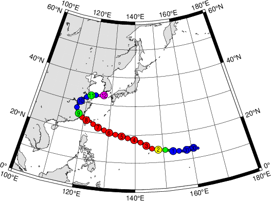
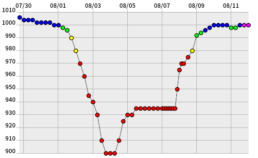
TC Soudelor formed on 30 July in northern-central tropical Pacific and was on 31 July classed as a tropical cyclone.

The plots below show precipitation observations and forecasts for the two days it affected Taiwan and southern China.


3. Predictability
3.1 Data assimilation
...
Via the Tropical cyclone list we obtained a radar loop for the landfall over Taiwan. This shows a clearcut eye, which seems to disappear over Taiwan at one point before reforming on the W side, as the cyclone also uindergoes a fairly substantial S'ward deflection in its track (possibly related to the very high topography). Below we compare model ppn rates before that episode, with a radar snapshot.


To interesting features appear in the plots above. Firstly, the eye is missing from the HRES ppn simulation (despite appearing to be there in the pressure field) Secondly, the areal coverage of sig ppn rates seems to be larger in HRES than in reality, consistent with the observation from the ppn totals verification above (note that only in the corners of the radar plot are the radars too remote to provide a signal)


The above plot shows that the coldest cloud tops are indeed in the eye in HRES, which is of course wrong, but is consistent with the rainfall errors. There is a hint of an eye on the actual IR image, though it was more apparent on the radar image above. HRES also has a white 'iris' around the 'pupil', suggesting perhaps a ring of less active ascent.
...