Status:Ongoing analysis Material Status: Finalised Material from: Linus,Thomas H,
| Show If | ||||||
|---|---|---|---|---|---|---|
| ||||||
Discussed in the following Daily reports:
|
...
During the first half of January 'enormous' amounts of snow fell over the northern Alps, and especially Austria was severely affected. A first evaluation of the accumulated fresh snow amount yield, that in some regions this was an event with an return period of 10 to 100 years. It was almost continuous snowfall on the northern side of the Alps from 1st to 15th January. Many villages were cut off, and ski resorts had to be evacuated. Avalanche danger was at the highest level in the most affected areas. Shows depths of around 50-100 cm appeared in valleys in the northern Alps, and up to 300-400 cm at elevations above 2000 m.
Confirmed numbers from the Austrian emergency services:
- In total 15 casualties, mainly due to avalanches
- At the height of the event (15.1.2019), 86.500 people were cut off due to unpassable roads
- 48.000 emergency personnel (mostly from voluntary fire departments) and 34 helicopters deployed
https://www.zamg.ac.at/cms/de/klima/news/stellenweise-neuschneerekorde
...
The first plot below shows the snow accumulation from 29 December to 10 January provided by ZAMG (https://www.zamg.ac.at/cms/de/wetter/news/vorerst-keine-entspannung-der-schneesituation). The highest accumulation was roughly in the box of 47-48N, 10-15E.

| Location | Elevation | Province | Total snow accumulation 1-15 Jan 2019 | Estimated return period | New record |
|---|---|---|---|---|---|
| Schroecken | 1244 m | Vorarlberg | 310 cm | 5 years | no |
| Holzgau | 1094 m | Tyrol | 170 cm | 10 years | no |
| Hoefen | 870 m | Tyrol | 170 cm | 10 years | no |
| Seefeld | 1184 m | Tyrol | 283 cm | >100 years | yes |
| Kufstein | 492 m | Tyrol | 168 cm | >100 years | yes |
| Hochfilzen | 960 m | Tyrol | 451 cm | >100 years | yes |
| Lofer | 622 m | Salzburg | 263 cm | >100 years | yes |
| Abtenau | 708 m | Salzburg | 240 cm | >100 years | yes |
| Bad Ischl | 509 m | Upper Austria | 240 cm | 20 years | no |
| Windischgarsten | 598 m | Upper Austria | 148 cm | 5-10 years | no |
| Bad Aussee | 742 m | Styria | 300 cm | 30-50 years | no |
| Bad Mitterndorf | 802 m | Styria | 270 cm | 100 years | yes |
Snow accumulations in inhabited places in Austria (valley stations, from west to east), as confirmed by ZAMG.
The plots below show analyses of MSLP and 6-hour precipitation forecasts from 3 to 8 January. The most intense precipitation appeared on 5 January.
...
The plot below shows the accumulated precipitation in the box 47-48N, 10-15E (think lines) in observations(black), short forecast (blue) and climatology (grey). Daily accumulation are plotted as thin lines.
...
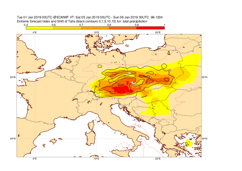
The plots below show the EFI and SOT for 1-day precipitation valid 5 January.


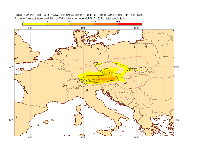
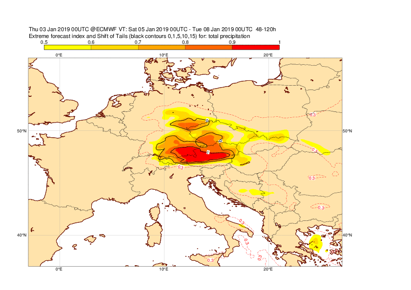
The plots below show the EFI and SOT for 3-day precipitation valid 5-7 January.


The plot below shows the forecast evolution of 72-hour precipitation (5-7 January) for the box of 47-48N, 10-15E . The blue box and whisker shows the ensemble, red dot HRES and red box-and whisker model climate.

3.4 Monthly forecasts
...