Status: Finalised Material from: Linus
1. Impact
On 7 December a storm named Caro passed over Norway and central Sweden. The wind was caused by a small-scale and short-lived cyclone that formed over Iceland on 6 January and dissipated late on 7 January over Finland. For the passage the wind gusts reached 40 m/s over sea and on mountain stations and mean wind of 36 m/s was observed on Sklinna lighthouse.
2. Description of the event
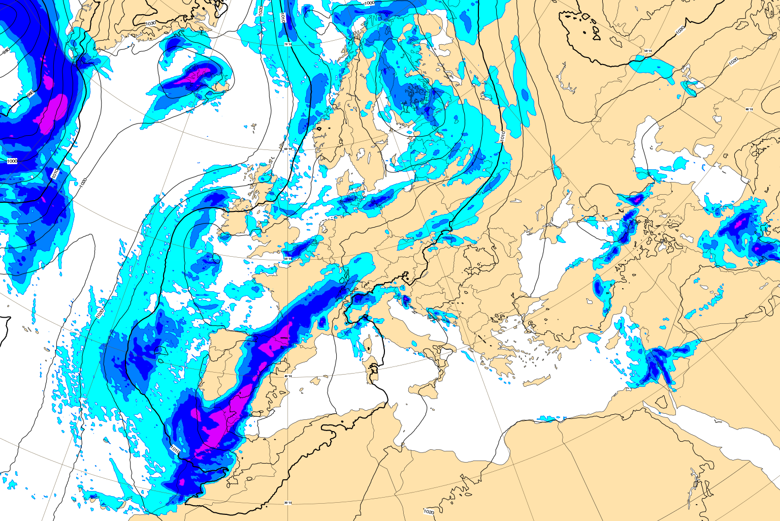
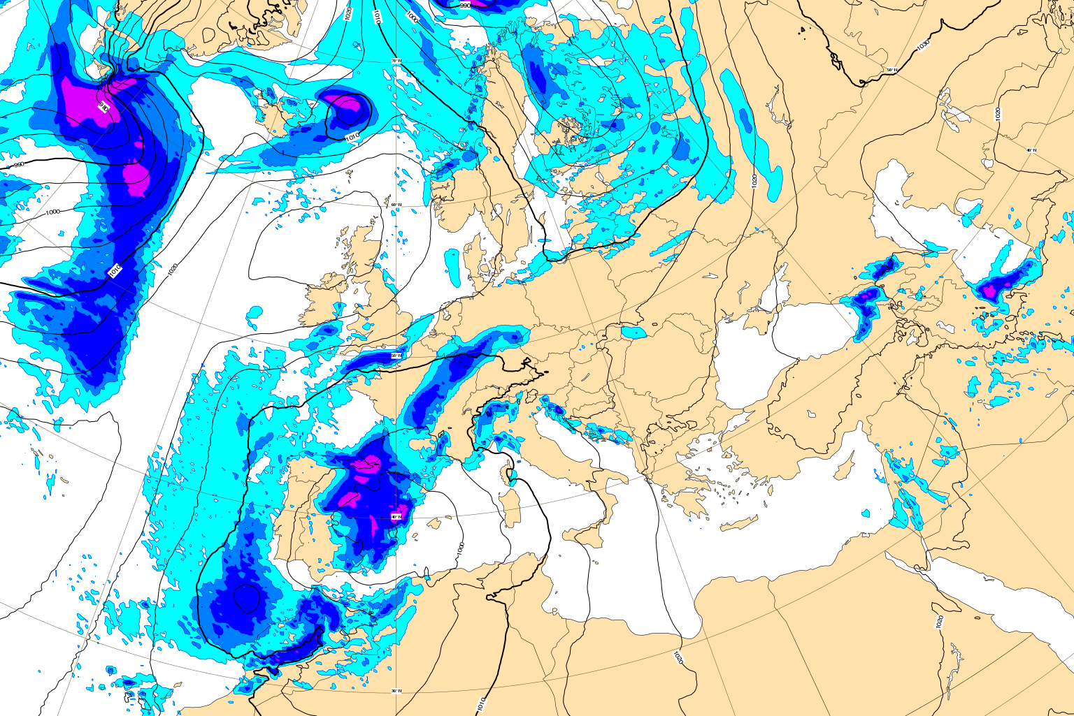
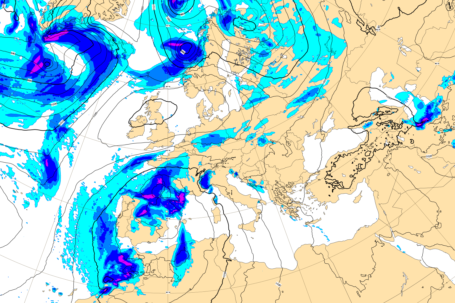
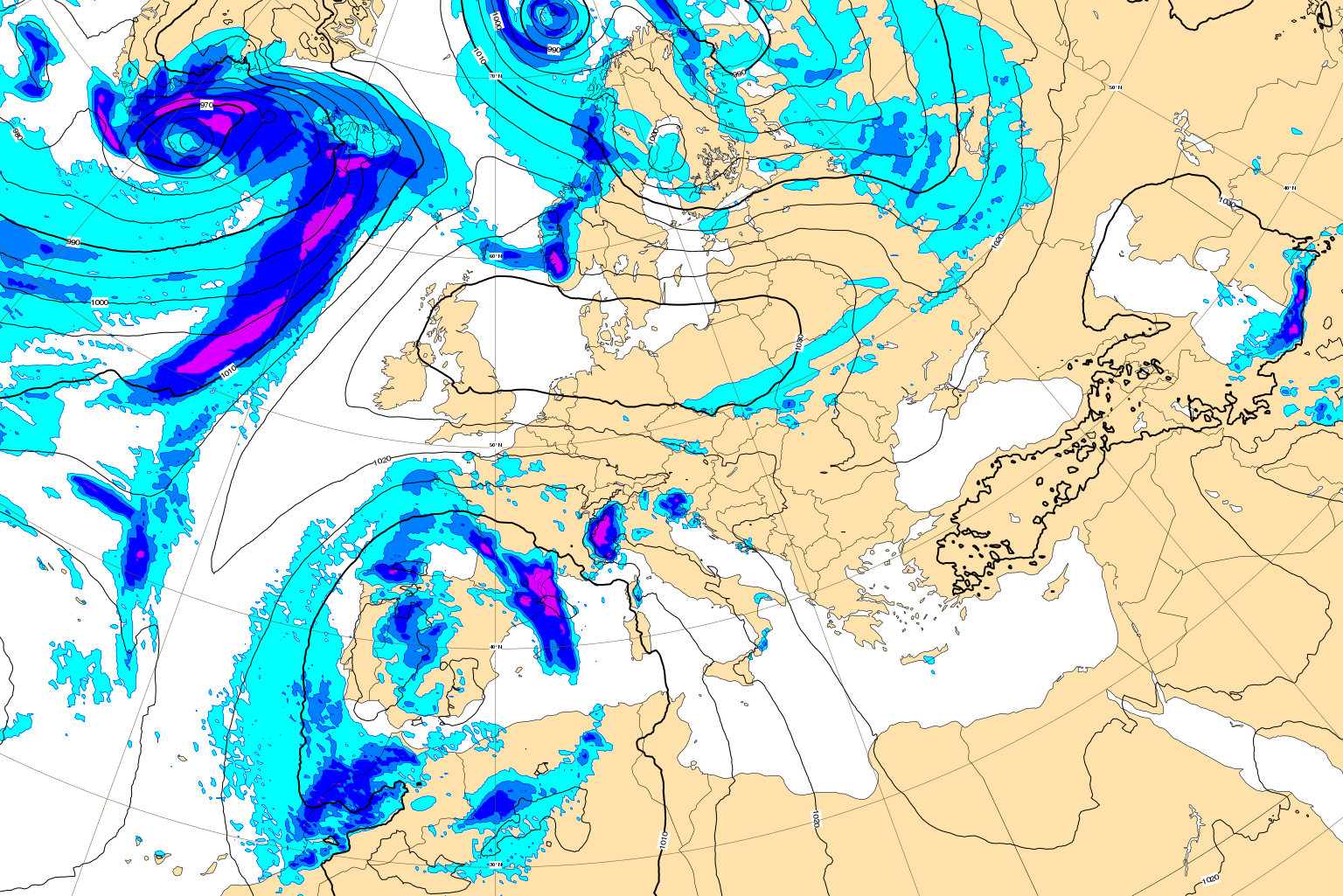
The plots below show MSLP and 6-hour precipitation with plots every 12th hour starting from 6 January 06z and ending 7 January 18z.
3. Predictability
3.1 Data assimilation
3.2 HRES
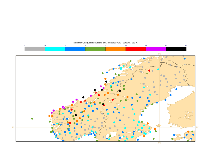
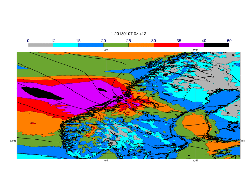
Observations of 24-hour maximum wind gusts on 7 January (left) and forecast for the maximum wind gusts (shade) and MSLP valid 12z (right).
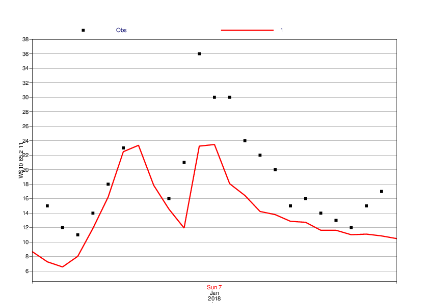
The plot below shows time-series of 10-metre mean wind for Heimoya (65.2N/11E) from HRES (red) and observations (black).
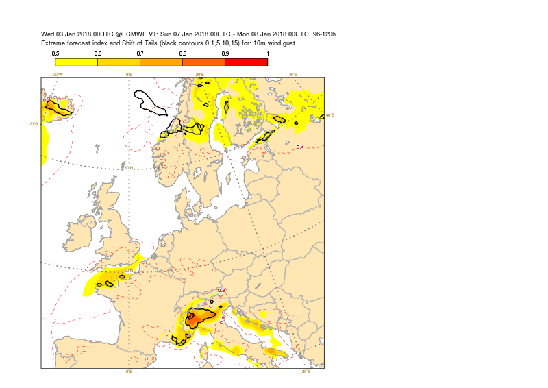
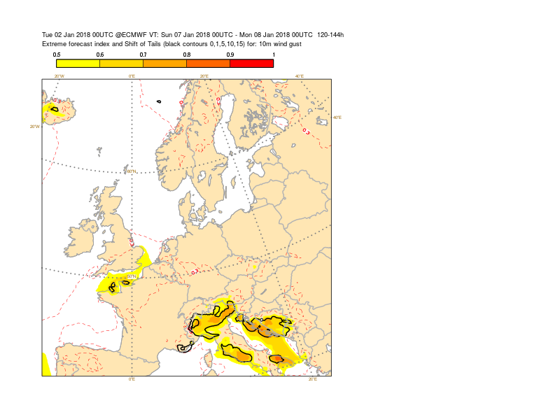
3.3 ENS
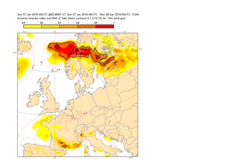
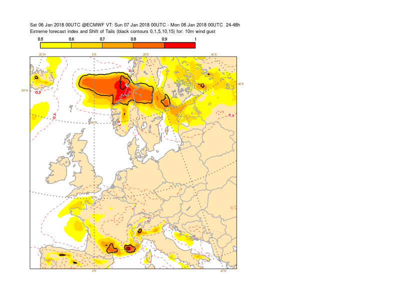
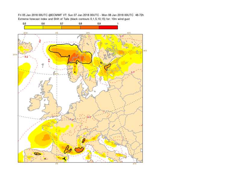
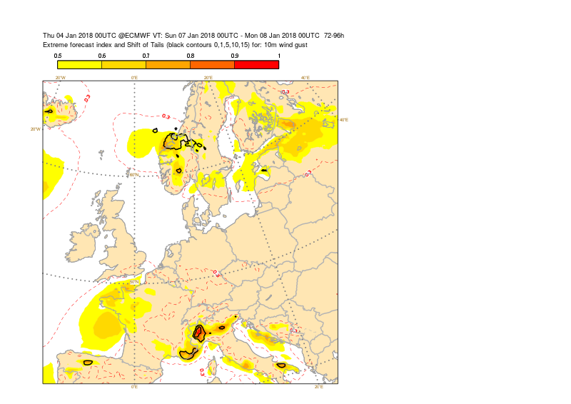
The plots below show EFI and SOT for 24-hour maximum wind gusts on 7 January from different initial times.