Status: Finalised Material from: Linus, David L., Tim
1. Impact
On 6 March large parts of France was hit by the windstorm Zeus. Note that the name "Zeus", that purportedly came from the naming system of the Free University of Berlin, does not actually correspond to the weather system labelled Zeus on the Berlin charts. In spite of being probably the most costly European Windstorm of the winter season 2016/17 (losses ~270M Euros) Zeus (so called) was so small, and deepened and decayed so quickly, that it was never actually named on the Berlin charts.

2. Description of the event
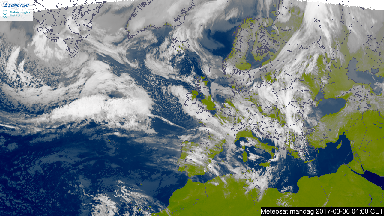
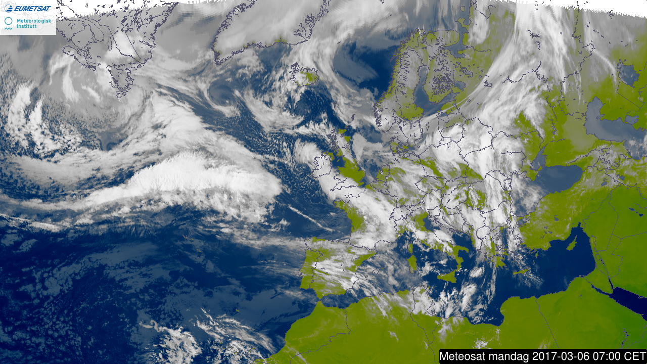
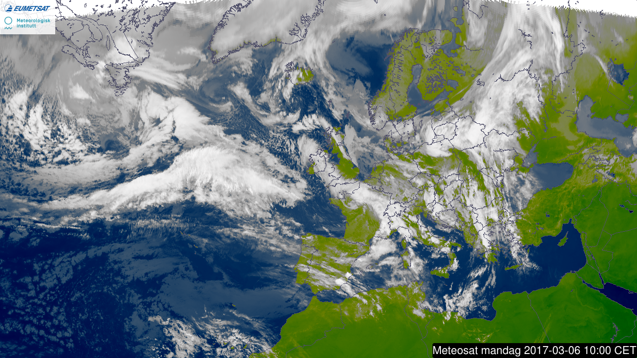
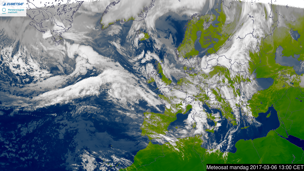
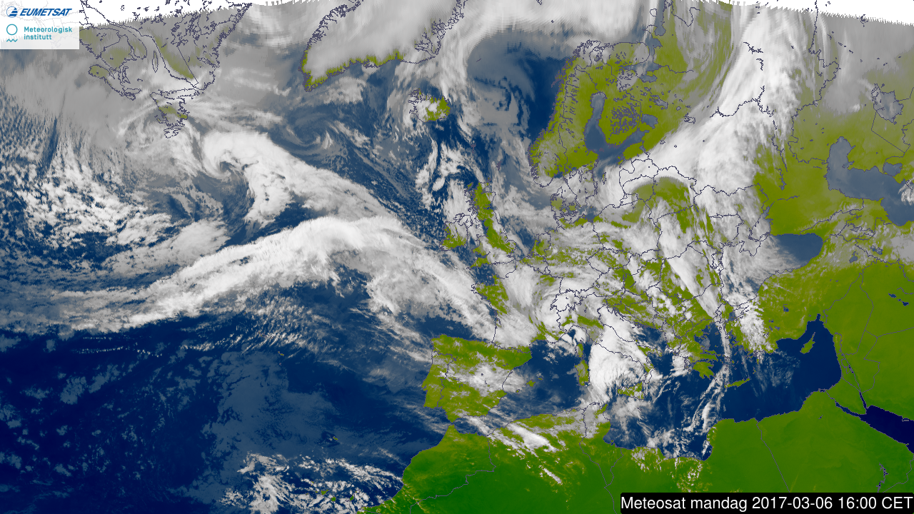
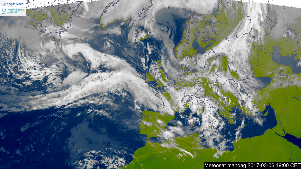
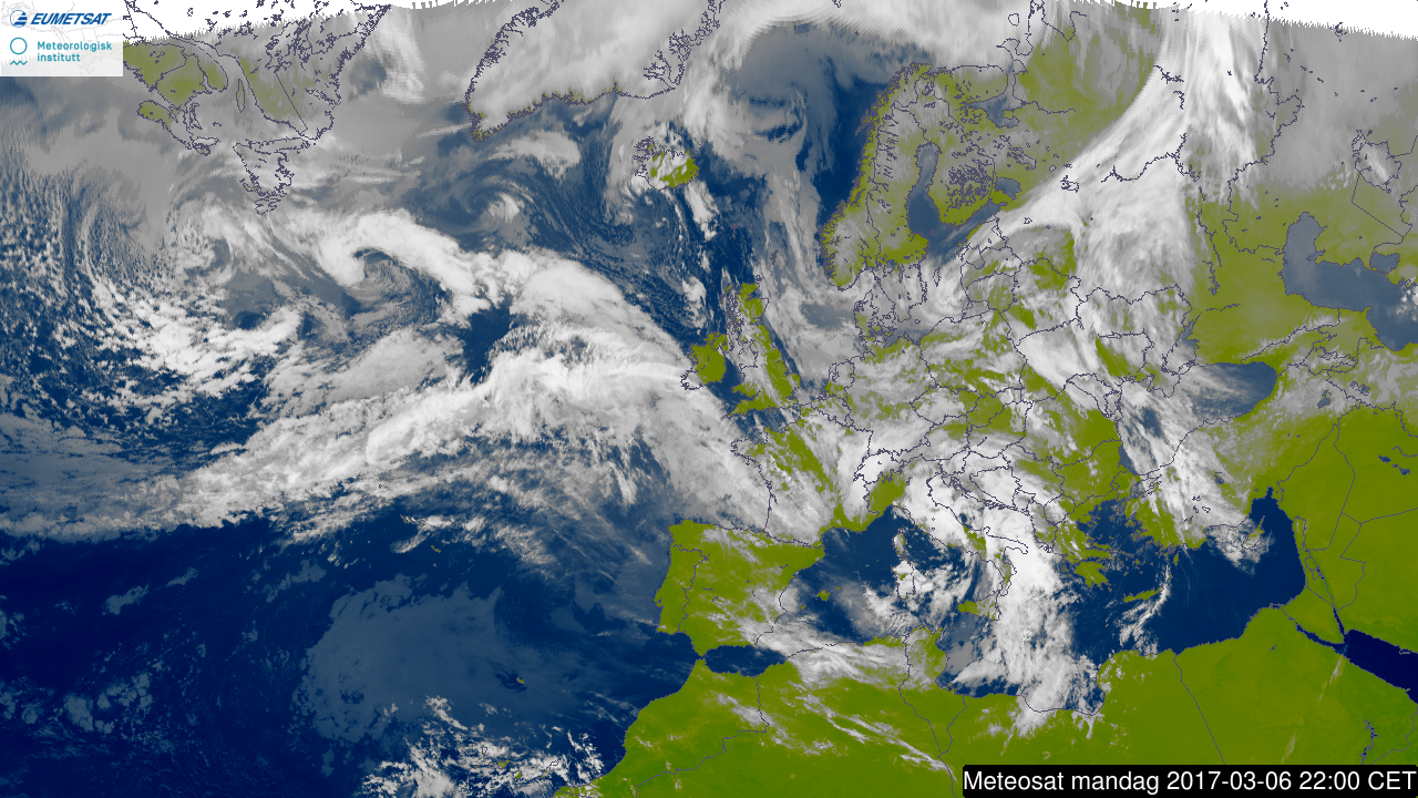
The series of plots below show satellite images from 6 March (every 3rd hour), provided from yr.no.

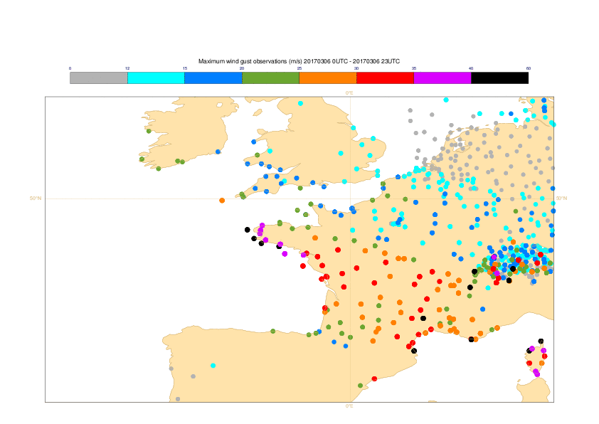
The plot below show observed 24-hour maximum wind gusts for 6 March.
3. Predictability
3.1 Data assimilation
3.2 HRES
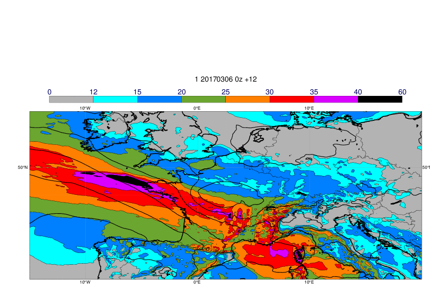
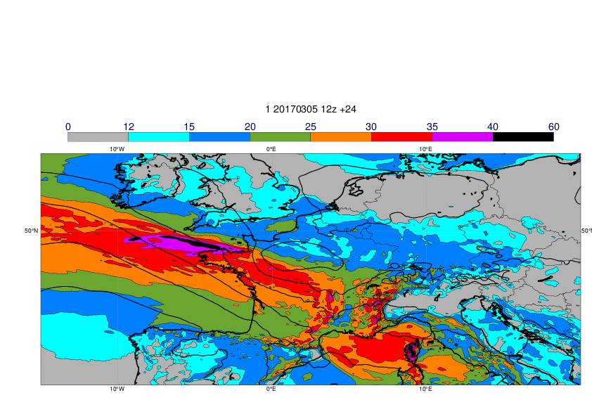
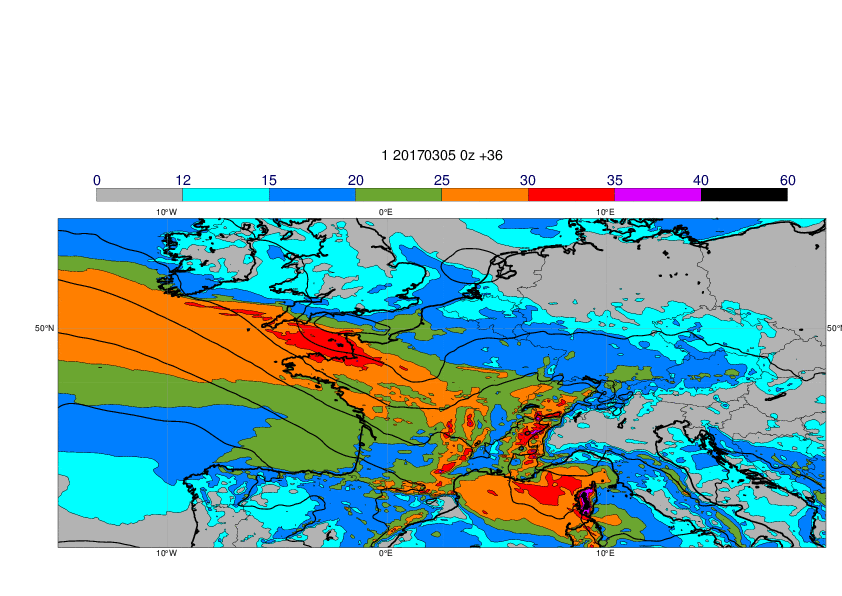
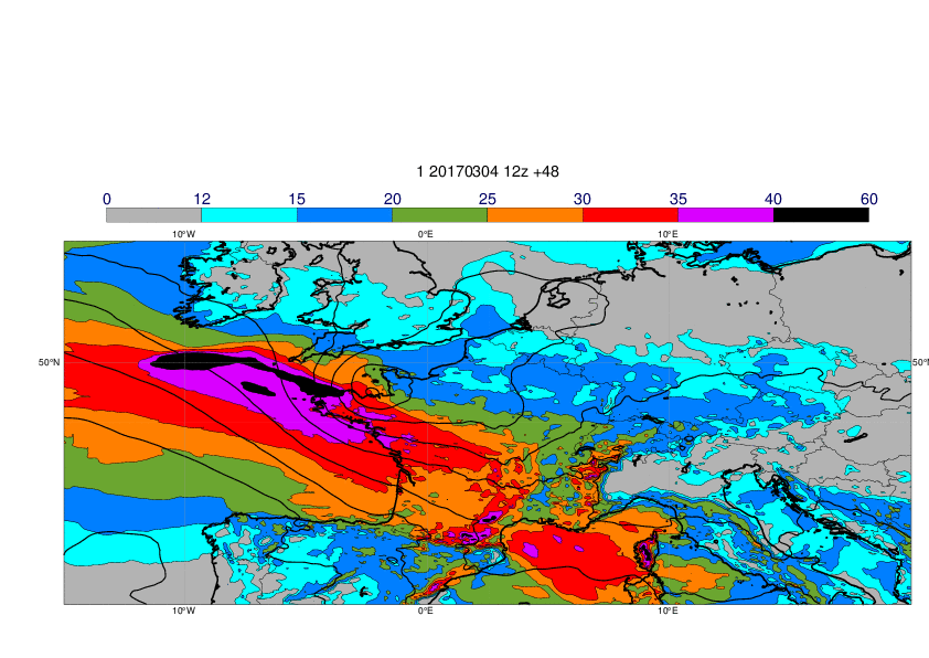
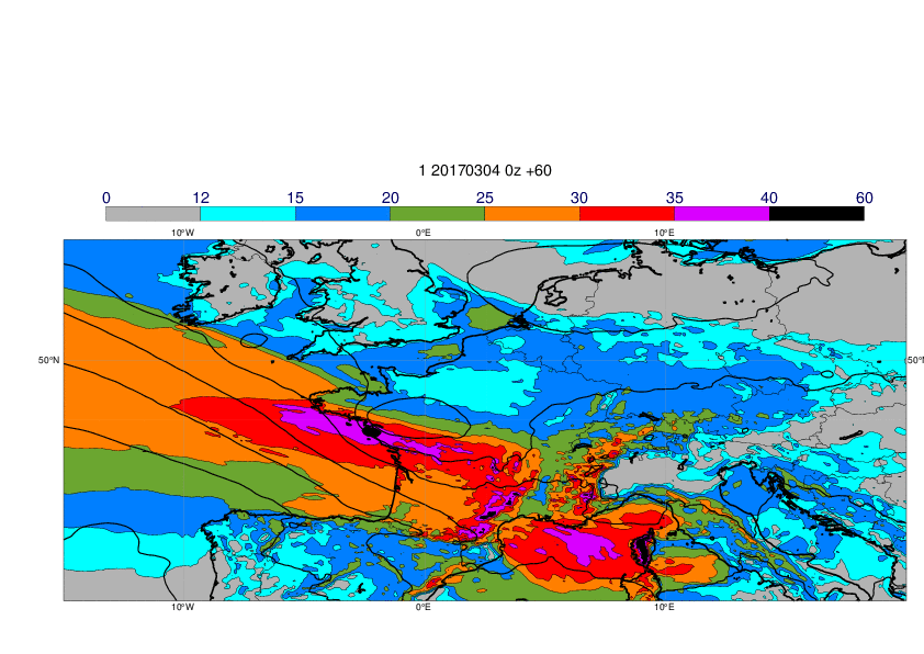
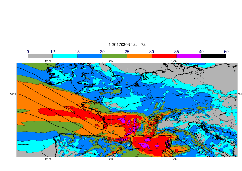
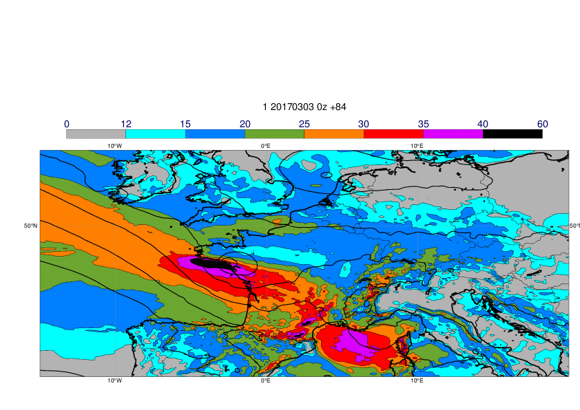
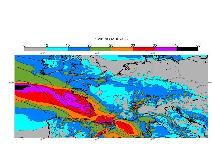
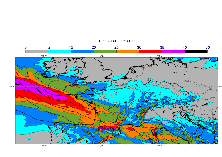
The plots below show 24-hour maximum wind gusts (shade) and MSLP valid 12UTC (contour) for 6 March.

3.3 ENS
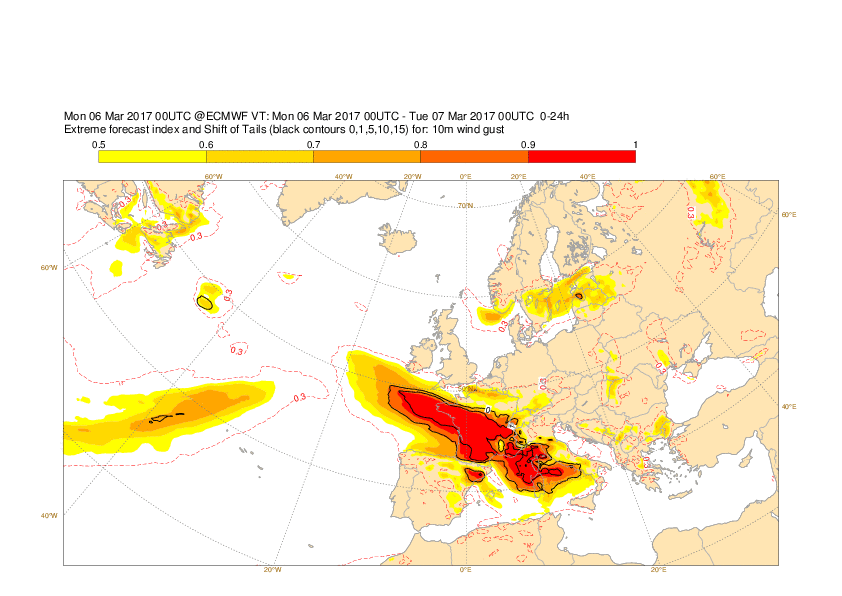
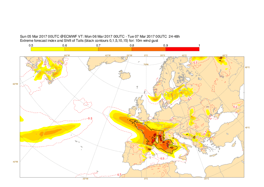
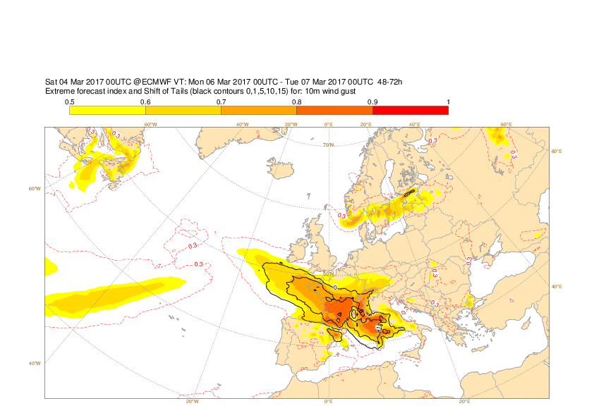
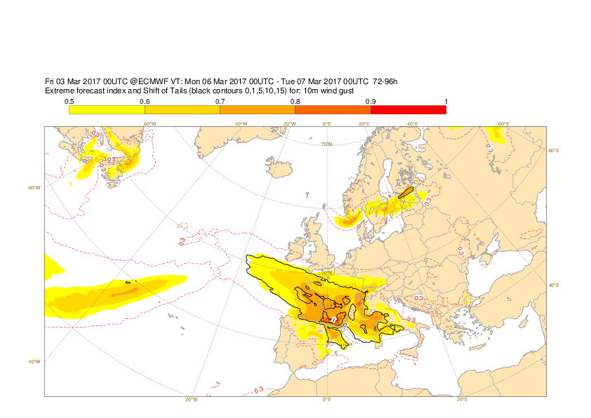
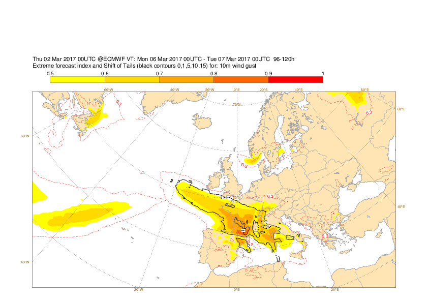
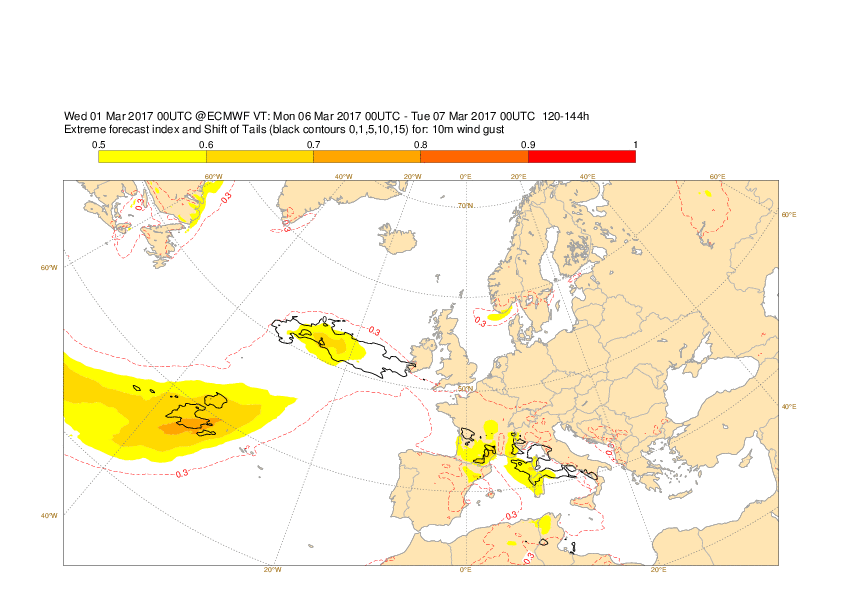
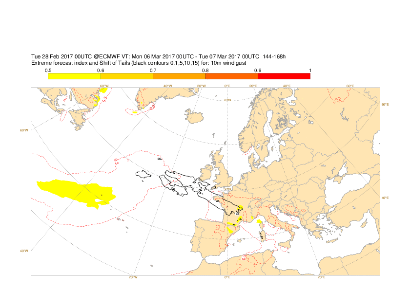
The plots below show EFI and SOT for wind gusts valid 6 March (24-hour maximum).
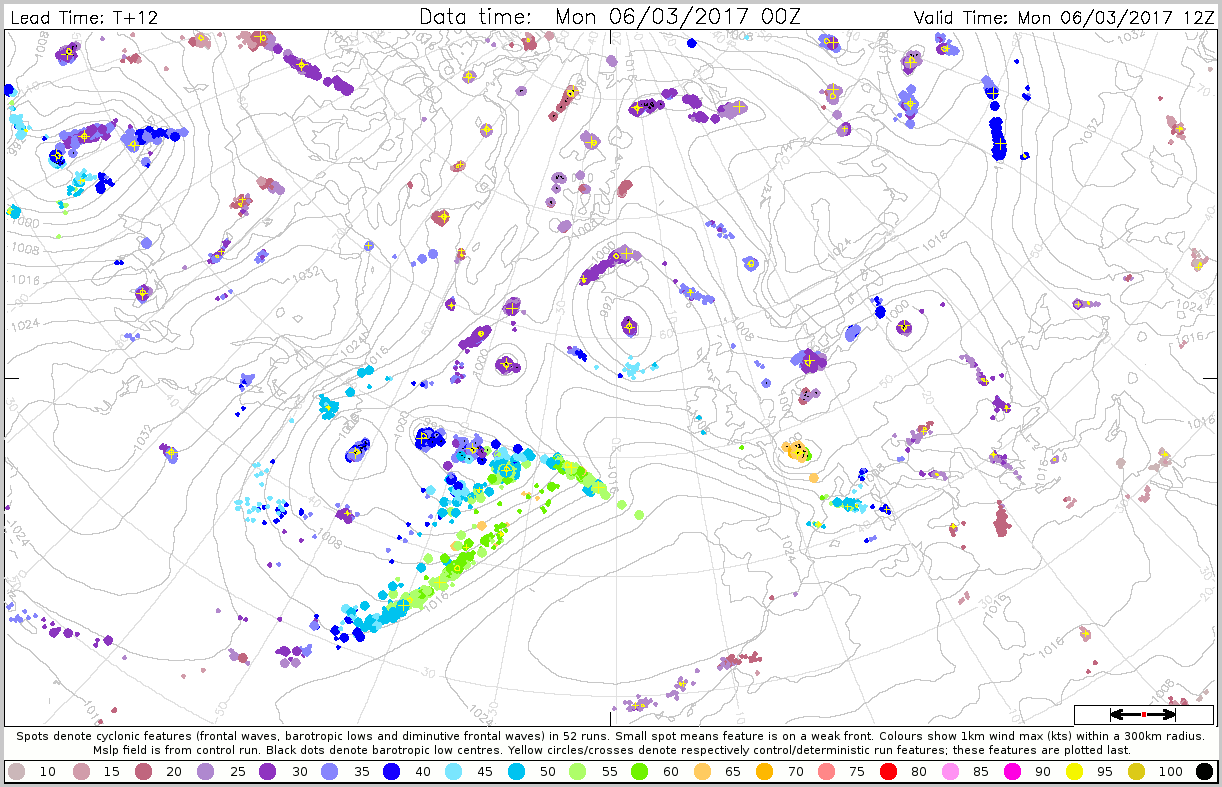
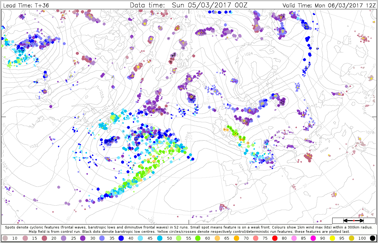
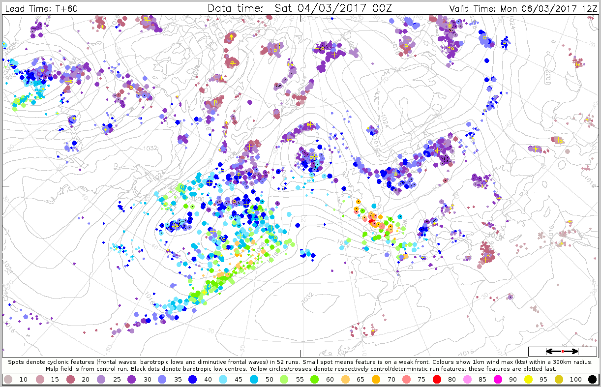
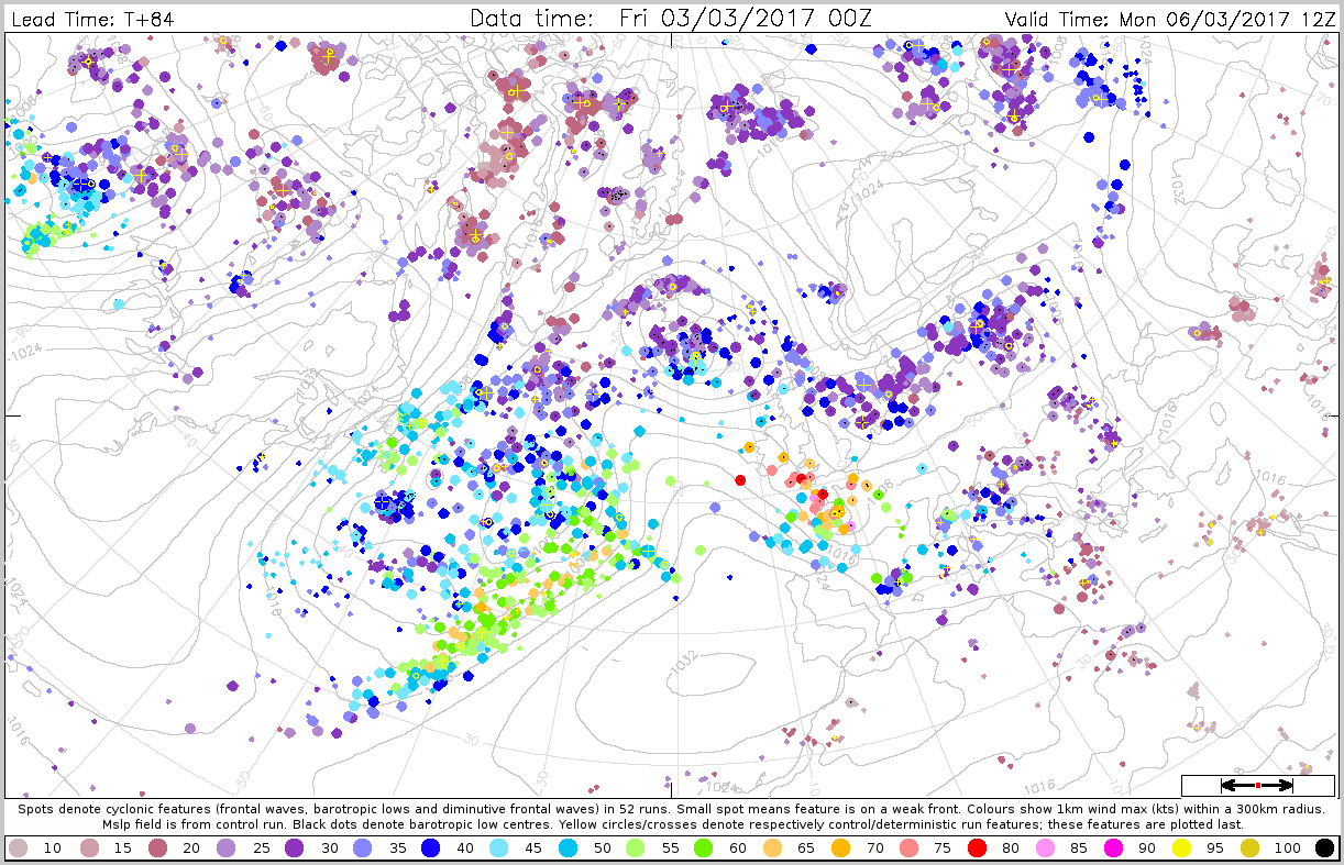
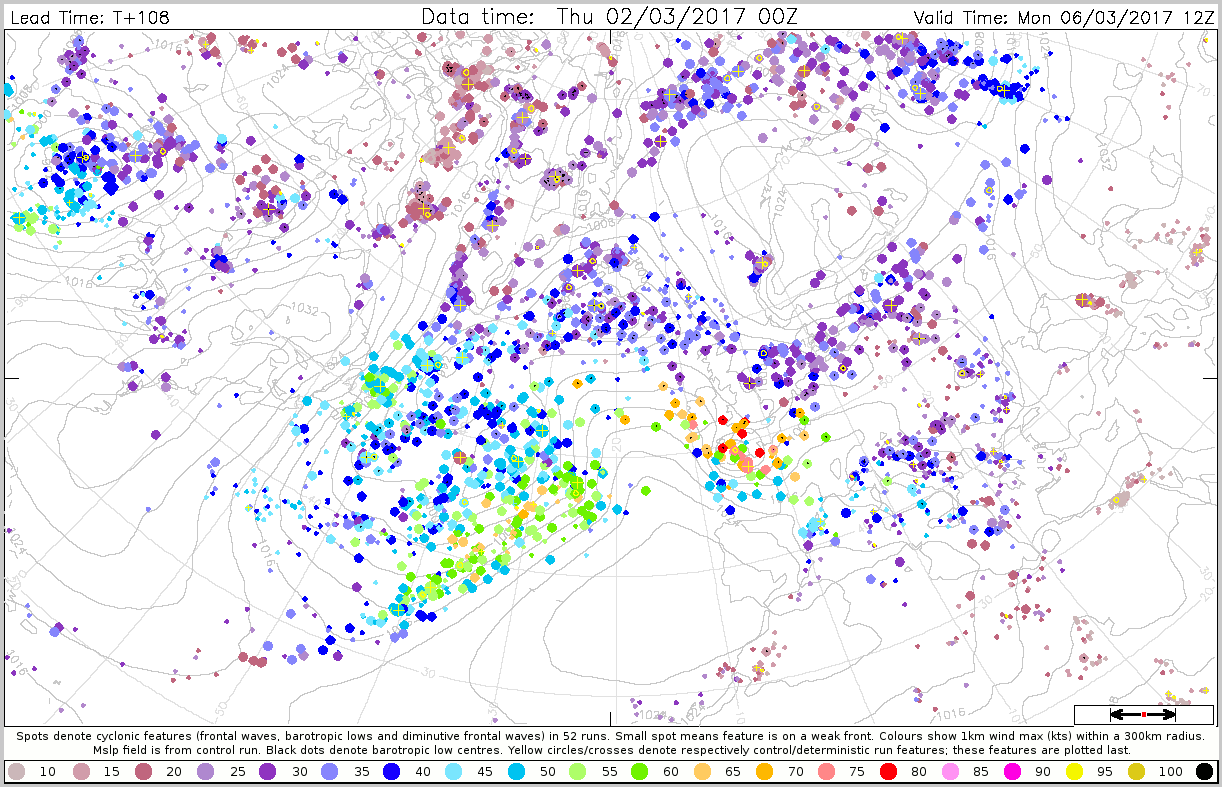
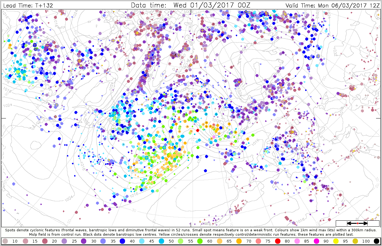
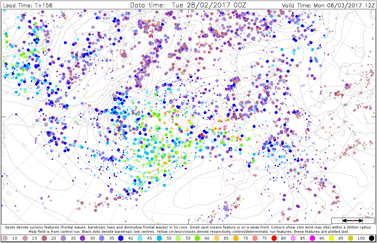
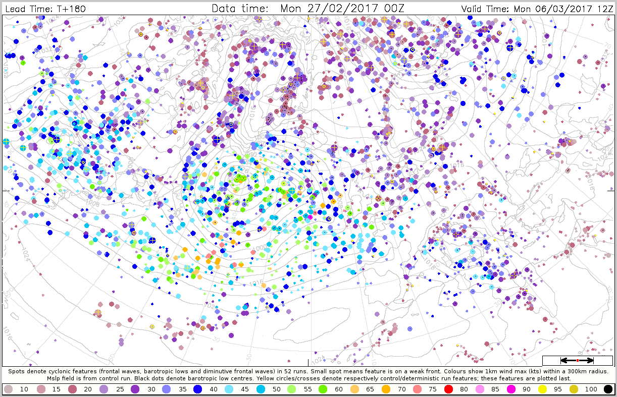
The plots below shows the cyclone feature plots for maximum wind within 300 km radius around the feature. All plots are valid 6 March 12UTC.
3.4 Monthly forecasts
3.5 Comparison with other centres
4. Experience from general performance/other cases
5. Good and bad aspects of the forecasts for the event
- The band of extreme wind gust well captured 4-5 days in advance
- The run from 5 March 00z was bad compared to earlier runs
6. Additional material
This case seems to provide evidence that ENS resolution was insufficient to capture the full force of the storm system (because it was so small):

The dynamics of Zeus, and investigations into the reasons for the poor forecasts of 5 March, were discussed by Tim Hewson at the the June 2017 UEF meeting - see ZeusOnly_fromUEF.pptx.
Status:Ongoing analysis Material from: Linus, David L., Tim
Picture
1. Impact
On 6 March large parts of France was hit by the windstorm Zeus. Note that the name "Zeus", that purportedly came from the naming system of the Free University of Berlin, does not actually correspond to the weather system labelled Zeus on the Berlin charts. In spite of being probably the most costly European Windstorm of the winter season 2016/17 (losses ~270M Euros) Zeus (so called) was so small, and deepened and decayed so quickly, that it was never actually named on the Berlin charts.
2. Description of the event
The series of plots below show satellite images from 6 March (every 3rd hour), provided from yr.no.
The plot below show observed 24-hour maximum wind gusts for 6 March.
3. Predictability
3.1 Data assimilation
3.2 HRES
The plots below show 24-hour maximum wind gusts (shade) and MSLP valid 12UTC (contour) for 6 March.
3.3 ENS
The plots below show EFI and SOT for wind gusts valid 6 March (24-hour maximum).
The plots below shows the cyclone feature plots for maximum wind within 300 km radius around the feature. All plots are valid 6 March 12UTC.
3.4 Monthly forecasts
3.5 Comparison with other centres
4. Experience from general performance/other cases
5. Good and bad aspects of the forecasts for the event
- The band of extreme wind gust well captured 4-5 days in advance
- The run from 5 March 00z was bad compared to earlier runs
6. Additional material
This case seems to provide evidence that ENS resolution was insufficient to capture the full force of the storm system (because it was so small):
The dynamics of Zeus, and investigations into the reasons for the poor forecasts of 5 March, were discussed by Tim Hewson at the the June 2017 UEF meeting - see ZeusOnly_fromUEF.pptx.