Status: Finalised Material from: Fernando, Ervin, Linus
1. Impact
Wales, the Midlands and SE England saw widespread disruption due to "significant" amounts of snow on 10 December. Power cuts left thousands of homes without power. Traffic was heavily affected and Airports had to cancelled flights. According with BBC, a quarter of flights were cancelled in Heathrow and Port of Calais was closed due to strong winds and significant wave heights. The few observations available across the UK showed snow depth amounts up to 33 cm in the Cambrian mountains. Elsewhere the amounts varies between the 3 and 18 cms (see plots in Section 2).
2. Description of the event
The first 2 plot below show snow observations from 10 December and the third plot includes the snow analysis and observations on 11 December (please discard the precipitation plot for Iberian peninsula).


3. Predictability
3.1 Data assimilation
3.2 HRES
3.3 ENS
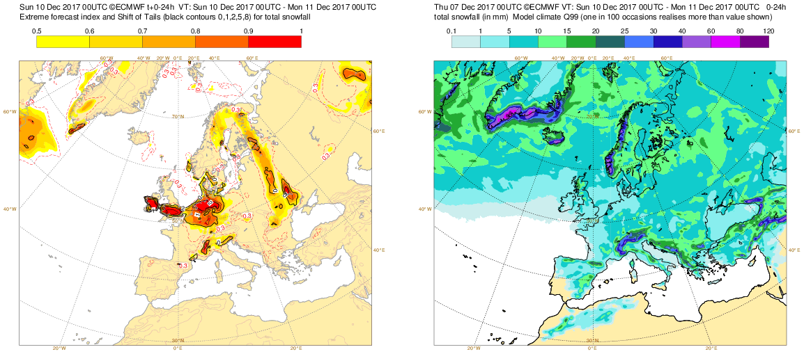
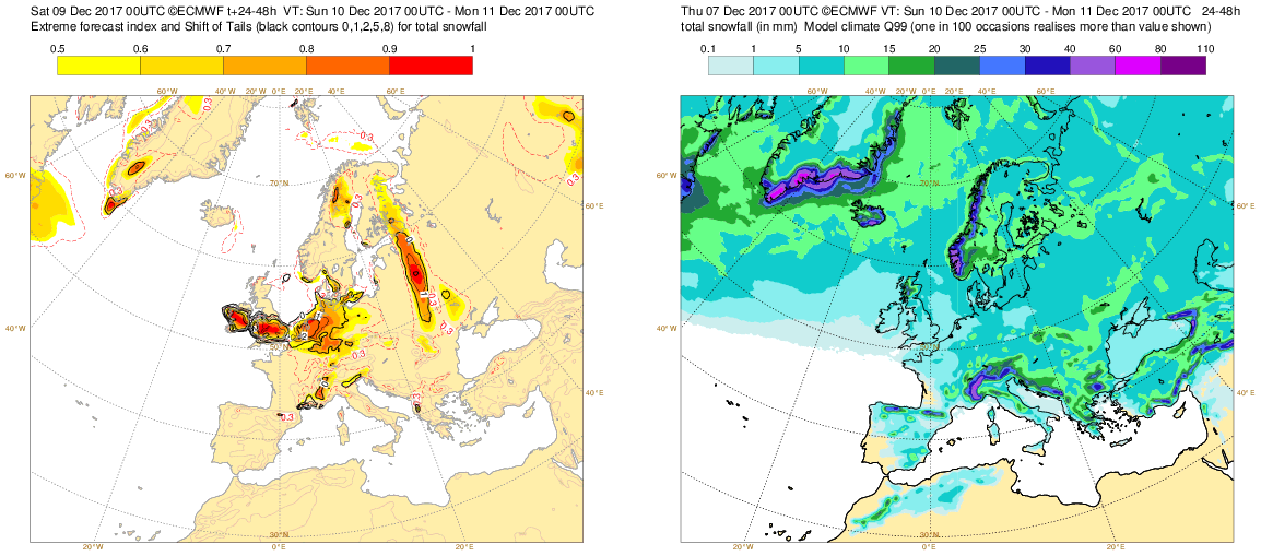
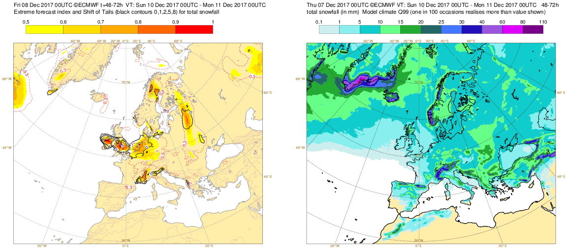
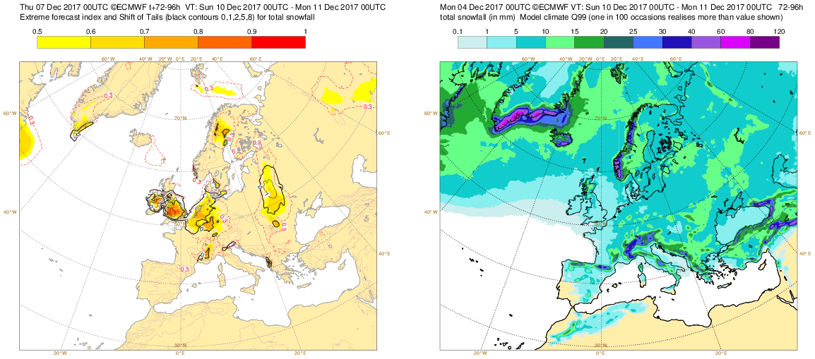
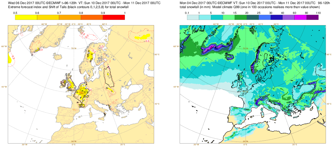
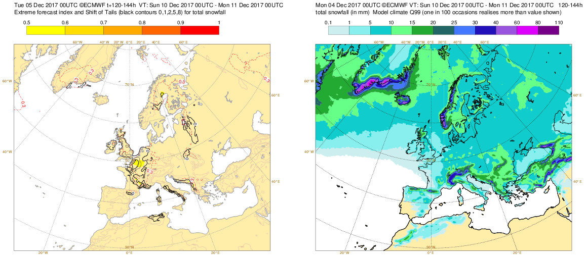
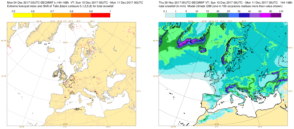
The plots below snow the EFI and SOT for snowfall on 10 December and the model climatology for the 99th percentile of snowfall. Already 7 days in advance SOT flagged the risk of snowfall on the British Isles and the last forecasts SOT took very high values.
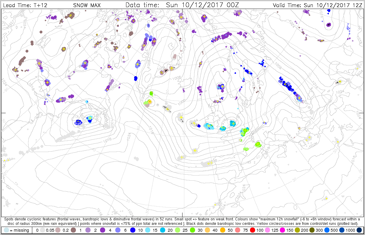
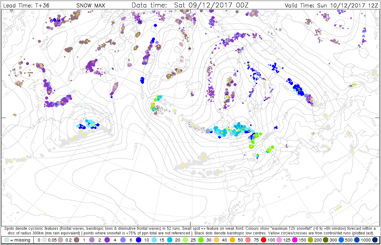
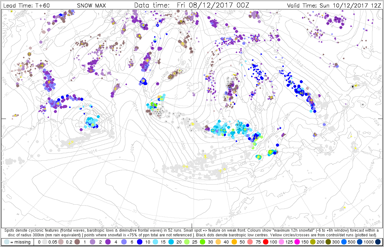
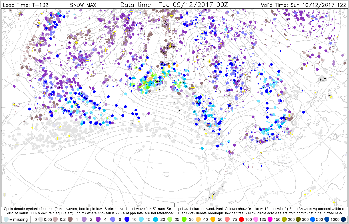
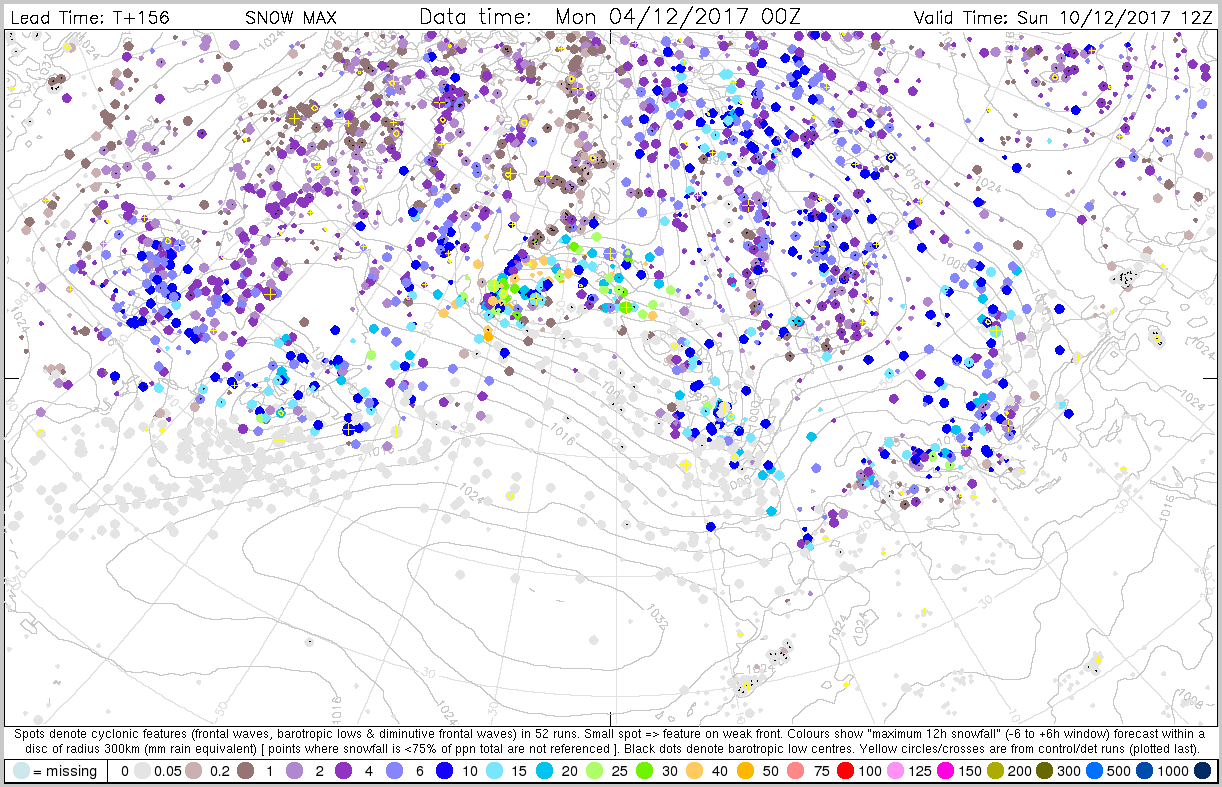
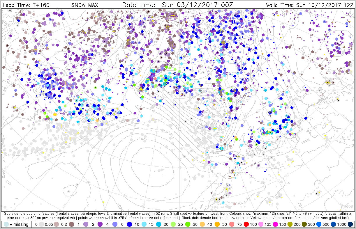
The plots below show the cyclone feature product of maximum snowfall.


3.4 Monthly forecasts
3.5 Comparison with other centres
4. Experience from general performance/other cases
5. Good and bad aspects of the forecasts for the event
- Good early signal for the snowfall