-
Created by
 Linus Magnusson, last updated on Jul 10, 2019
5 minute read
Linus Magnusson, last updated on Jul 10, 2019
5 minute read
Status: Finalised Material from: Fernando, Linus
Picture
1. Impact
Early on 15 October heavy rainfall hit northern Spain and southern France. The river L' Aude in SE France (Carcassonne region) burst its banks, destroying road, bridges, houses. At least 10 people died related with this severe event.
https://www.bbc.co.uk/news/world-europe-45861428
2. Description of the event
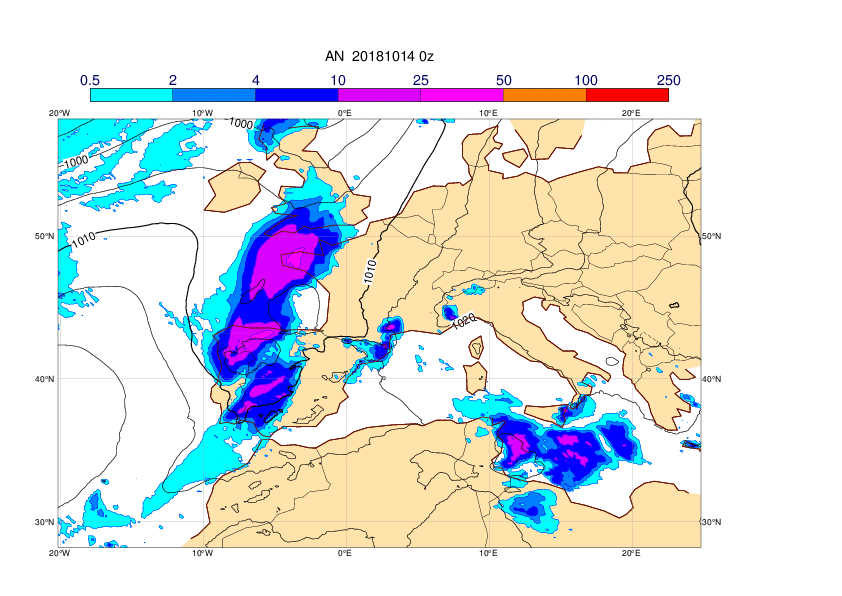
The plots below show analyses of MSLP and short forecasts of 6-hour total precipitation covering 13 October 00UTC to 15 October 12UTC, every 12th hour.


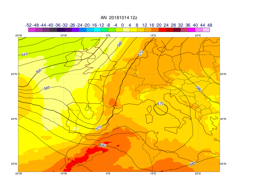
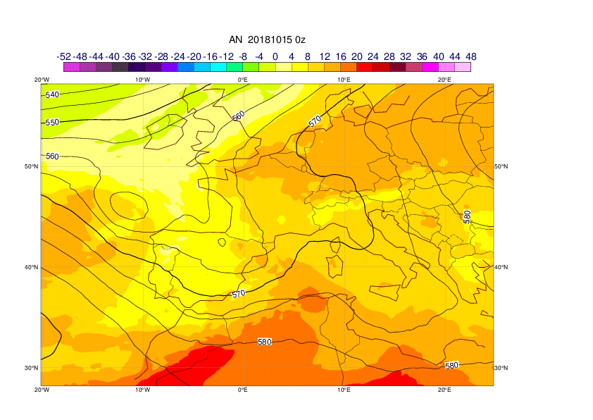
The plots below show analyses of z500 (contour) and T850 (shade) covering 13 October 00UTC to 15 October 12UTC, every 12th hour. The upper-level trough was related to tropical cyclone Leslie that hit Portugal late on 13 October (see above).


The two upper panels in the plot below show the totals valid at midnight (left) and 06Z (right) of last Monday. Most of the rain occurred during the first hours of the day. A couple of places reported values in excess of 100 mm in 24 h. The maximum was observed near Carcassonne with 140 mm (most of this in 12 hours).

3. Predictability
3.1 Data assimilation
3.2 HRES
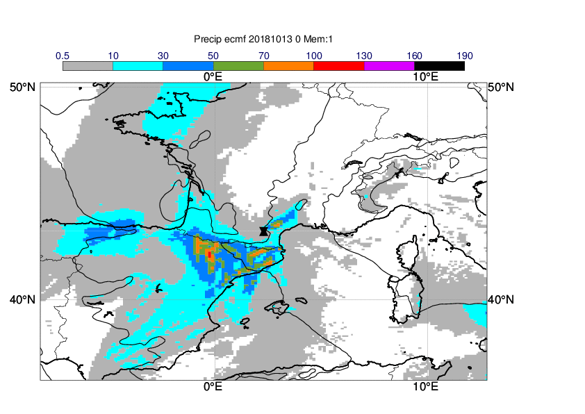
The first plots below shows observations of 24-hour precipitation 14 October 06z to 15 October 06z and the following plots HRES forecasts from different initial times valid the same time. The plots also includes MSLP valid at 18UTC on 14 October.


When we look at the analysis map of T850/Wind850/Z500/ valid for 15@00 (figure shown below) some details emerge which may be relevant to understand the totals observed in the region. One feature is the strong low level southeasterly winds in the Golfe du Lion bringing extra-moisture from the Mediterranean sea which at this time shows SSTs above the normal (not shown). The vertical profile near Carcassonne is near saturation as we can see from the tephigram. The veering winds (see on right of the tephigram) suggests the possibility of dynamical lifting enhancing the vertical motions in the region. Meanwhile the strong winds (30-40 kts) in the lower troposphere blowing from the Mediterranean Sea generate a secondary vortex on the lee side of the mountain (French side, mid-pyrennes region, close to the pinpoint) which could play a role on enhancing the vertical motions.


Left: Analysis T850(shades)/Wind850(barbs)/Z500(contours) and vertical profile near Carcassonne (pinpoint) valid for 15@00. Right: Same as previous map but for a forecast +60h from HRES (same run used for the verification chart showed before)
3.3 ENS
The plots below show a sequence of EFIs of precipitation based on the forecasts starting on 11@12. All forecasts are valid for Monday 15th. Arrow shows the location of the heavy rain.

An interesting feature was found in the evolution of the CDFs of precipitation for a point close to Carcassonne. Three days before the event the CDFs started to deviate significantly from Model Climate. As we get close to the event a "quanta-jump" behaviour is seen for the subsequent forecast runs which is unusual to see in this kind of plots.

3.4 Monthly forecasts
3.5 Comparison with other centres
4. Experience from general performance/other cases
- The predictability of the event was probably related to Tropical cyclone Leslie. 201810 - Tropical cyclone - Leslie