Status: Finalised Material from: Linus
1. Impact
On 16 February a cyclone named Julia passed northern Norway and Sweden. On the Swedish side, 36 m/s in mean wind was measured at Stora Sjofallet/Suorva.
2. Description of the event
The plots below show analyses of MSLP and 6-hour precipitation forecasts.


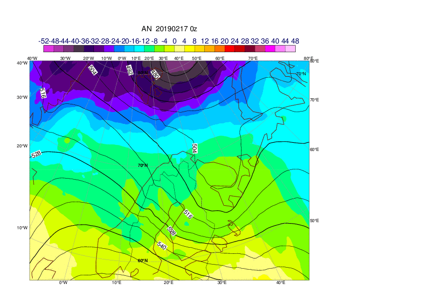
The plots below show analyses of z500 and t850.


3. Predictability
3.1 Data assimilation
3.2 HRES
The plots below show times-series short forecasts of observations (black), HRES (red) and ensemble control (blue) for 10-metre mean wind (left) and wind gusts (right) for Suorva/Stora Sjofallet in Sweden. The maximum wind gusts measured was 44 m/s.


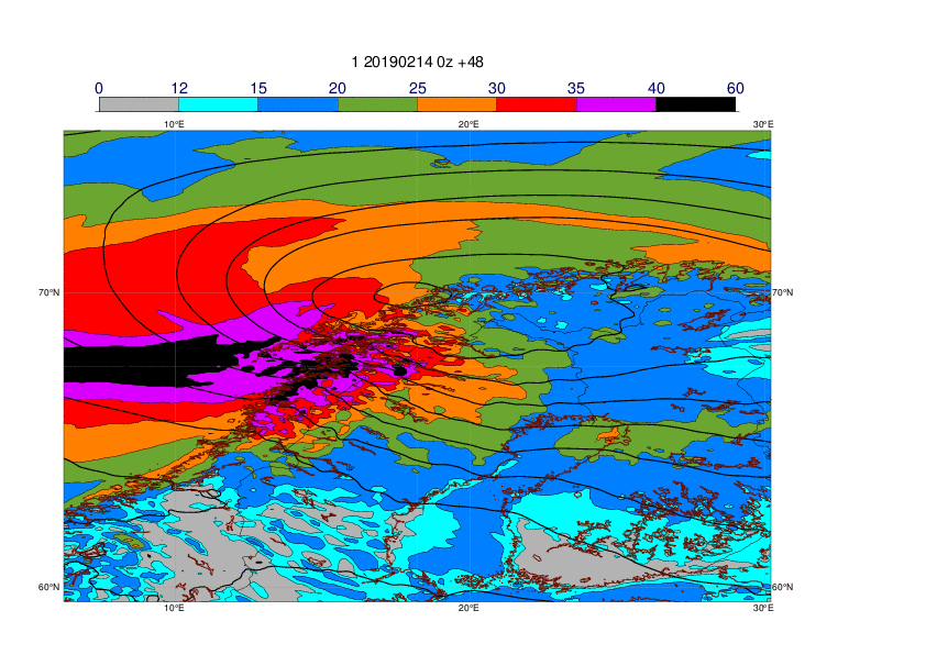
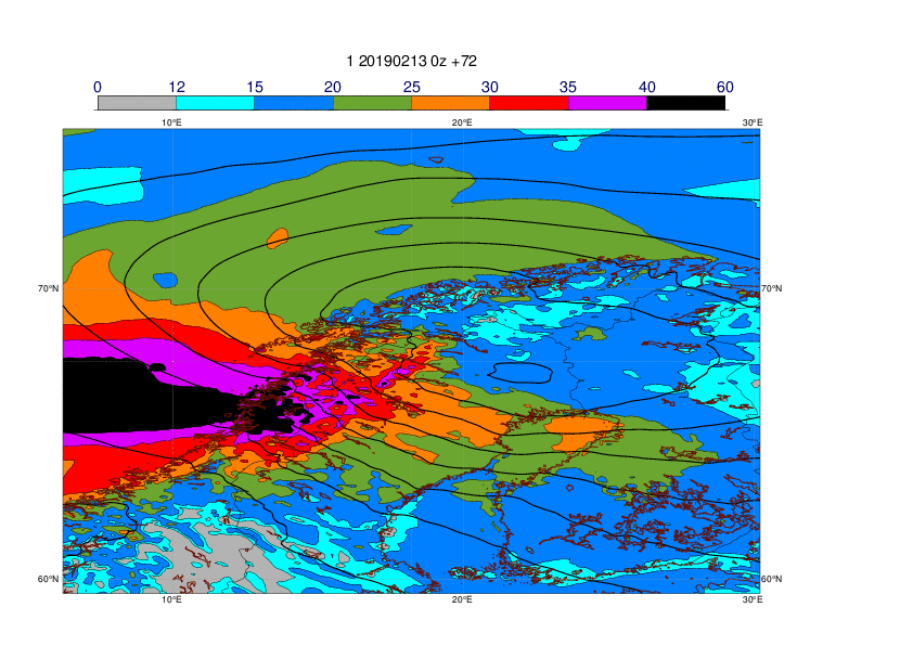
The plots below show observations of 24-hour maximum wind gusts valid 16 February 00UTC to 17 February 00UTC (first plot) and HRES forecasts valid at the same period. The forecast plots also includes MSLP valid 16 February 12UTC.


3.3 ENS
The plots below show EFI and SOT for wind gusts valid 16 February.


The plot below shows the evolution of forecast for 24-hour maximum wind gusts valid 16 February for Stora Sjofallet (67.5N, 18.2N), where the maximum gusts reached 43 m/s. The plot includes ensemble (blue box-and-whisker), HRES (red dot) and model climate (red box-and-whisker).
