-
Created by
 Linus Magnusson on Apr 13, 2023
4 minute read
Linus Magnusson on Apr 13, 2023
4 minute read
Status:Ongoing analysis Material from: Linus
1. Impact
The cyclone Mathis hit the British Isles and France on 31 March with strong wind and heavy rainfall.
2. Description of the event
The plots below show analyses of z500 and T850 from 28 March to 1 April 00UTC, every 24 hour.


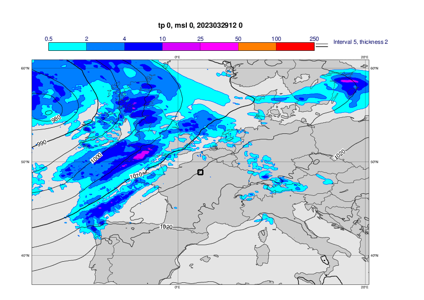
The plots below show analyses of MSLP and 6 hour rainfall from 29 March 00UTC to 1 April 00UTC, every 12th hour.


3. Predictability
3.1 Data assimilation
3.2 HRES
The plots below show observations from SYNOP (first plot), concatenated 6-hour forecasts (2nd plot) and o-suite HRES forecasts of 24-hour maximum wind gusts from 31 March 00UTC - 1 April 00UTC, from different initial dates.


3.3 ENS
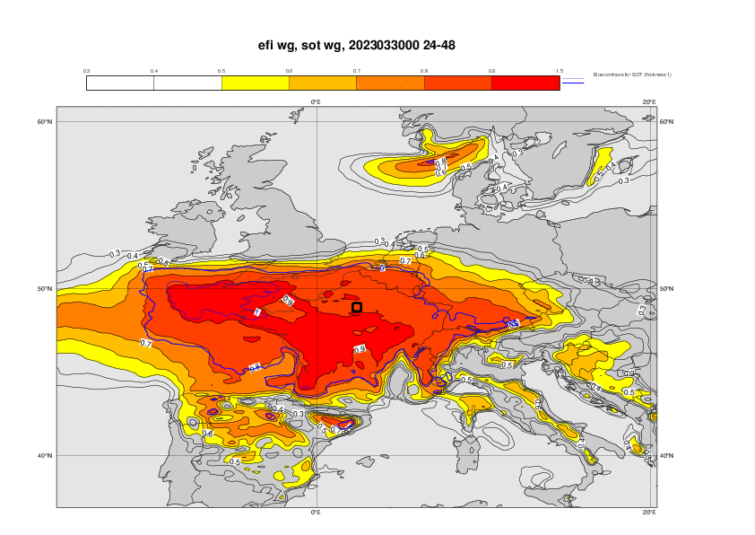
The plots below show EFI for 1-day maximum wind gusts on 31 March, from different initial times.


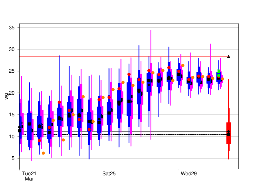
The plot below shows the forecast evolution plot for 24-hour maximum valid 31 March 00UTC - 1 April 00UTC for 0.5 degree box around Paris. Mean of observations - green hourglass, concatenated 6-hour forecasts - green dot, HRES –red, ENS blue box-and-whisker, Model climate – red box-and-whisker. Ensemble median as black box and ensemble mean as black diamonds. Triangle marks the maximum in the model climate based on 1200 forecasts. 48r1 e-suite is included in orange dot (HRES/ENS control) and purple (ENS distribution).