-
Created by
 Linus Magnusson, last updated on Jan 11, 2024
3 minute read
Linus Magnusson, last updated on Jan 11, 2024
3 minute read
Status:Ongoing analysis Material from: Linus
1. Impact
On 3 January southern Sweden was hit by a blizzard related to the cyclonic system named Henk. Parts of Skane (southern Sweden) got 40 cm of snow in combination with strong winds, leading to hundreds of cars getting stuck on a motorway. At the same time northern Sweden experienced extreme cold temperatures (below -40C). Storm Henk also led to severe rainfall on the British Islands.
2. Description of the event
The evaluation will focus on 24-hour snowfall on 3 January in a 0.5x0.5 box over eastern Skane (centre point 55.8N, 13.7E).
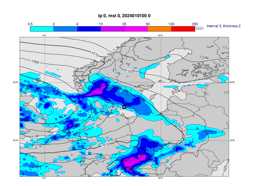
The plots below show analyses of MSLP and 6 hour rainfall from 1 January 00UTC to 4 January 00UTC, every 12th hour.


The plot below shows the snow depth at 06UTC on 4 January in Sweden.

3. Predictability
3.1 Data assimilation
3.2 HRES
The plots below show 24-hour snowfall in mm water (3 January 00UTC - 4 January 00UTC) in concatenated short forecasts (first plot) and ENS control forecasts with different lead times.


3.3 ENS
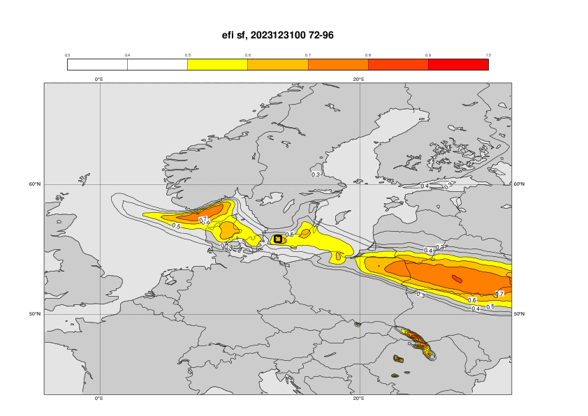
The plots below shows EFI and SOT for 1-day snowfall (3 January) from different initial dates.


The plot below shows the forecast evolution plot for 24-hour snowfall (3 january) for points inside a 0.5x0.5 box over eastern Skane. Concatenated 6-hour forecasts - green dot, ENS control –red, , ENS blue box-and-whisker, Model climate – cyan box-and-whisker. Ensemble mean as black diamonds. Triangle marks the maximum in the model climate based on 1800 forecasts.

3.4 Monthly forecasts
3.5 Comparison with other centres
4. Experience from general performance/other cases
5. Good and bad aspects of the forecasts for the event
- Good signal 3 days in advance for the extreme snofall in parts of southern Sweden.