Status:Ongoing analysis Material from: Tim, Linus
1. Impact
On 18 January the windstorm named Friederike (by Germany) hit UK, The Netherlands and Germany and killed at least 8 people.
http://www.bbc.co.uk/news/world-europe-42731505
2. Description of the event
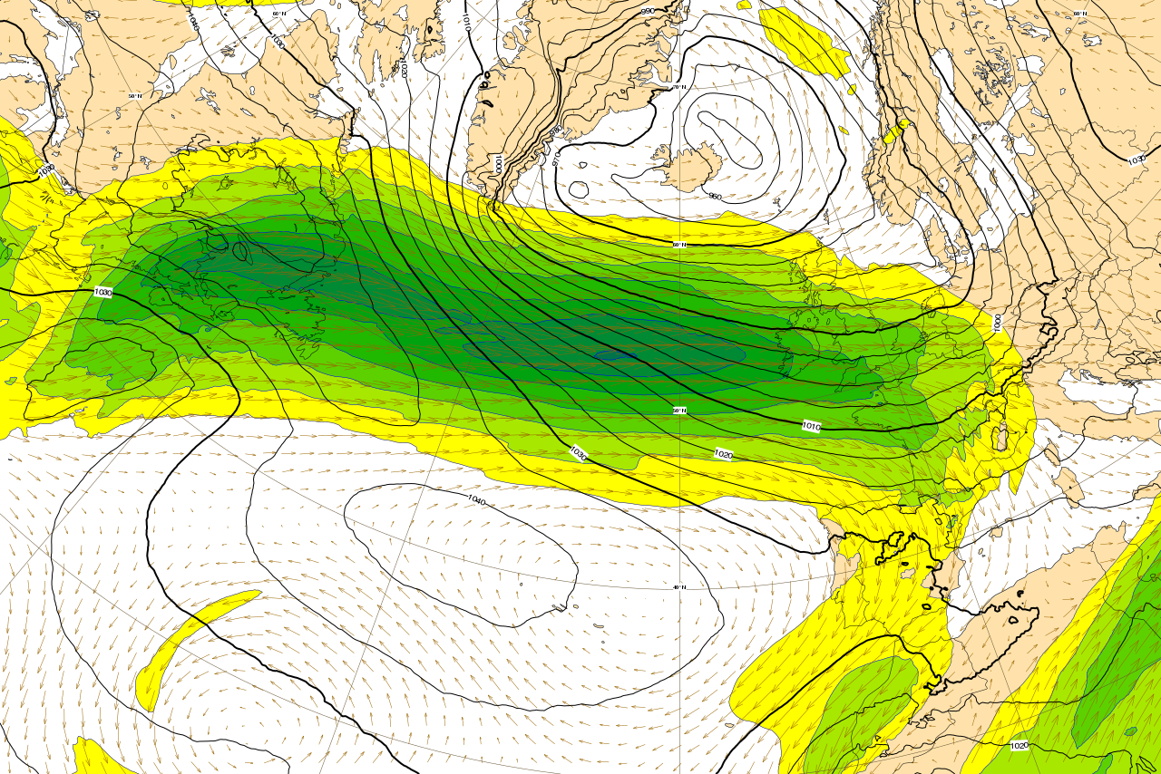
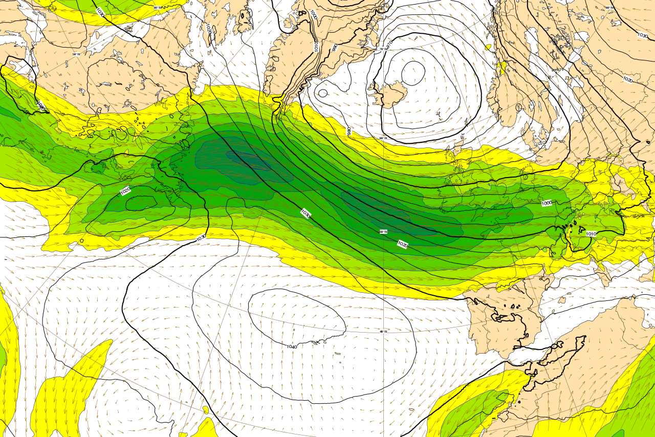
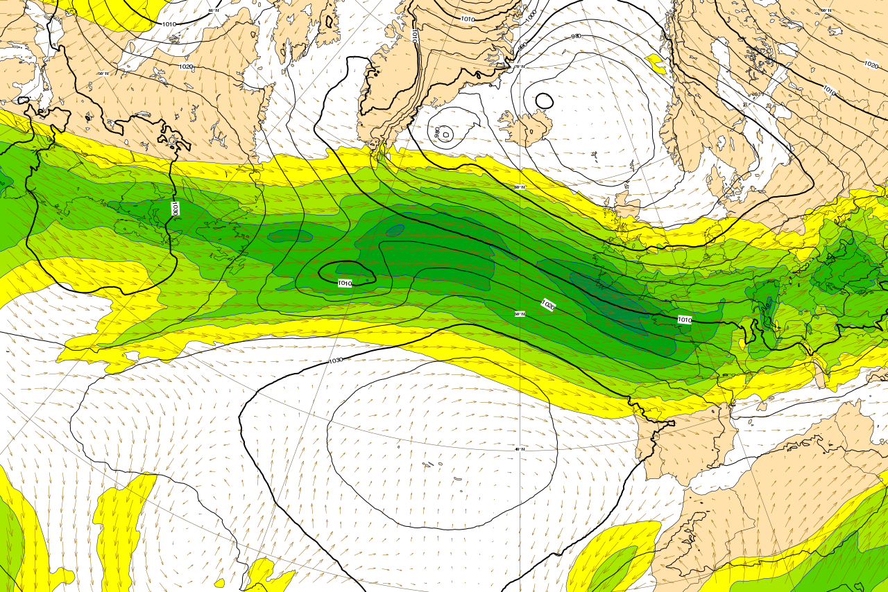
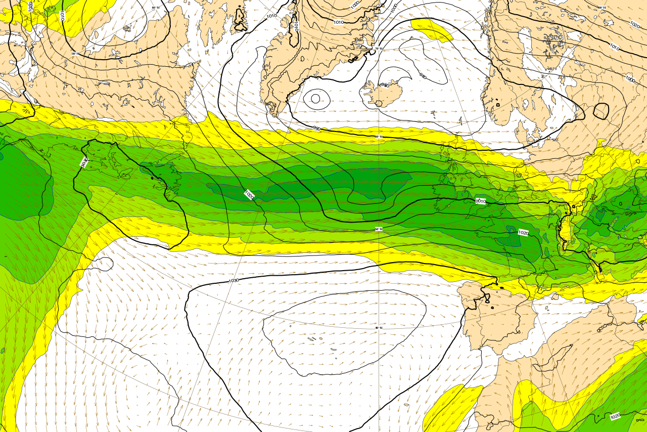
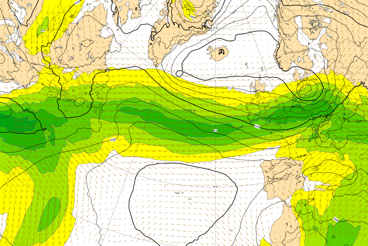
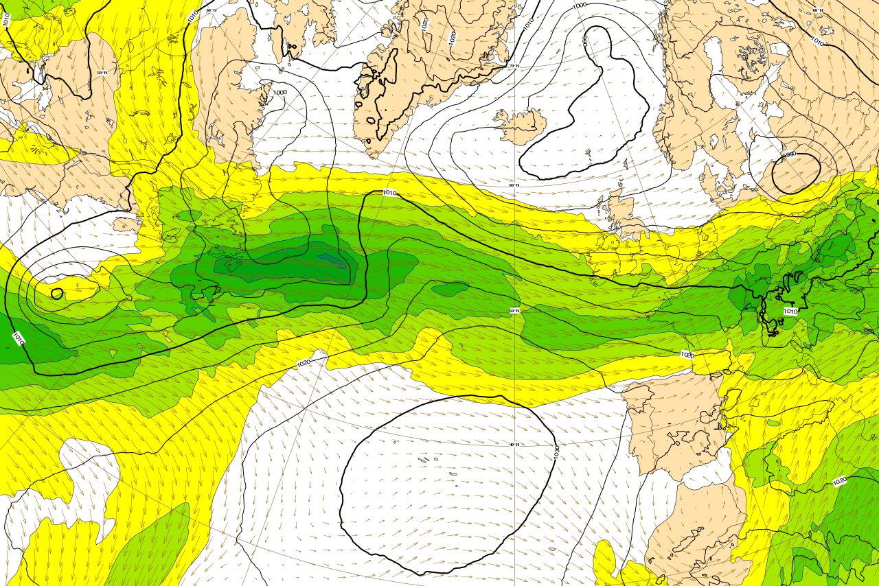
The plots below show the evolution of mslp (contour) and wind at 200hPa from 16 January 00UTC to 19 January 00UTC, every 12th hour.

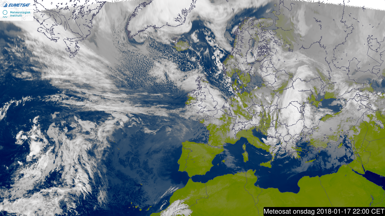
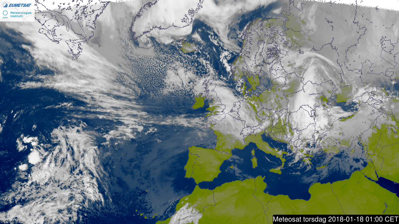
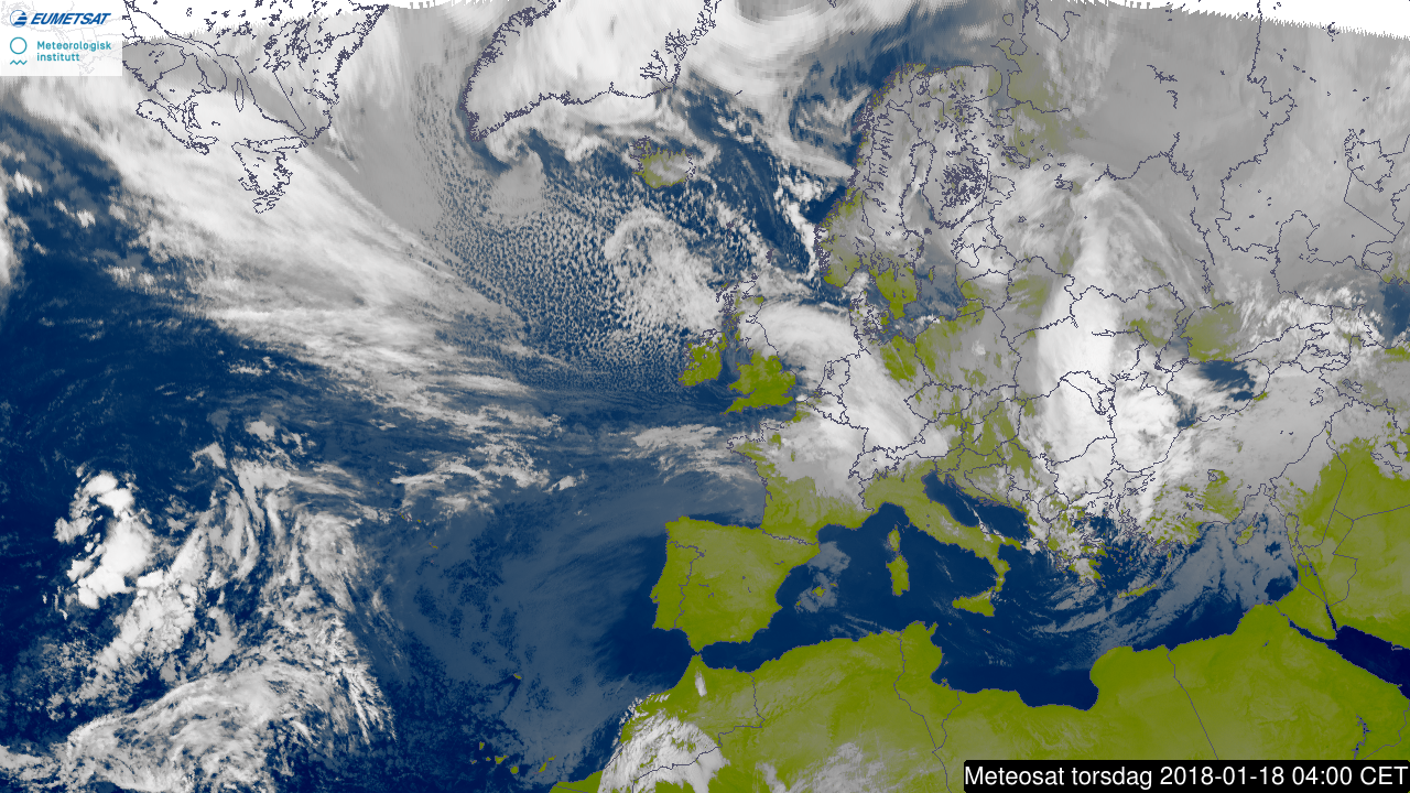
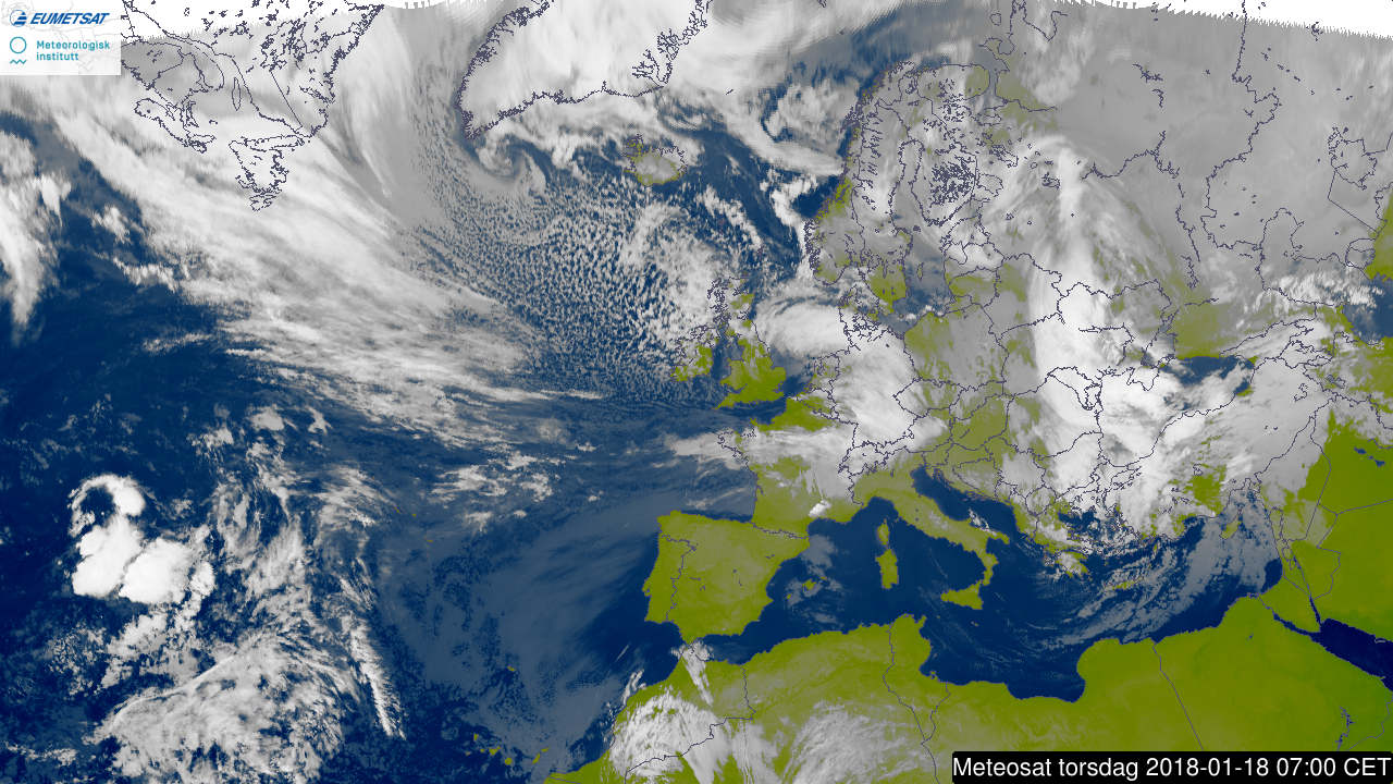
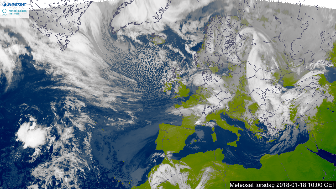
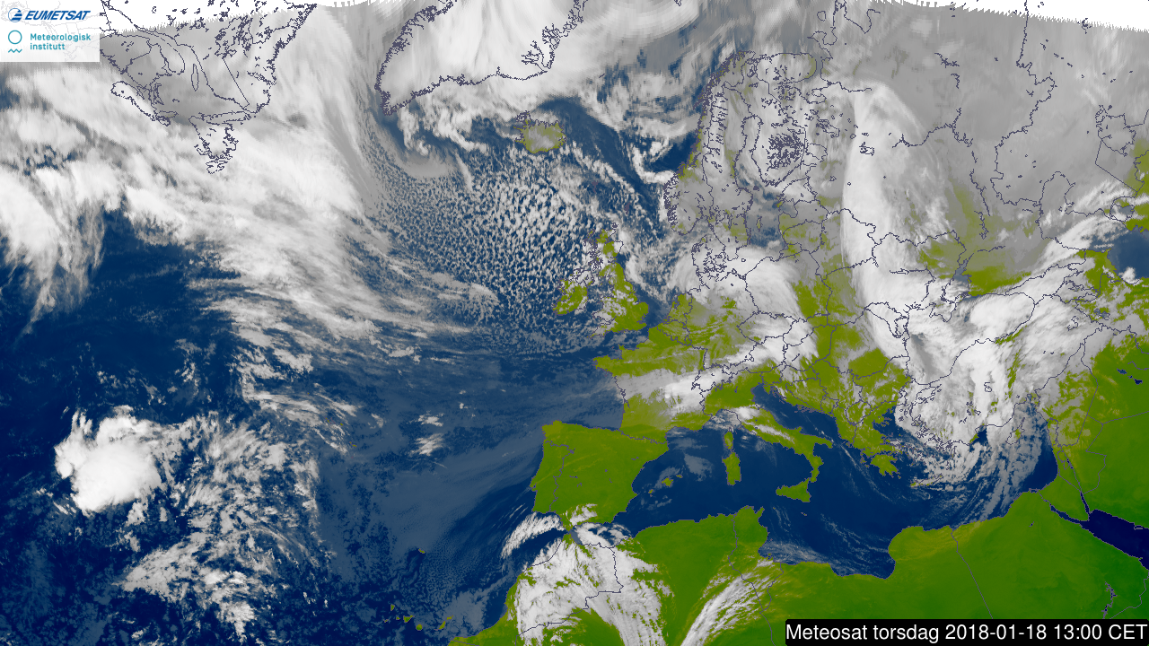
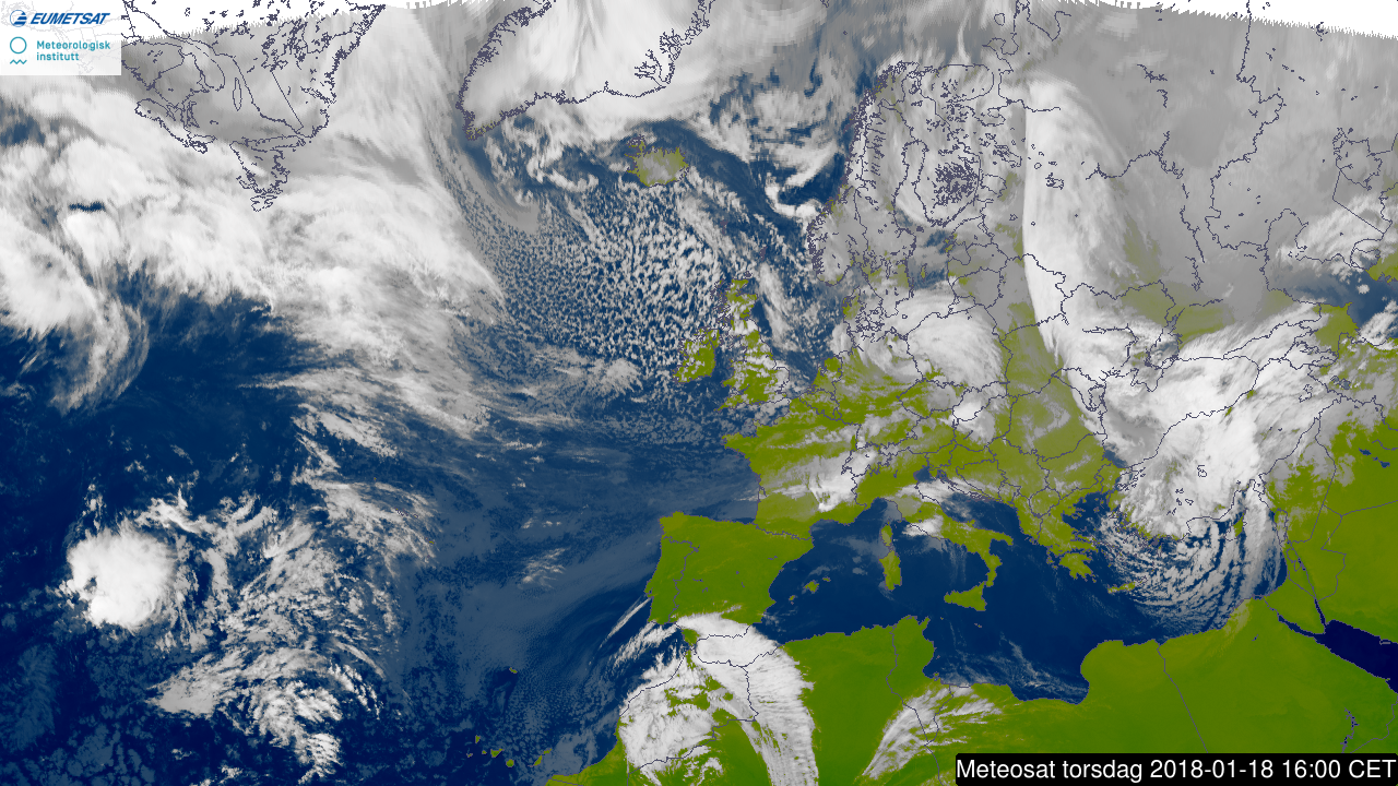
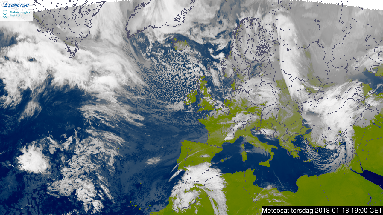
The plots below show satellite images (from yr.no) from 17 January 21UTC to 18 January 18UTC every 3rd hour.
3. Predictability
3.1 Data assimilation
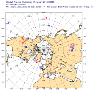
The plot below shows 18Z 1000mb increments - note blue region over the British Isles.
3.2 HRES
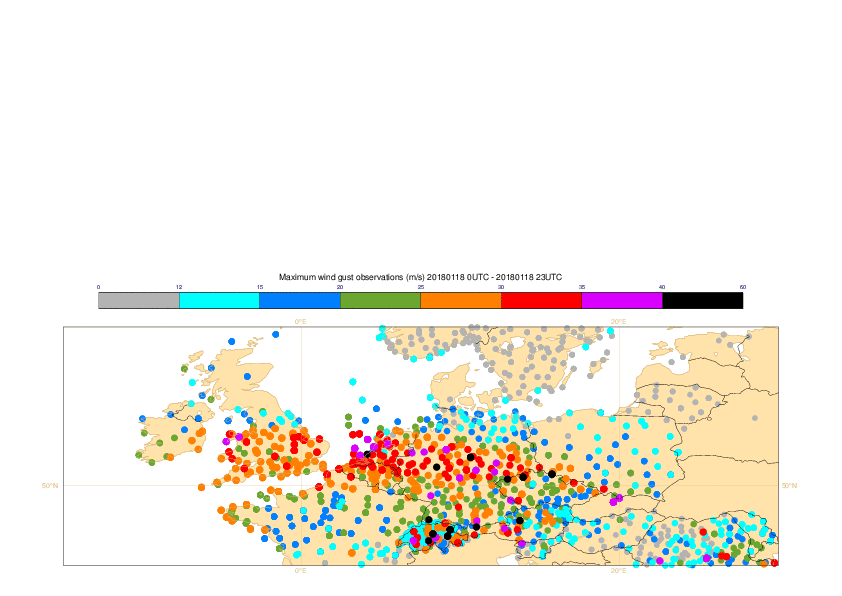
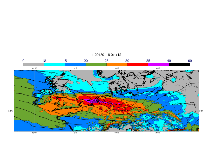
The plots below show observations of 24-hour maximum wind gusts from 18 January (first plot) and forecasts of 24-hour maximum wind gusts together with MSLP valid 12UTC on 18 January.
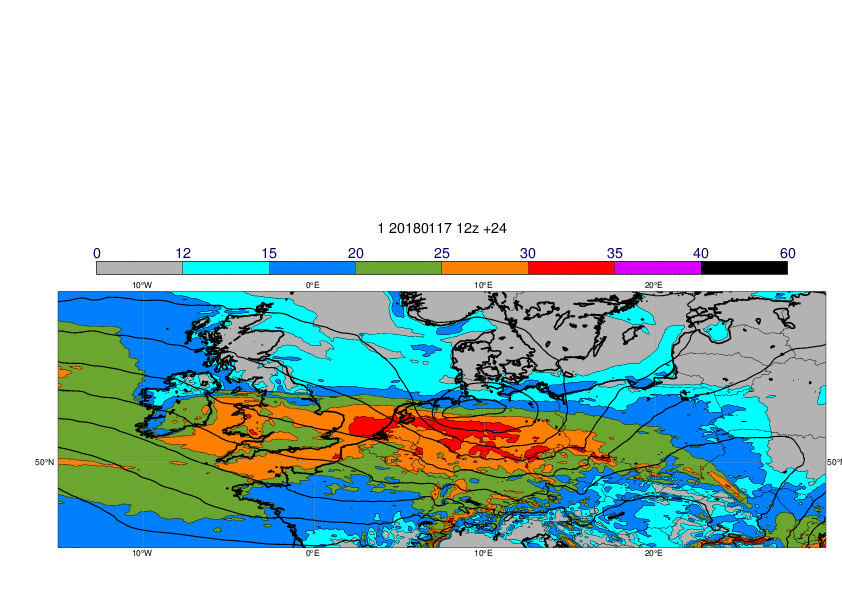
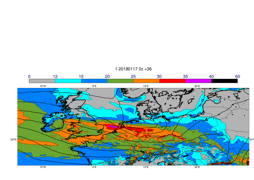
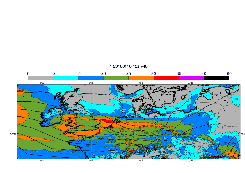

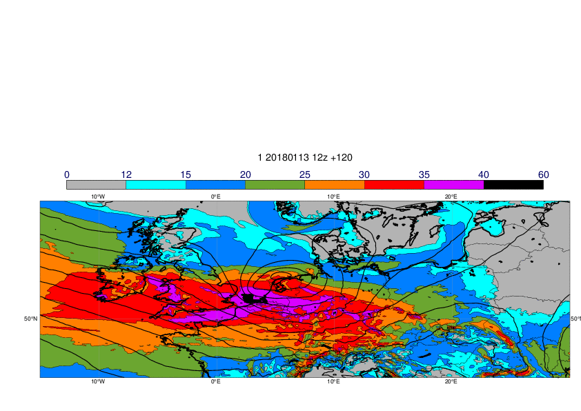
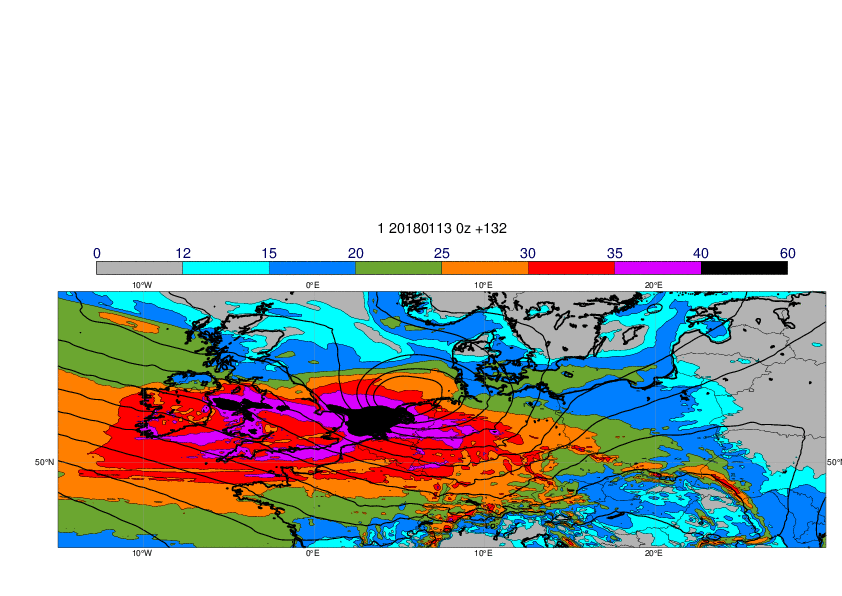
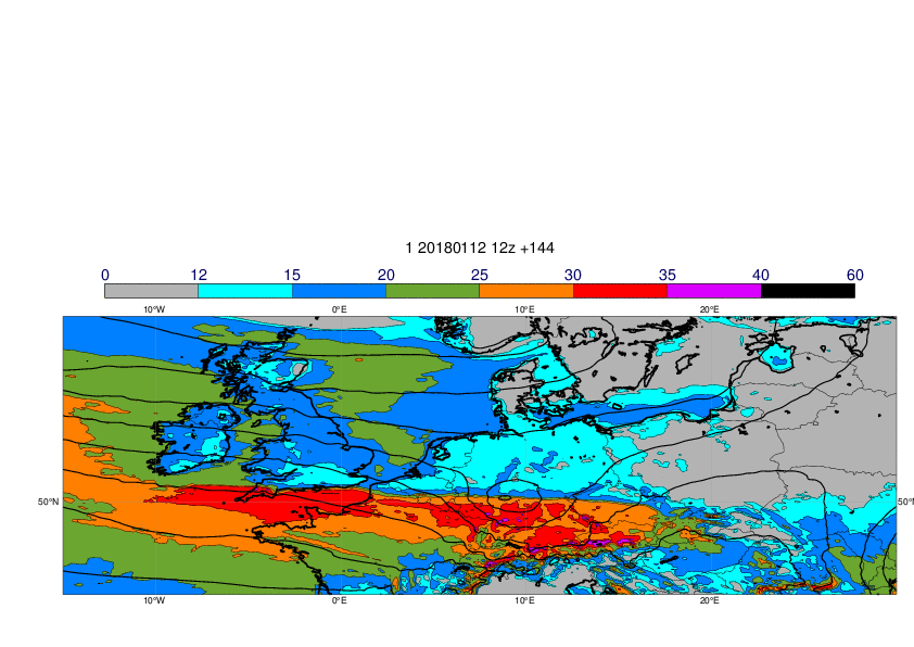
The plots above highlight a yoyoing behaviour in the forecast. The track first appears S of the UK, migrates steadily N in successive forecasts, then S again, then back N a little at the end. HRES shows similar behaviour, at least for 6 and shorter lead times, suggesting that ENS spanned HRES behaviour fairly evenly on either side, and fairly consistently so. These oscillating trends would not have been helpful to the forecaster. Moreover very short range forecasts failed to capture the full depth of the low, being 4mb or so out at T+12 over the UK,
3.3 ENS
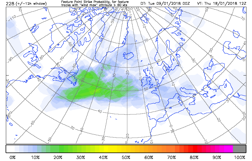
The plot below shows the ENS strike probability charts for cyclones associated with strong winds, day 10 down to day 1.
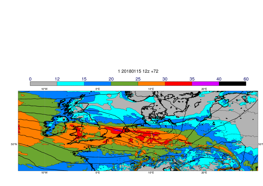
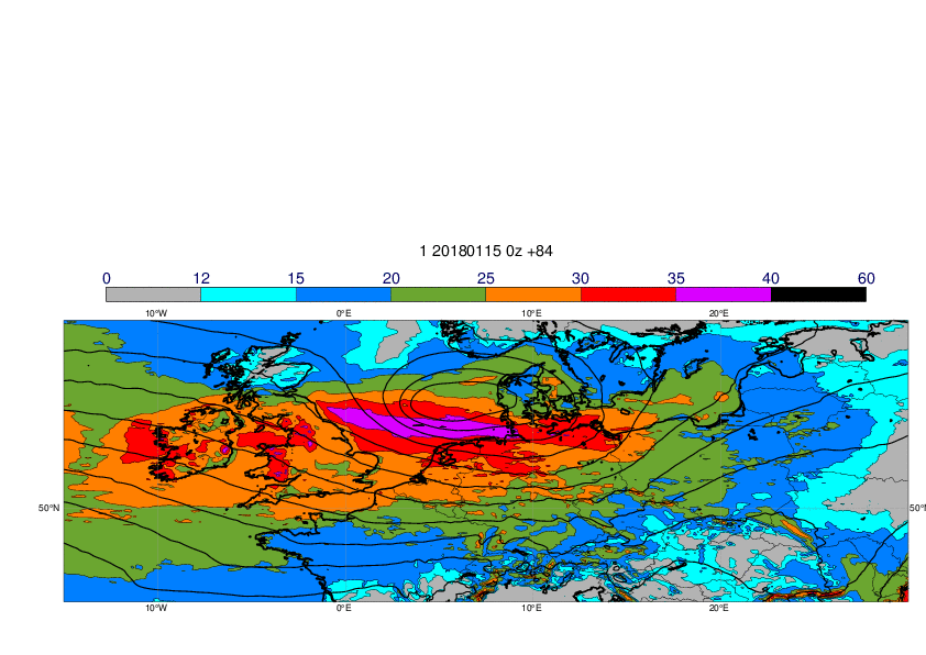
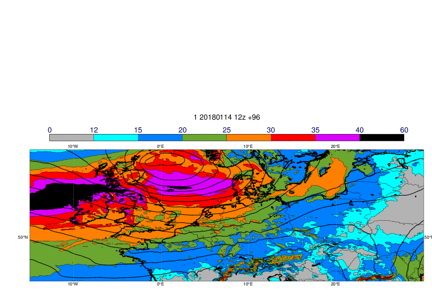
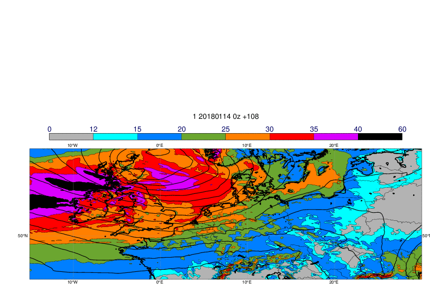
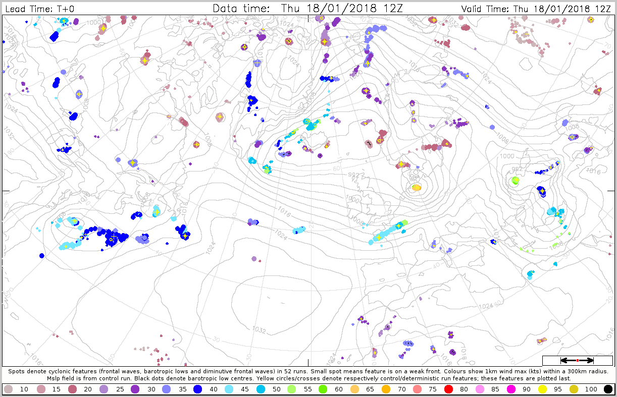
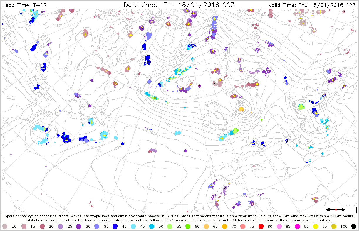
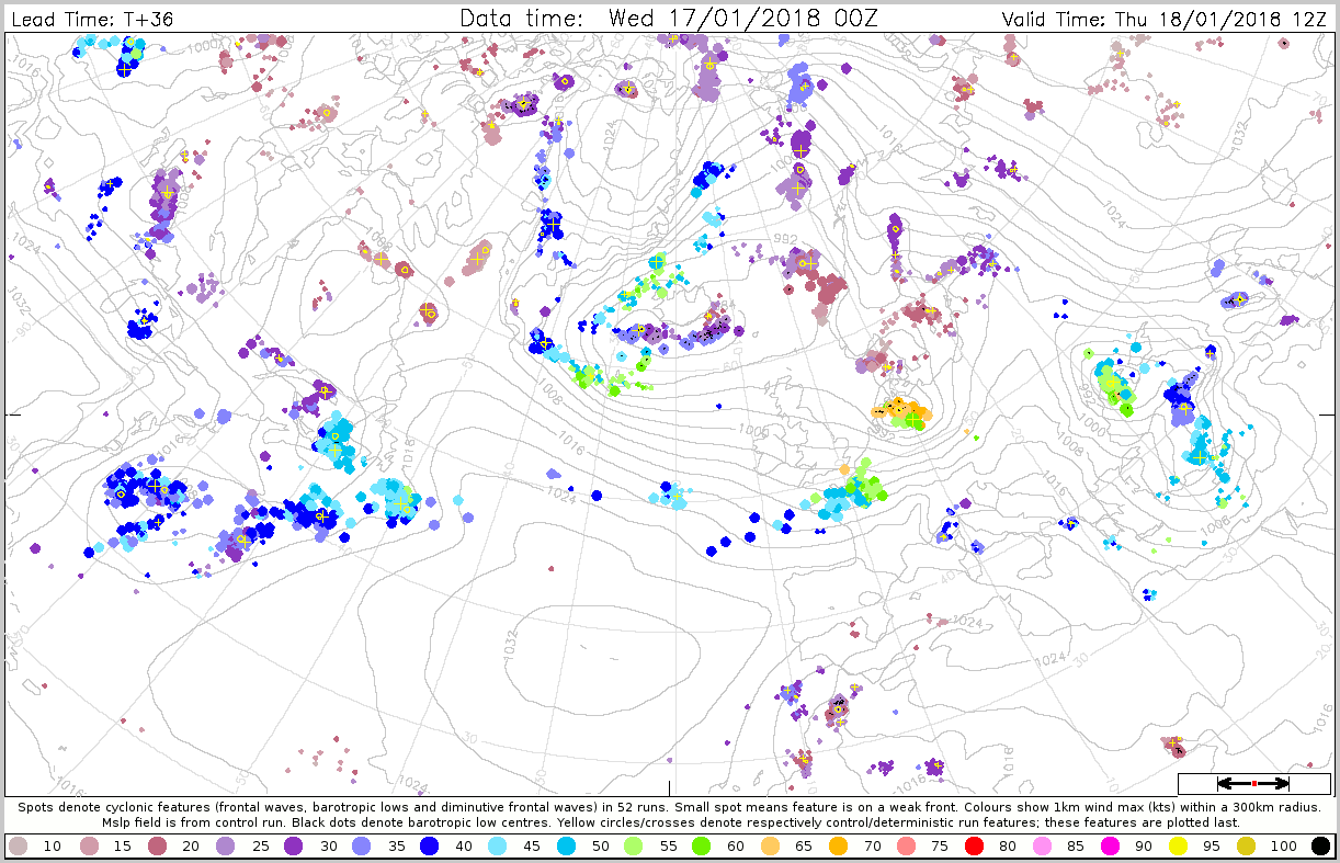
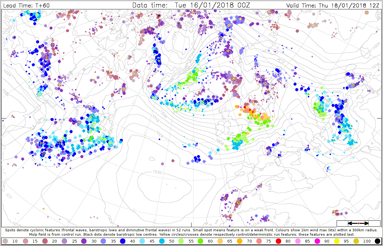
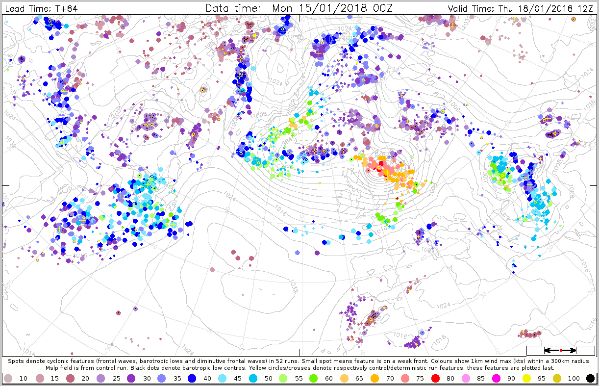
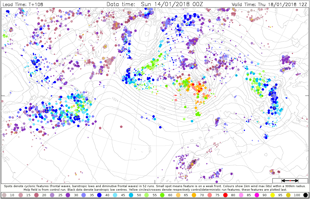
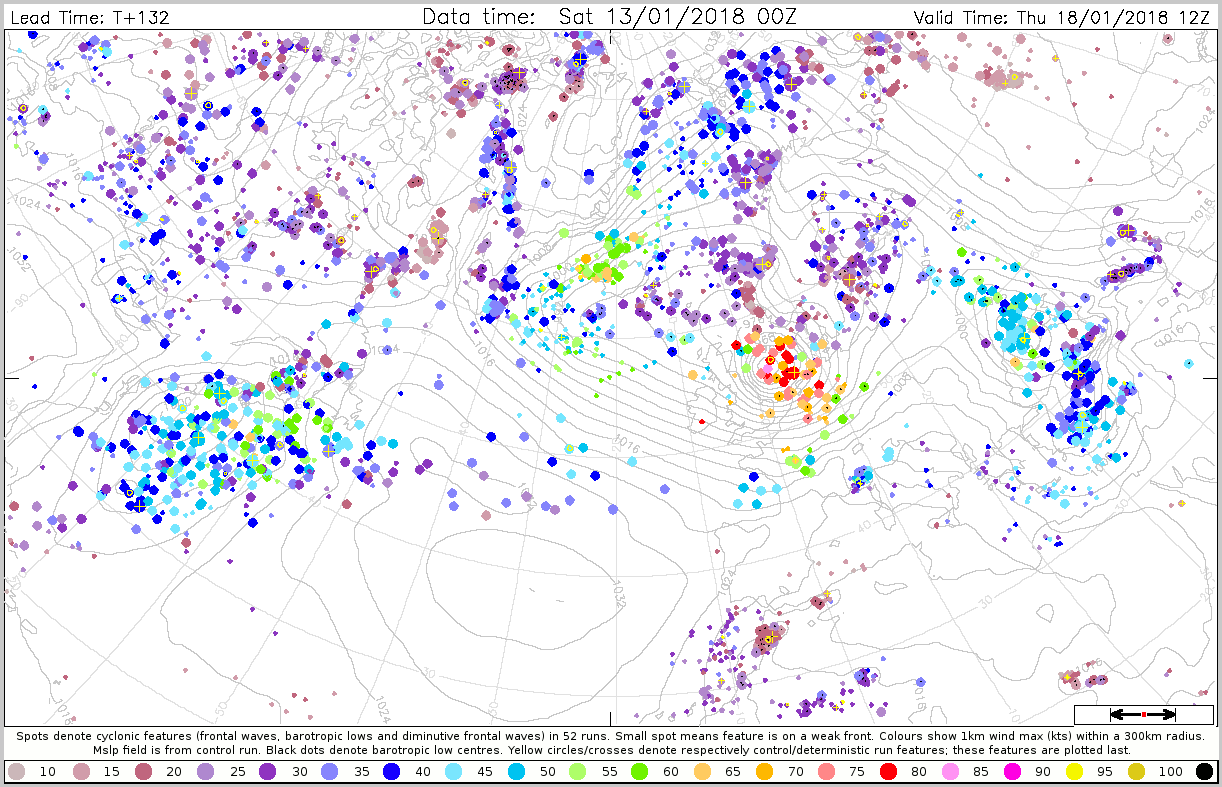
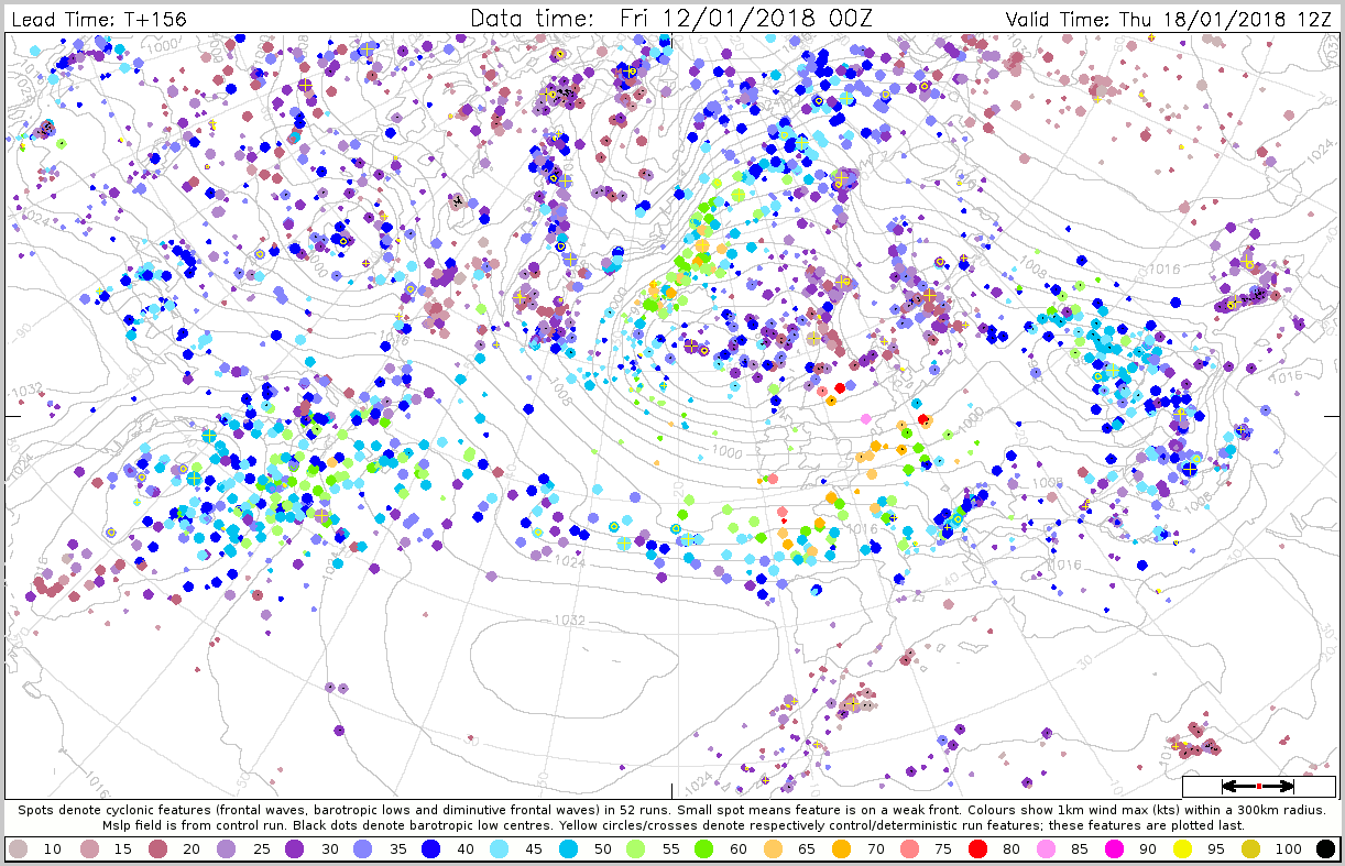
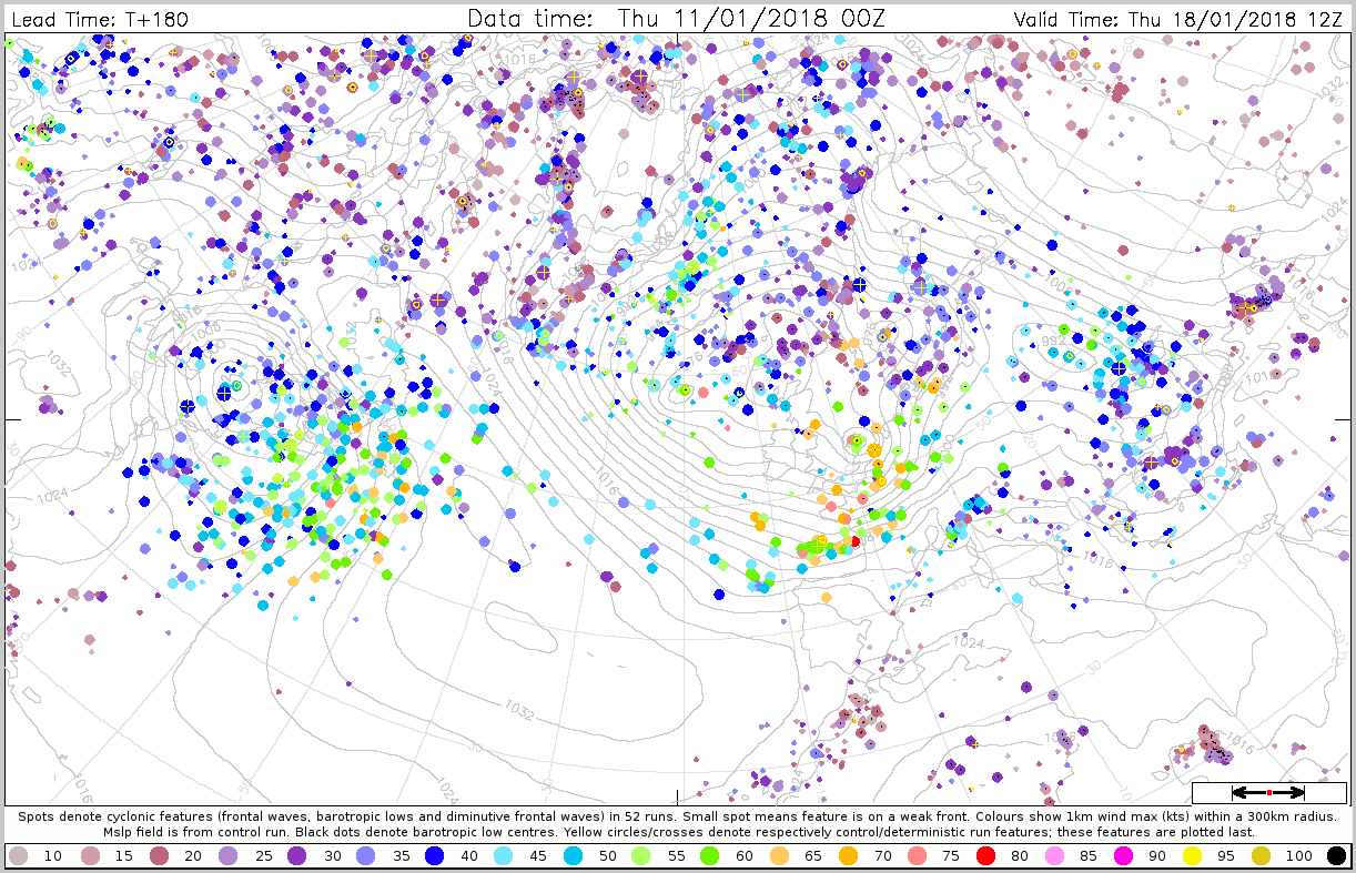
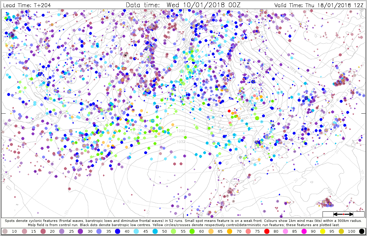
The plots below show cyclone feature maps for maximum wind within 300 km valid for 18 January 12UTC.
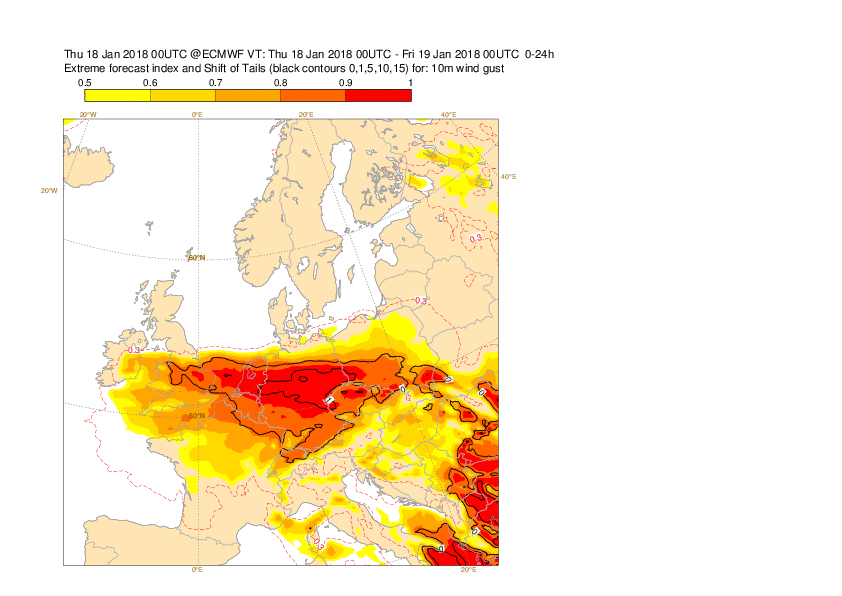
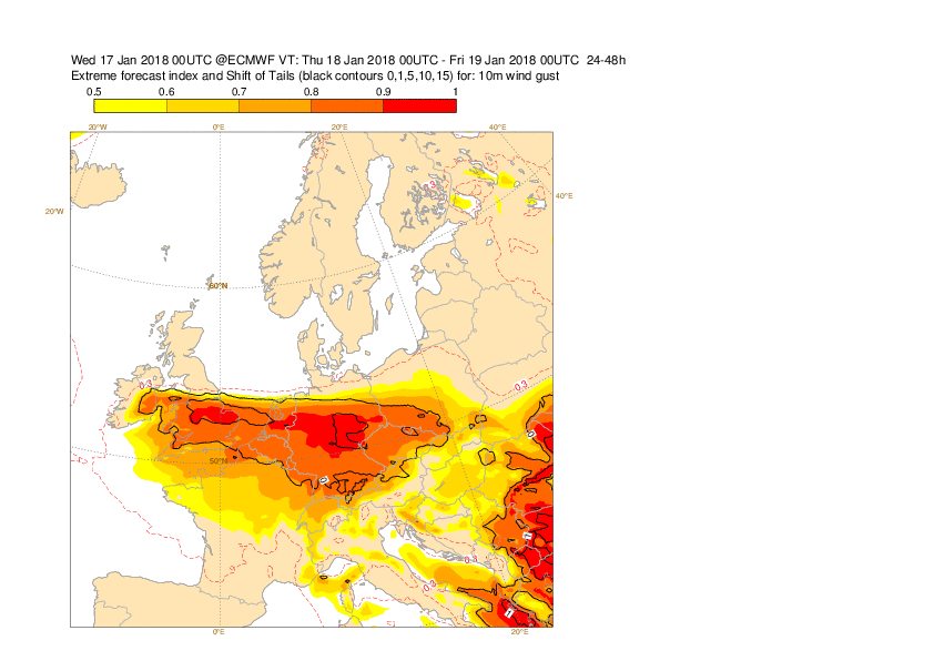
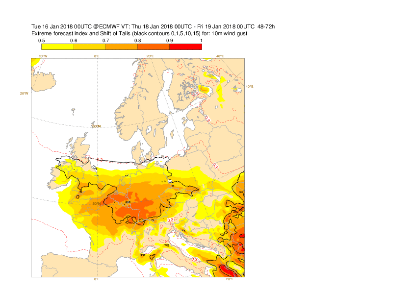
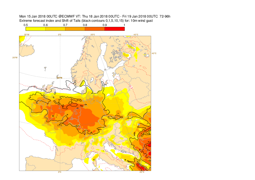
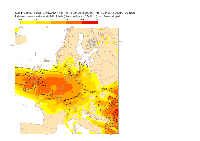
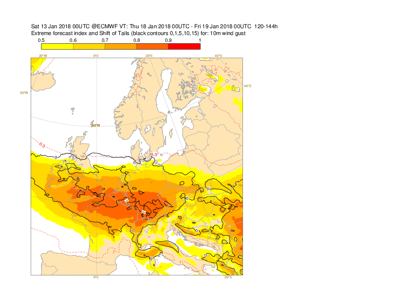
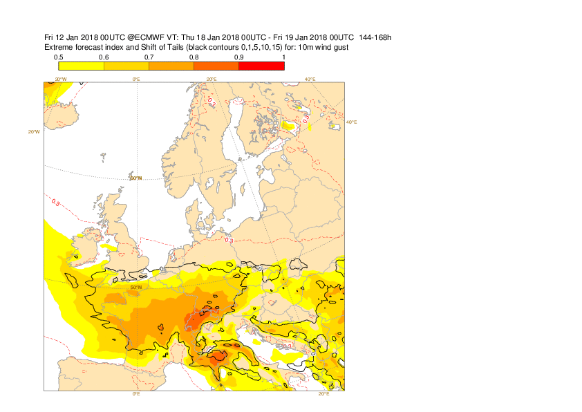
The plots below show the EFI and SOT for 24-hour maximum wind gusts for 18 January.
3.4 Monthly forecasts
3.5 Comparison with other centres
4. Experience from general performance/other cases
5. Good and bad aspects of the forecasts for the event
- Early (~7-8 days in advance) prediction of risk for windstorm in north-western Europe.
- Wild swings in the track of the low in the medium ranges, settling from day 1-2
- Large uncertainties in the time of onset of very strong winds at short ranges, even 12h, related to time of jet-crossing of the responsible cyclone