Status: Finalised Material from: Ivan, Linus
Picture
1. Impact
On 27 May severe thunderstorms developed over various parts of Western Europe, including Germany and UK. A thunderstorm caused flash flooding across the West Midlands as more than a month's rainfall fell in parts of Birmingham in just one hour on Sunday. The Met Office reported that a site at Winterbourne, in Edgbaston, recorded 58 mm of rainfall in just one hour on Sunday afternoon, and 81mm in a 12-hour period. A man in his 80s died in Walsall, Birmingham after his vehicle was submerged in flooding. In the European Severe Weather Database (ESWD) there are a lot of reports of convective hazards such as heavy rain, large hail and damaging lightning across Benelux and Germany on Sunday.
2. Description of the event
The plot below shows the analysis of z500 and t850 from 27 May 12UTC, with a warm air mass moved to north-west by the trough over eastern Atlantic and the Iberian peninsula.

Satellite animation below gives a detailed picture of the development and extension of convective storms starting from Saturday late afternoon to morning hours on Monday.

3. Predictability
3.1 Data assimilation
3.2 HRES
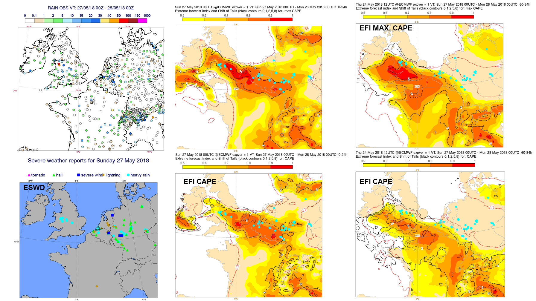
The plots below show the observed precipitation (first plot) between 27 May 06UTC and 28 May 06UTC and the subsequent plots show HRES forecasts valid for the same period.


3.3 ENS
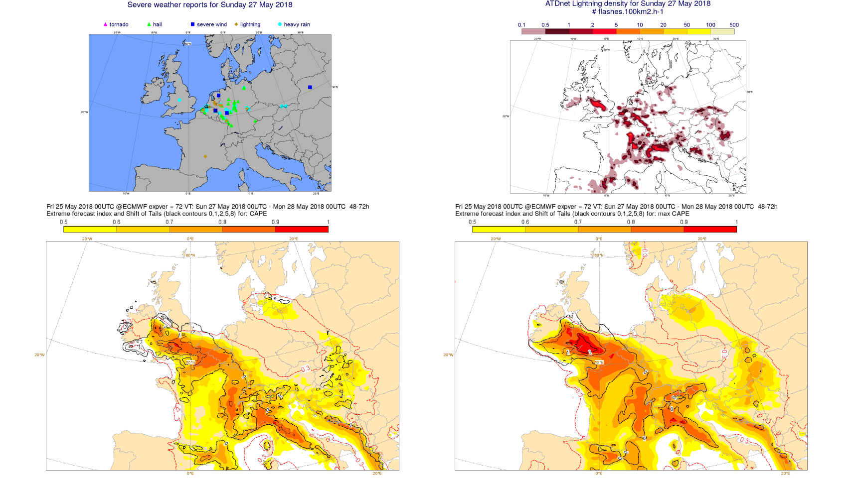
The predictability of convective heavy rain events is generally low. About excessive rain in the Midlands, the EFI provided a very good warning in the short range and it gave a useful signal as far as T+60-84h although the latter forecast had the highest values of the EFI shifted to the SW of the affected area. Reports from the ESWD show that heavy rain and flash floods occurred also in some parts of Germany and Benelux. The EFI was not good even in the shortest range forecast. It basically failed to provide warnings of excessive rain in those areas. CAPE EFI did a better job. In the short range it covered all these reports of heavy rain. Note that excessive rain was not the only convective hazard in the area. Large hail and strong winds also accompanied severe convective storms. Yesterday I mentioned that the forecast lost the signal over parts of Germany and the Netherlands quickly in time and as you can see T+60-84h forecast missed some of the areas affected by severe convection. New max CAPE performed a bit better although it also missed events in Germany at T+60-84h.
The plots below compare different EFI products and also includes observations of 24-hour precipitation and reports of severe weather from the European Severe Weather Database (ESWD).


The plot below shows the probability for lightning (0.1 flashes.100km2) on 27 May in the ensemble from 23 May. The top-right panel in the next figure shows the lightning observations from ADnet.

3.4 Monthly forecasts
3.5 Comparison with other centres
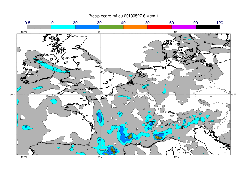
The plots below show 24-hour precipitation in the first 9 ensemble members for the last forecast before the event from ECMWF, COSMO-LEPS, Meteofrance LAM-EPS, UKMO LAM-EPS and DWD LAM-EPS from the TIGGE-LAM archive.


The plots below show the same as above but for only the first ensemble member. Here one clearly see that the DWD forecast has the most extreme precipitation rates.