Status: Finalised Material from: Linus, Jonny, Ervin
Picture
1. Impact
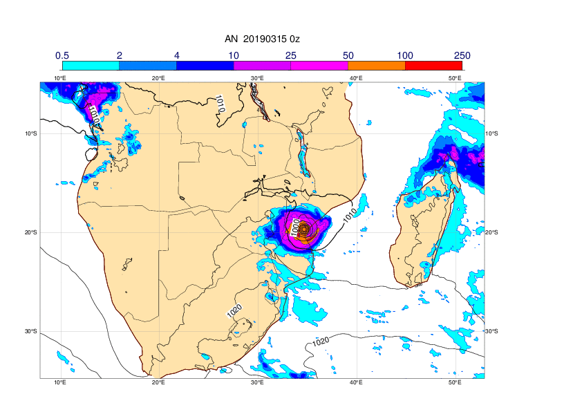
On 15 March the tropical cyclone Idai made landfall in Mozambique causing many fatalities. The cyclone formed from a tropical depression that already had brought fatal floodings to Mozambique and Malawi the week before. During the second landfall a storm surge hit the area of Beira together with extreme wind and extensive rainfall leading to further flooding inland.
The evaluation of the case has been published in: https://doi.org/10.1016/j.ijdrr.2020.101811
https://www.bbc.co.uk/news/world-africa-47624156
https://en.wikipedia.org/wiki/Cyclone_Idai
2. Description of the event
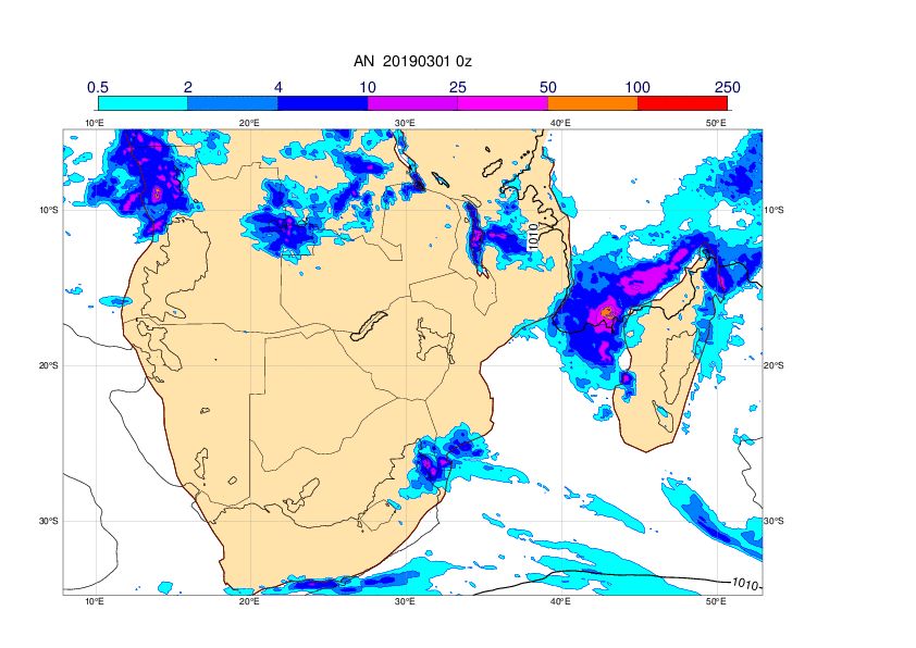
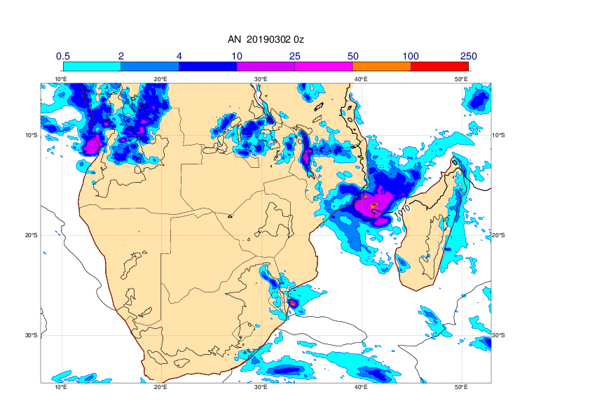
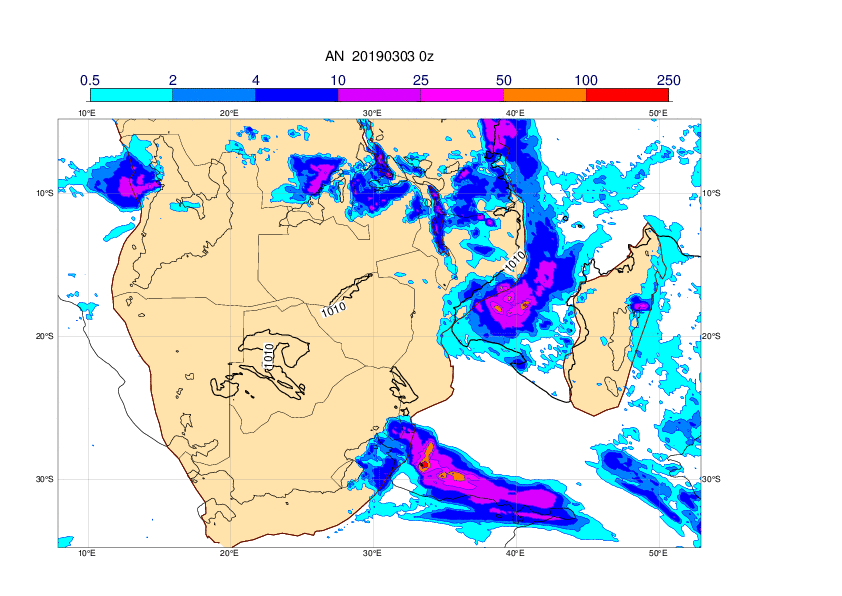
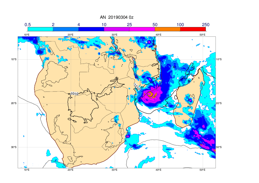
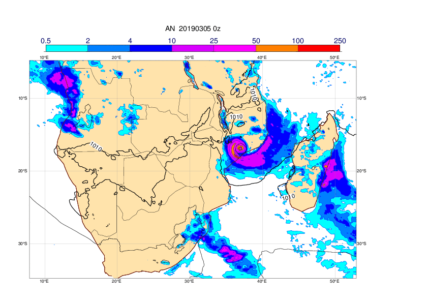
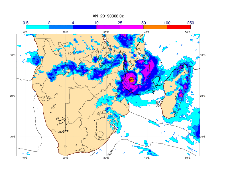
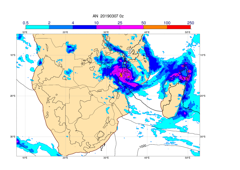
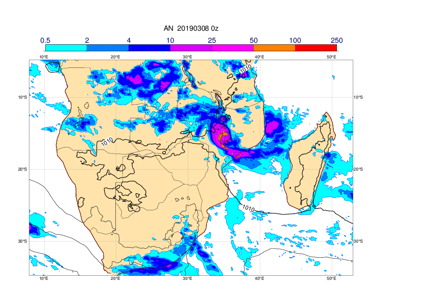
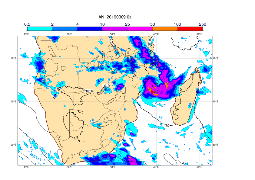
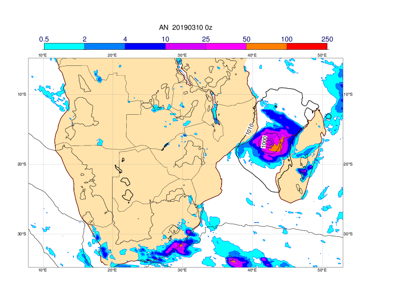
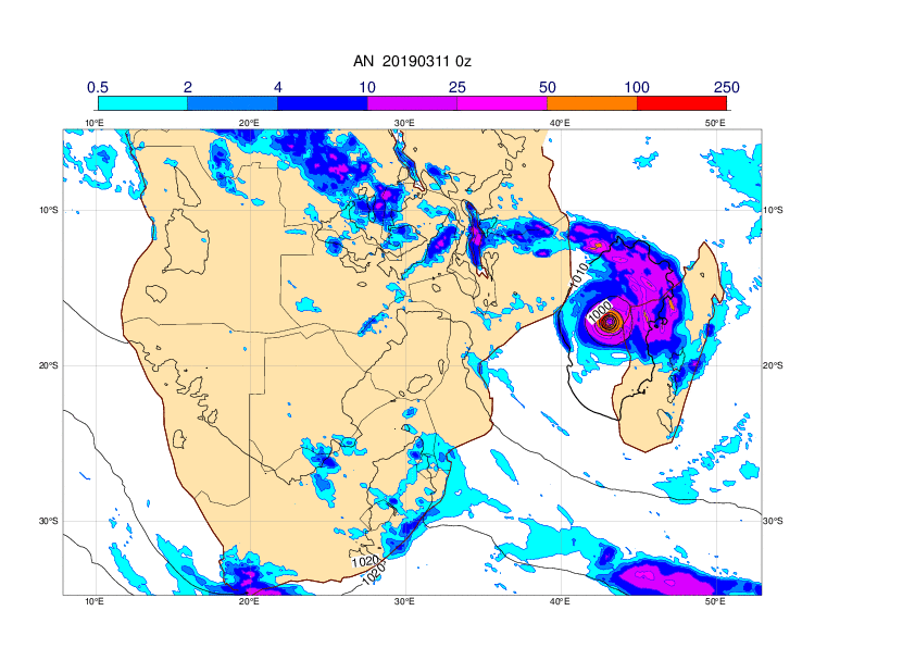
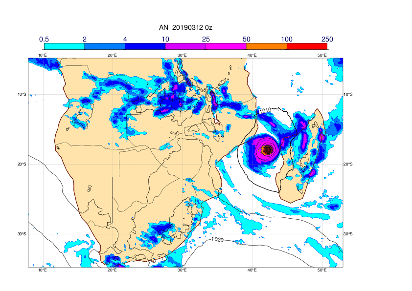
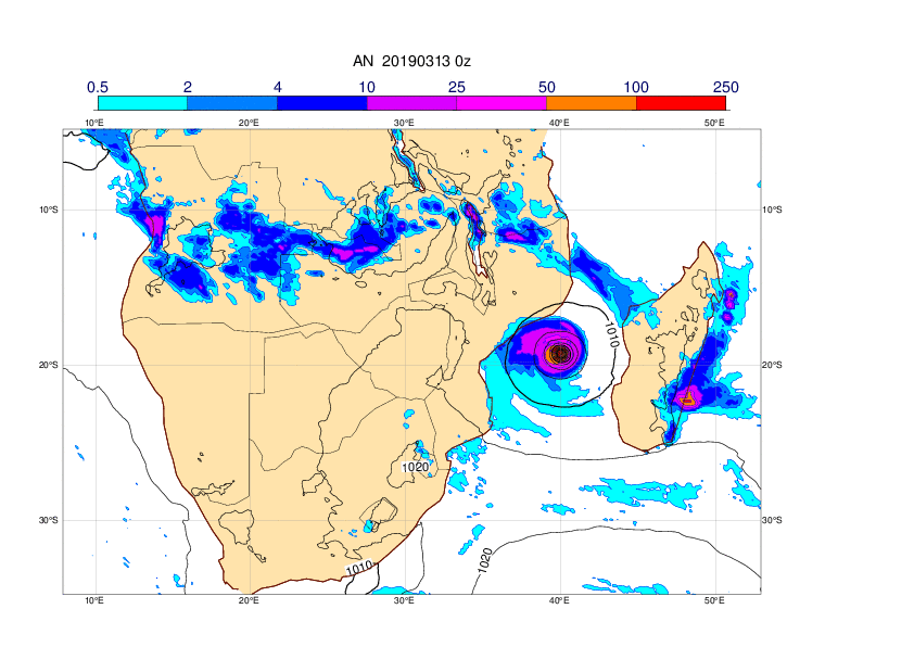
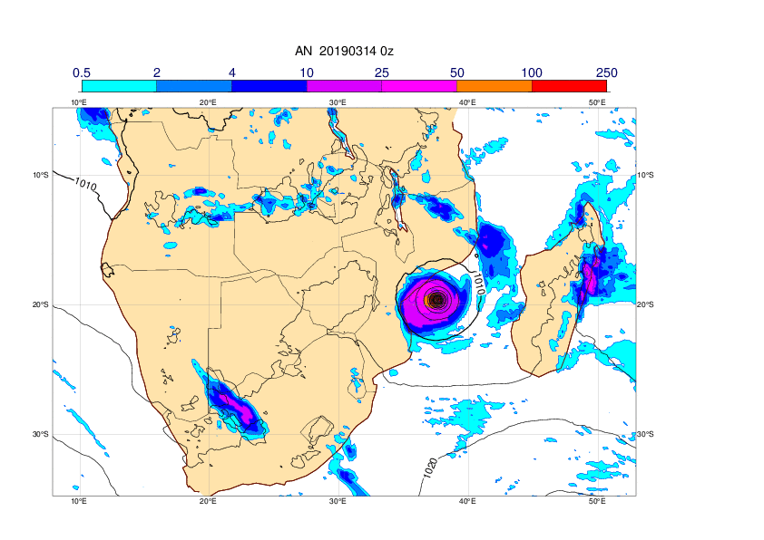
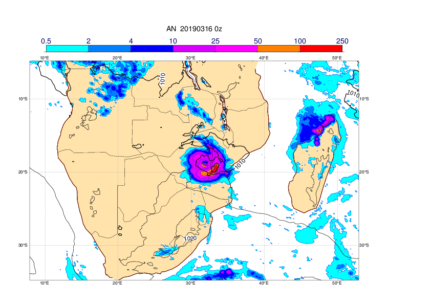
The plots below show MSLP and 6-hour precipitation in analyses from 00UTC spanning 1 March to 16 March.The tropical depression made a first landfall on Mozambique on 4 March, entered sea again on 9 March, intensified on 10 March and made landfall on 15 March.
3. Predictability
3.1 Data assimilation
3.2 HRES
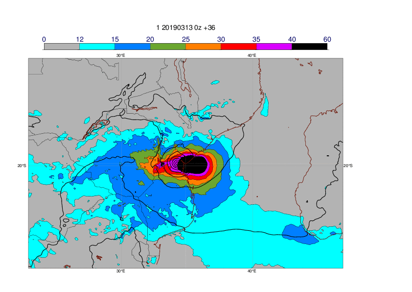
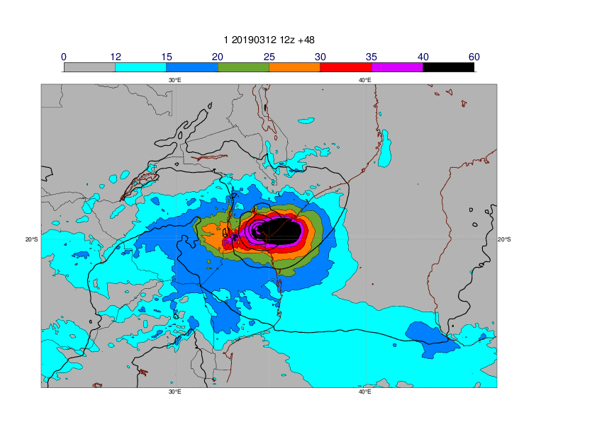
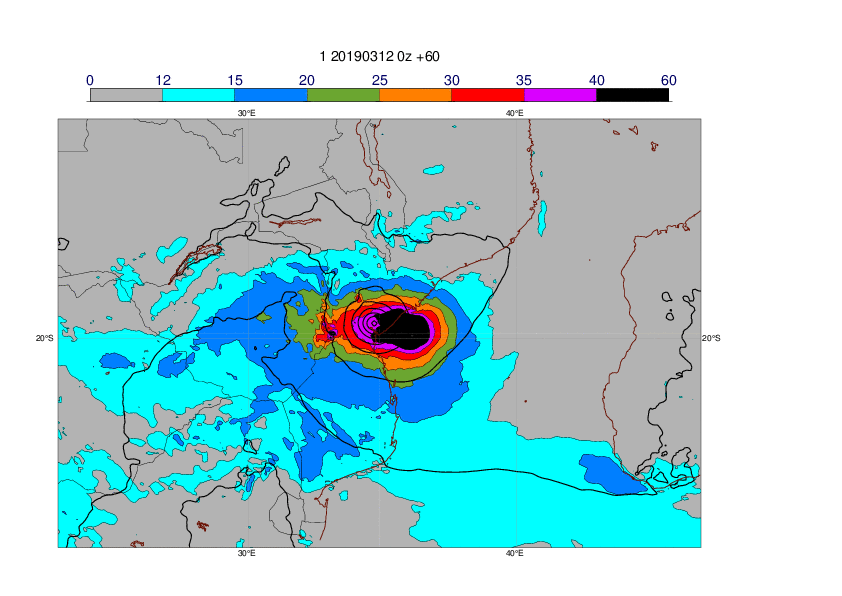
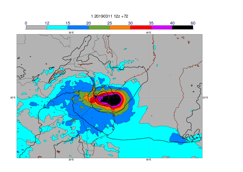
The plots below show the 24-hour maximum wind gusts in HRES forecasts valid 14 March 12UTC to 15 March 12UTC. The forecast were very consistent from 10 March 00UTC and onwards.


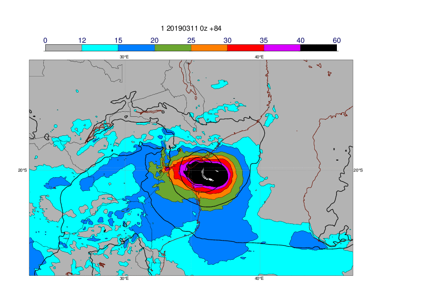
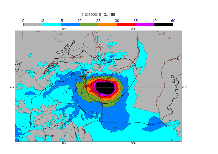
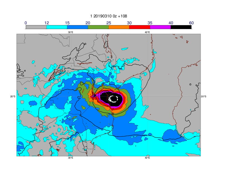
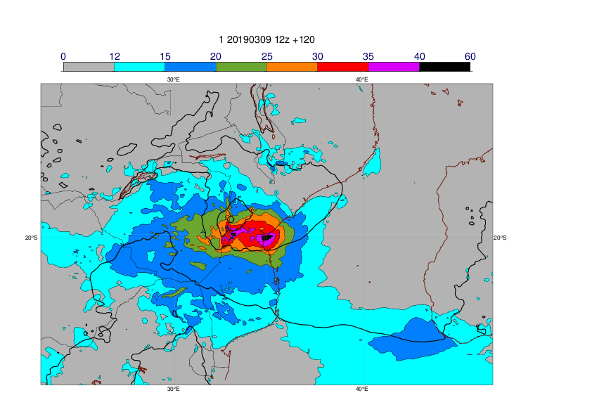
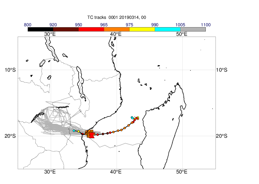
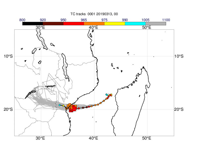
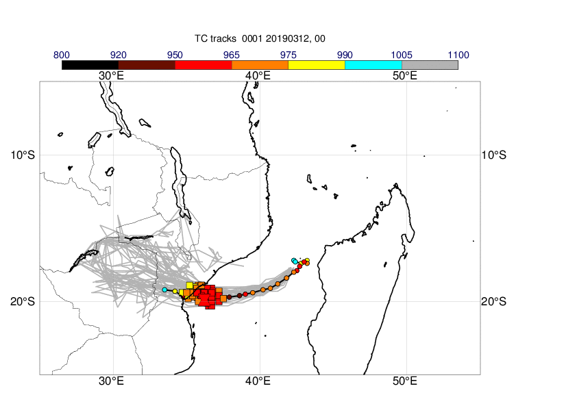
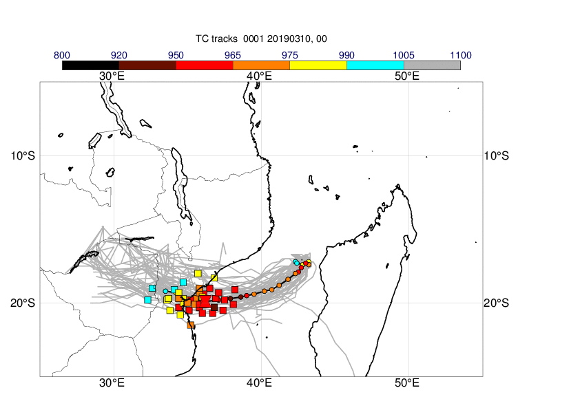
3.3 ENS
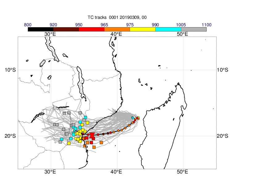
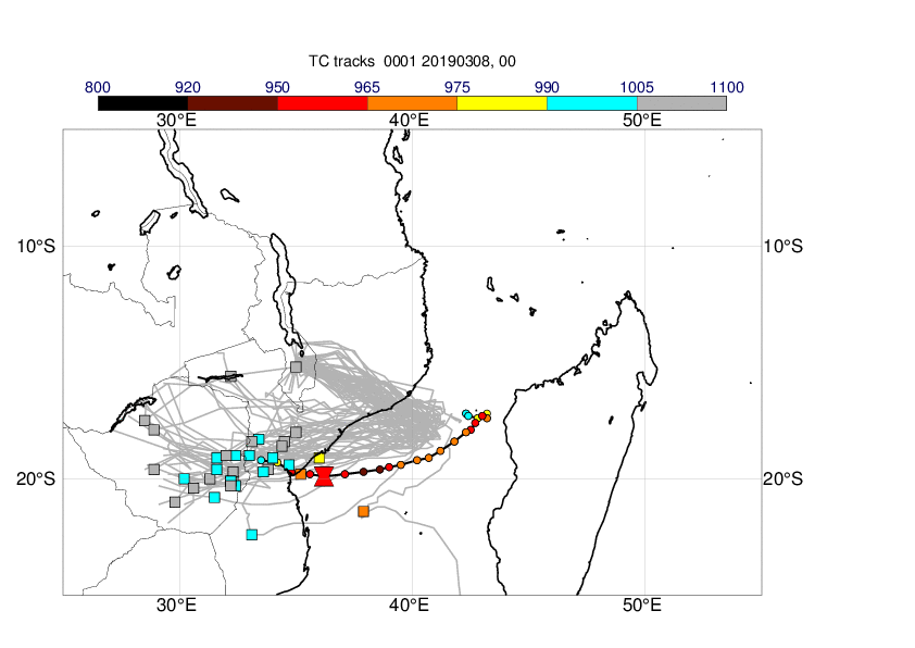
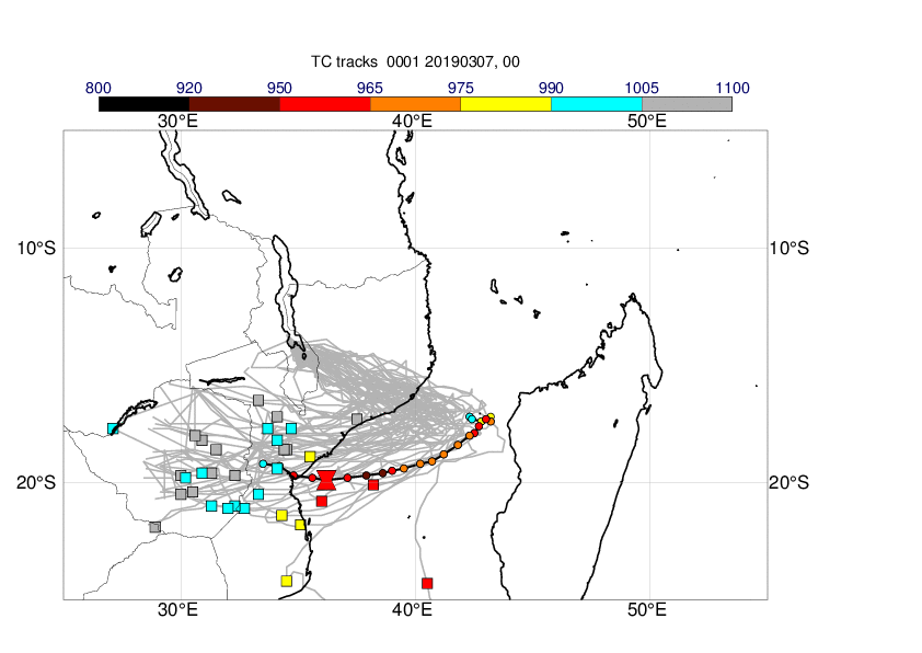
The plots below show the tracks (ensemble -grey, best track - black), position and intensity on 14 March 12UTC (ensemble - squares, best track - hourglass) in forecasts from 14 March (first plot) to 7 March (last plot). The cyclone was recognised as a tropical cyclone on 10 March. Before that, the ensemble predicted the re-emerging over the Indian ocean but had large uncertainties regarding the westward turn.

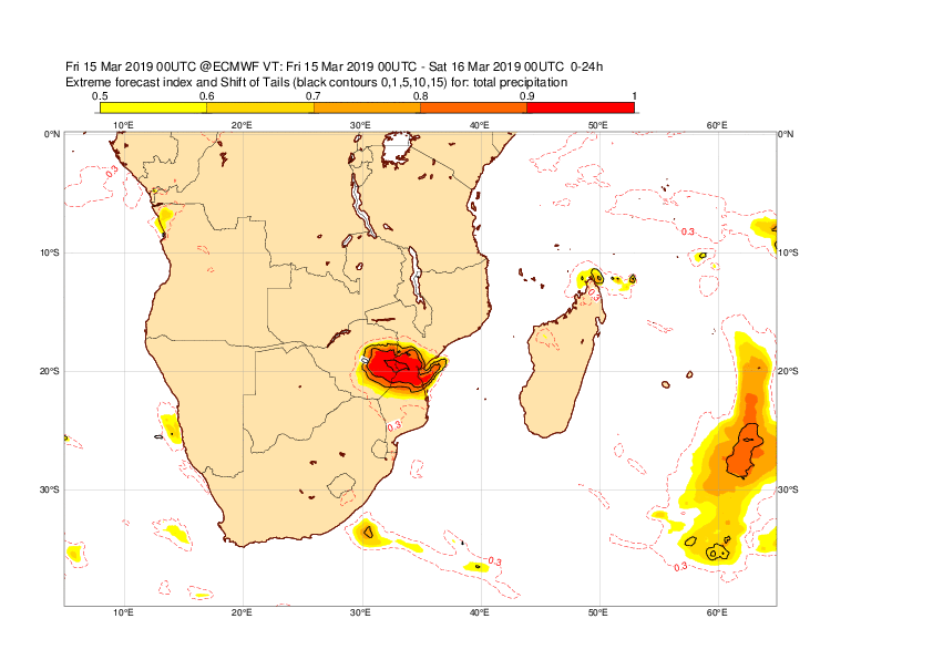
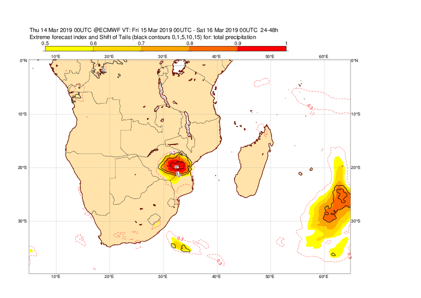
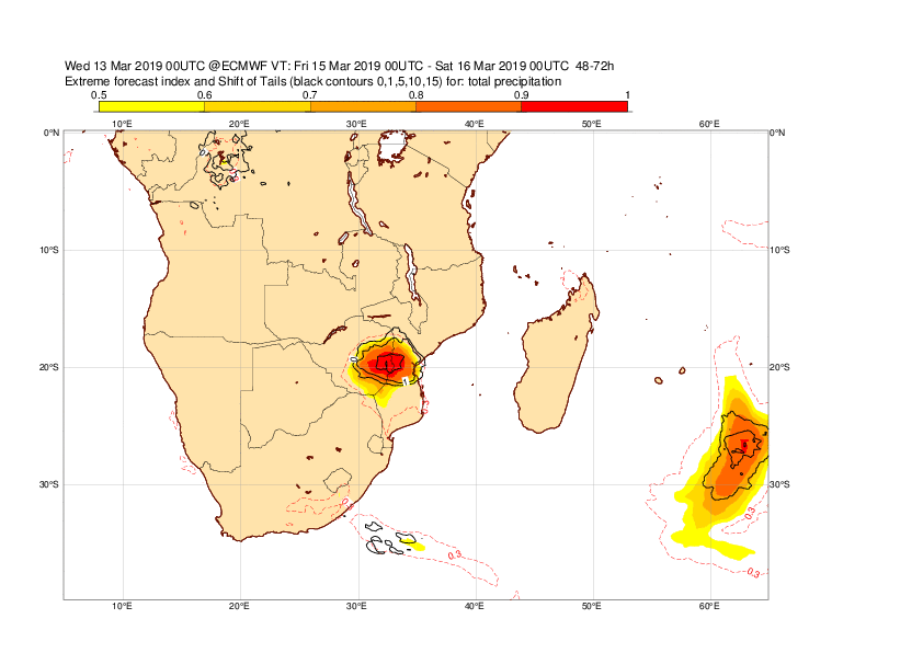
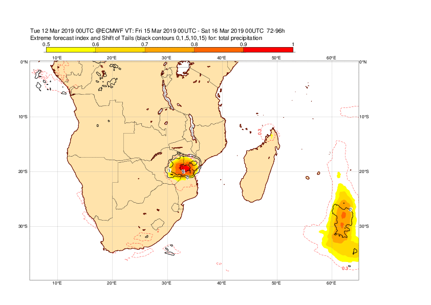
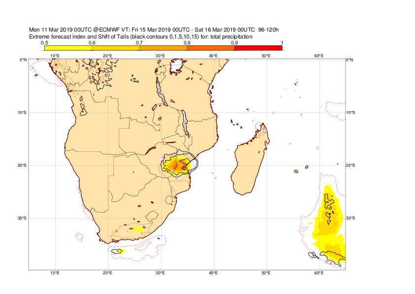
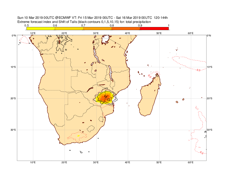
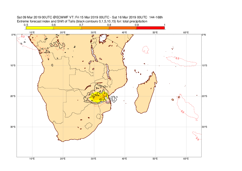
The plots below show EFI and SOT for rainfall on 15 March.Already the forecast from 9 March indicated the risk of extreme precipitation in southern Mozambique.
The plot below shows the evolution of forecast for 24-hour maximum wind gusts valid 14 March 12UTC to 15 March 12UTC for Beira. The plot includes ensemble (blue box-and-whisker), HRES (red dot) and model climate (red box-and-whisker).

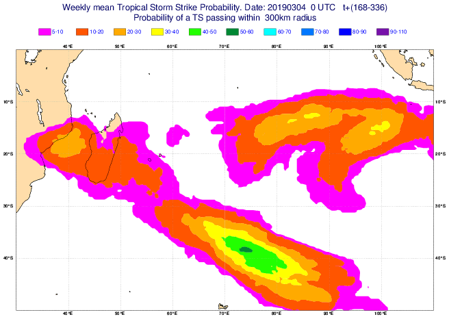
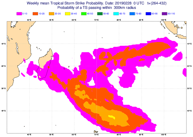
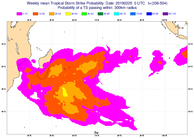
3.4 Monthly forecasts
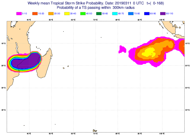
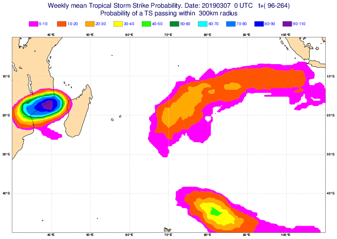
The plots below show the tropical cyclone strike probability for the week of 11 March to 17 March. The forecast from 4 March had an elevated probability for cyclone activity between Africa and Madagascar.
3.5 Comparison with other centres
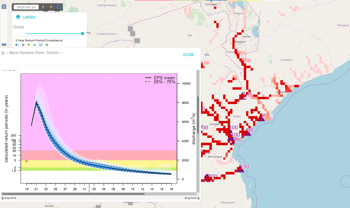
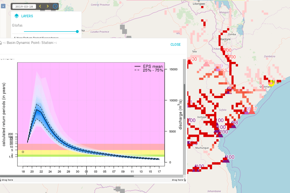
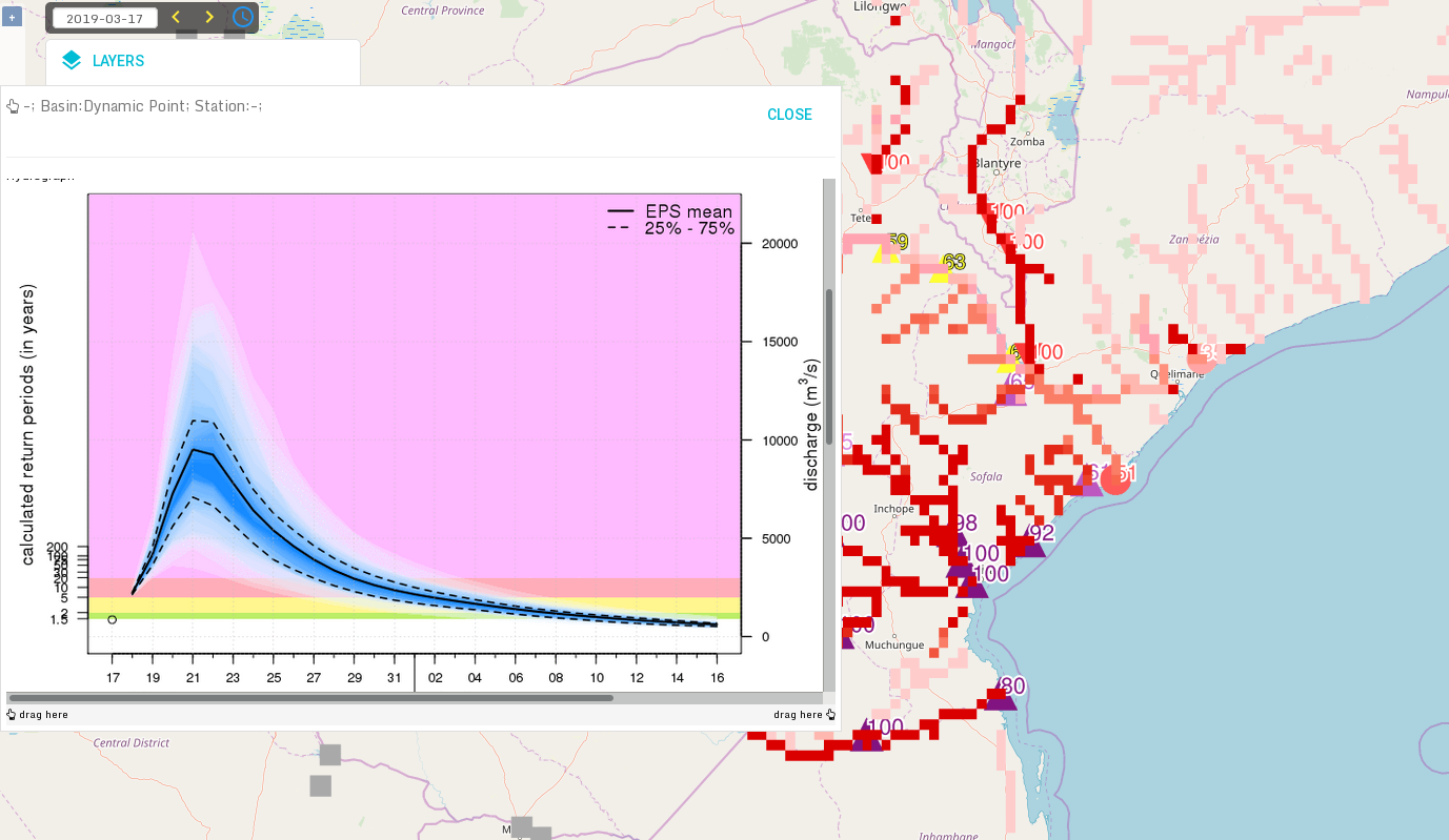
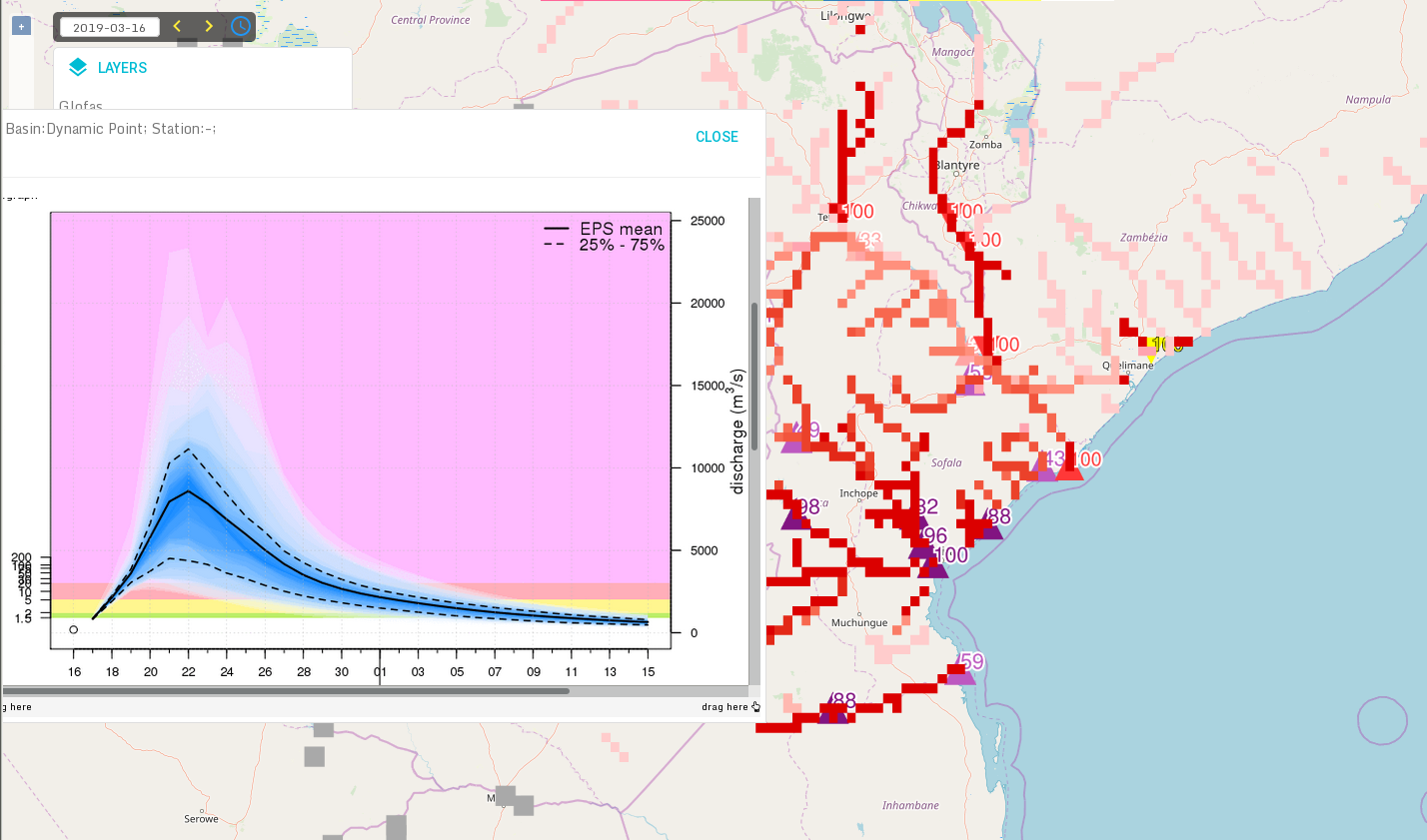
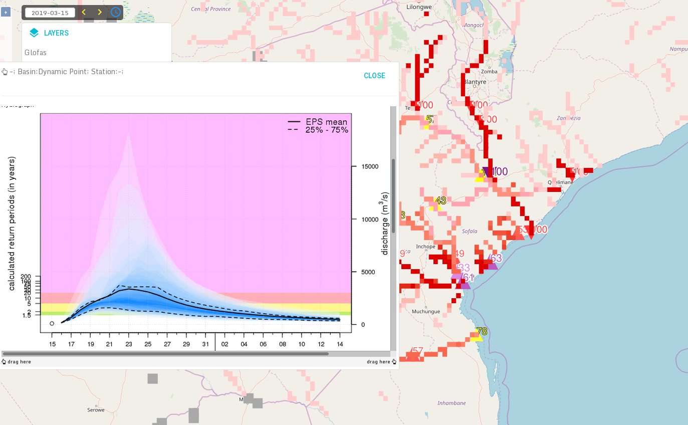
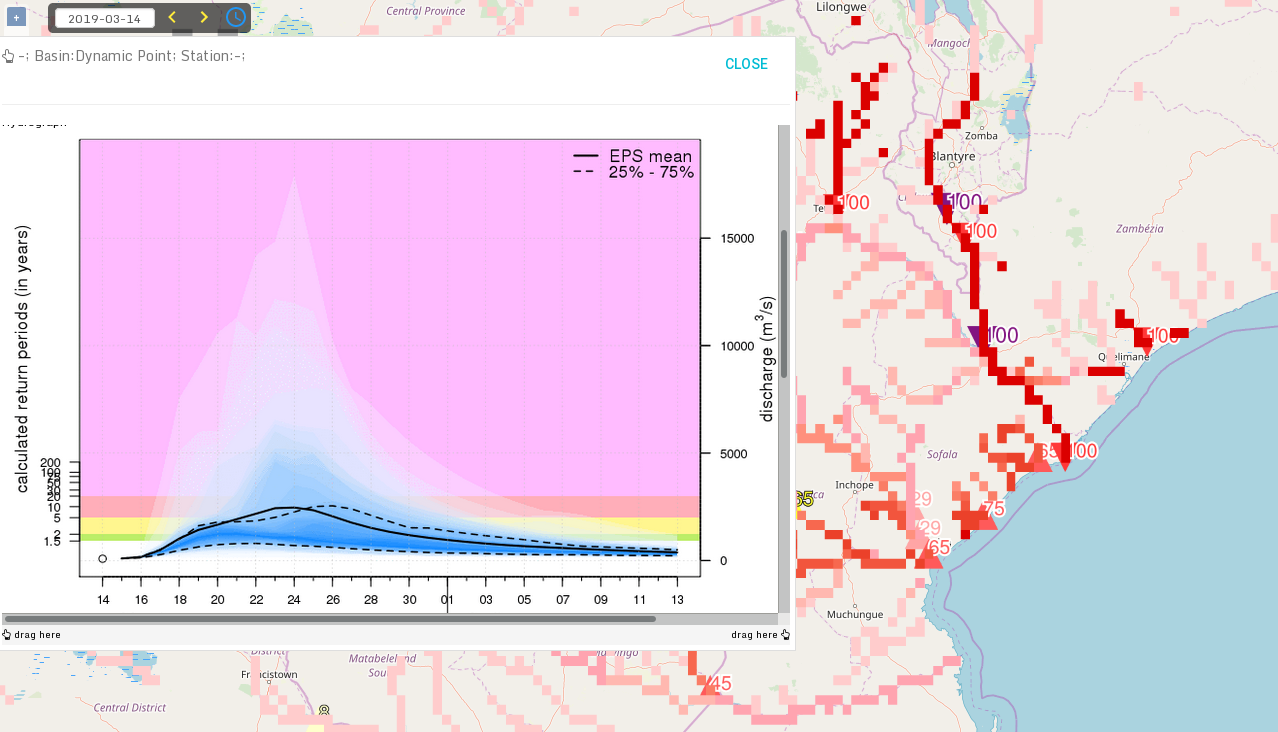
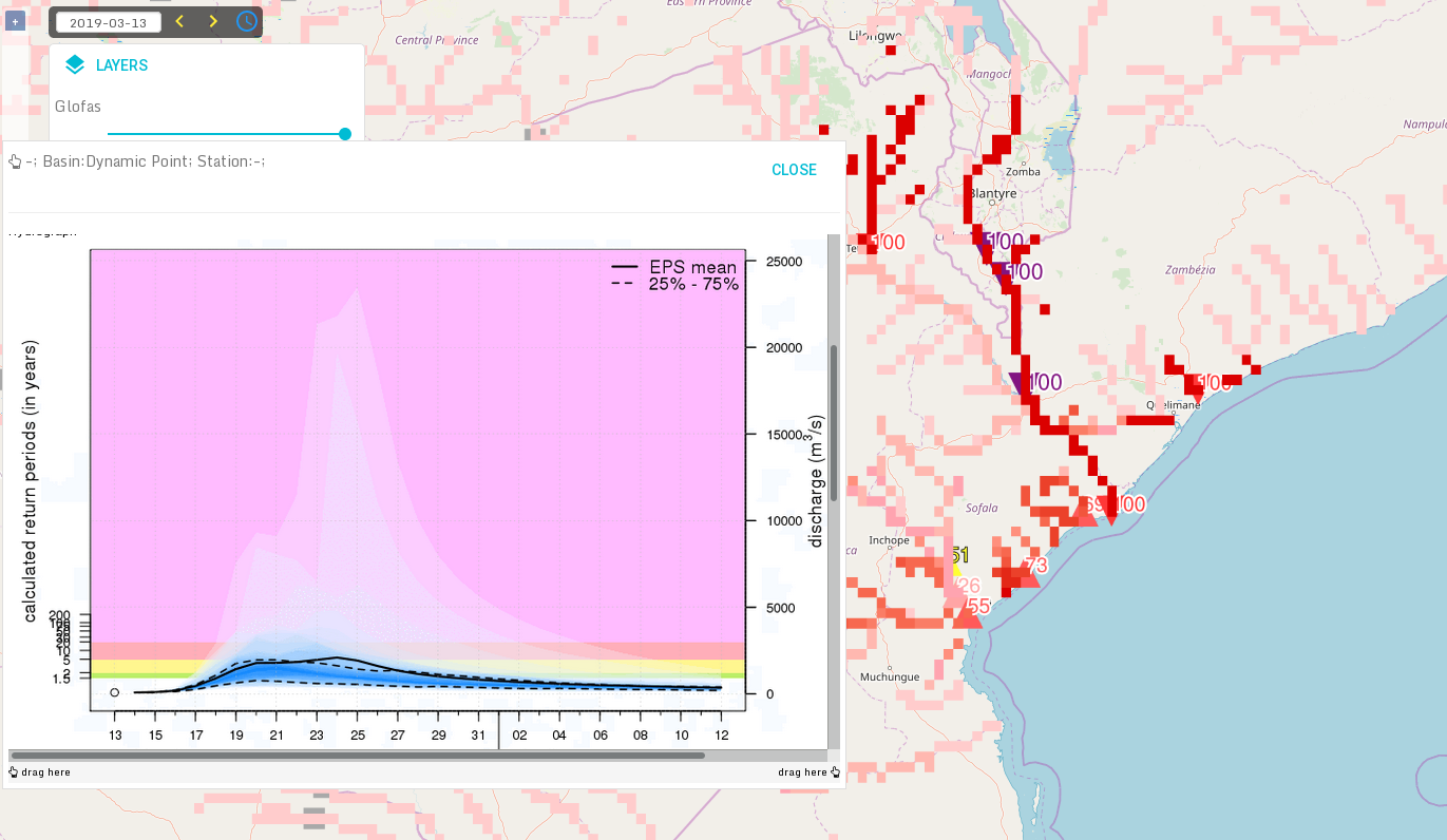
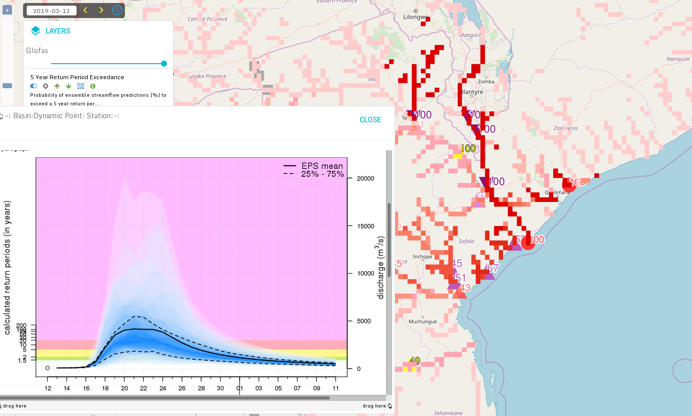
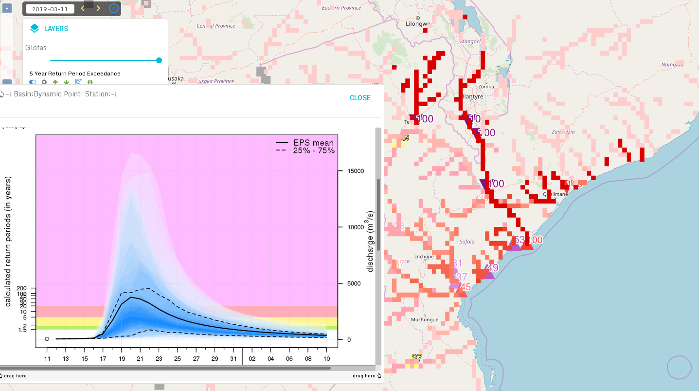
3.6 Glofas
The plots below show the flood risk from globalfloods.eu for a point near Beira, starting with the latest forecast (from 19 March). After the rainfall on 15 March the ensemble converged as the water was already "on ground", but the risk for extreme flooding was indicated already in the earliest forecast displayed here from 10 March.

4. Experience from general performance/other cases
5. Good and bad aspects of the forecasts for the event
- Complex case with two landfalls
- The injuries are a combination from the flooding of the first landfall, surge and wind during the second landfall and flooding later
- Regarding 2nd landfall, good prediction 5 days a head (with uncertainties), and indication at least a week ahead